MyTopo
Milburn Oklahoma US Topo Map
Couldn't load pickup availability
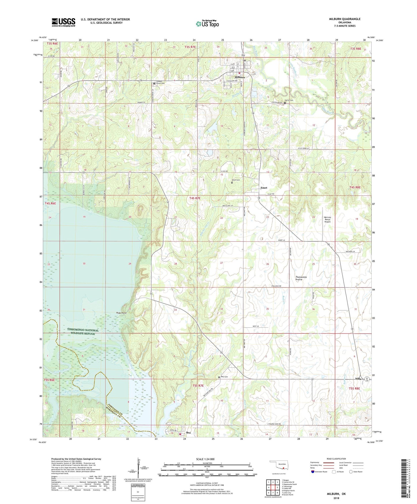
2022 topographic map quadrangle Milburn in the state of Oklahoma. Scale: 1:24000. Based on the newly updated USGS 7.5' US Topo map series, this map is in the following counties: Johnston, Marshall. The map contains contour data, water features, and other items you are used to seeing on USGS maps, but also has updated roads and other features. This is the next generation of topographic maps. Printed on high-quality waterproof paper with UV fade-resistant inks.
Quads adjacent to this one:
West: Tishomingo
Northwest: Reagan
North: Connerville SE
Northeast: Wapanucka South
East: Caddo NW
Southeast: Durant North
South: Little City
Southwest: Kingston North
This map covers the same area as the classic USGS quad with code o34096b5.
Contains the following named places: Bee - Butcher Fire Department, Bee Cemetery, Bee Census Designated Place, Brushy Creek, Butcher Pen Creek, Condon Grove Cemetery, Emet, Emet Cemetery, Emet Census Designated Place, Harris Cemetery, Little Sandy Creek, Mercury Ranch Airport, Milburn, Milburn Elementary School, Milburn Fire Department, Milburn High School, Milburn Post Office, Nida Point, Rock Creek, Town of Milburn, Township of Thomas