MyTopo
Dustin Oklahoma US Topo Map
Couldn't load pickup availability
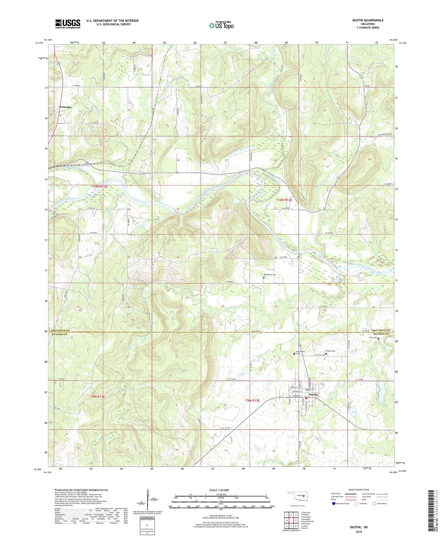
2018 topographic map quadrangle Dustin in the state of Oklahoma. Scale: 1:24000. Based on the newly updated USGS 7.5' US Topo map series, this map is in the following counties: Okfuskee, Hughes. The map contains contour data, water features, and other items you are used to seeing on USGS maps, but also has updated roads and other features. This is the next generation of topographic maps. Printed on high-quality waterproof paper with UV fade-resistant inks.
Quads adjacent to this one:
West: Weleetka
Northwest: Clearview
North: Pharoah
Northeast: Henryetta
East: Henryetta SW
Southeast: Hanna
South: Carson
Southwest: Wetumka
Contains the following named places: Alabama Creek, Bad Creek, Bookertee, Dustin, Dustin Cemetery, Dustin Elementary School, Dustin Fire Department, Dustin High School, Dustin Lake, Dustin Lake Dam, Dustin Post Office, East Weleetka Oil and Gas Field, Fife Cemetery, Gregory Oil and Gas Field, KVAZ-FM (Henryetta), Mosewiley Cemetery, Oknoname 063012 Dam, Oknoname 063012 Reservoir, Oknoname 107030 Dam, Oknoname 107030 Reservoir, Old Dustin Cemetery, Parsley Creek, Rock Creek, Salt Creek, Thewatle Church, Town of Dustin, Township of Weleetka, West Dustin Oil Field