MyTopo
Eagletown Oklahoma US Topo Map
Couldn't load pickup availability
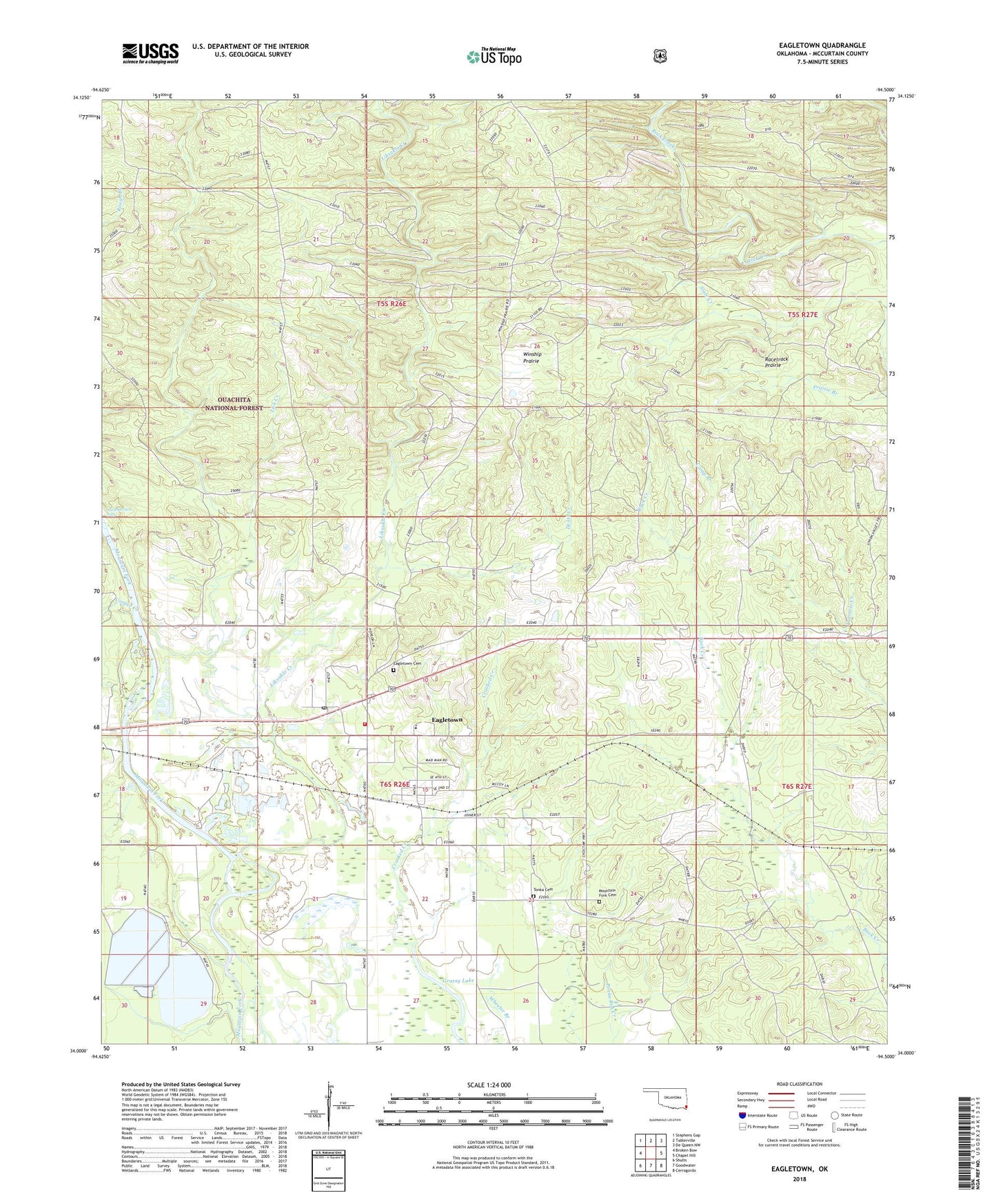
2018 topographic map quadrangle Eagletown in the state of Oklahoma. Scale: 1:24000. Based on the newly updated USGS 7.5' US Topo map series, this map is in the following counties: McCurtain. The map contains contour data, water features, and other items you are used to seeing on USGS maps, but also has updated roads and other features. This is the next generation of topographic maps. Printed on high-quality waterproof paper with UV fade-resistant inks.
Quads adjacent to this one:
West: Broken Bow
Northwest: Stephens Gap
North: Tablerville
Northeast: De Queen NW
East: Chapel Hill
Southeast: Cerrogordo
South: Goodwater
Southwest: Shults
Contains the following named places: Buck Creek Landing, Camp Branch, Cooper Creek, Death Creek, Eagletown, Eagletown Cemetery, Eagletown Census Designated Place, Eagletown Elementary School, Eagletown High School, Eagletown Post Office, Eagletown Volunteer Fire Department, Grassy Lake, Lick Creek, Liksuklo Creek, Mountain Fork Cemetery, Mountain Fork Church, Oknoname 089013 Dam, Oknoname 089013 Reservoir, Presbyterian Falls, Racetrack Prairie, Saint Paul Church, Tonka Cemetery, Winship Prairie, ZIP Code: 74734