MyTopo
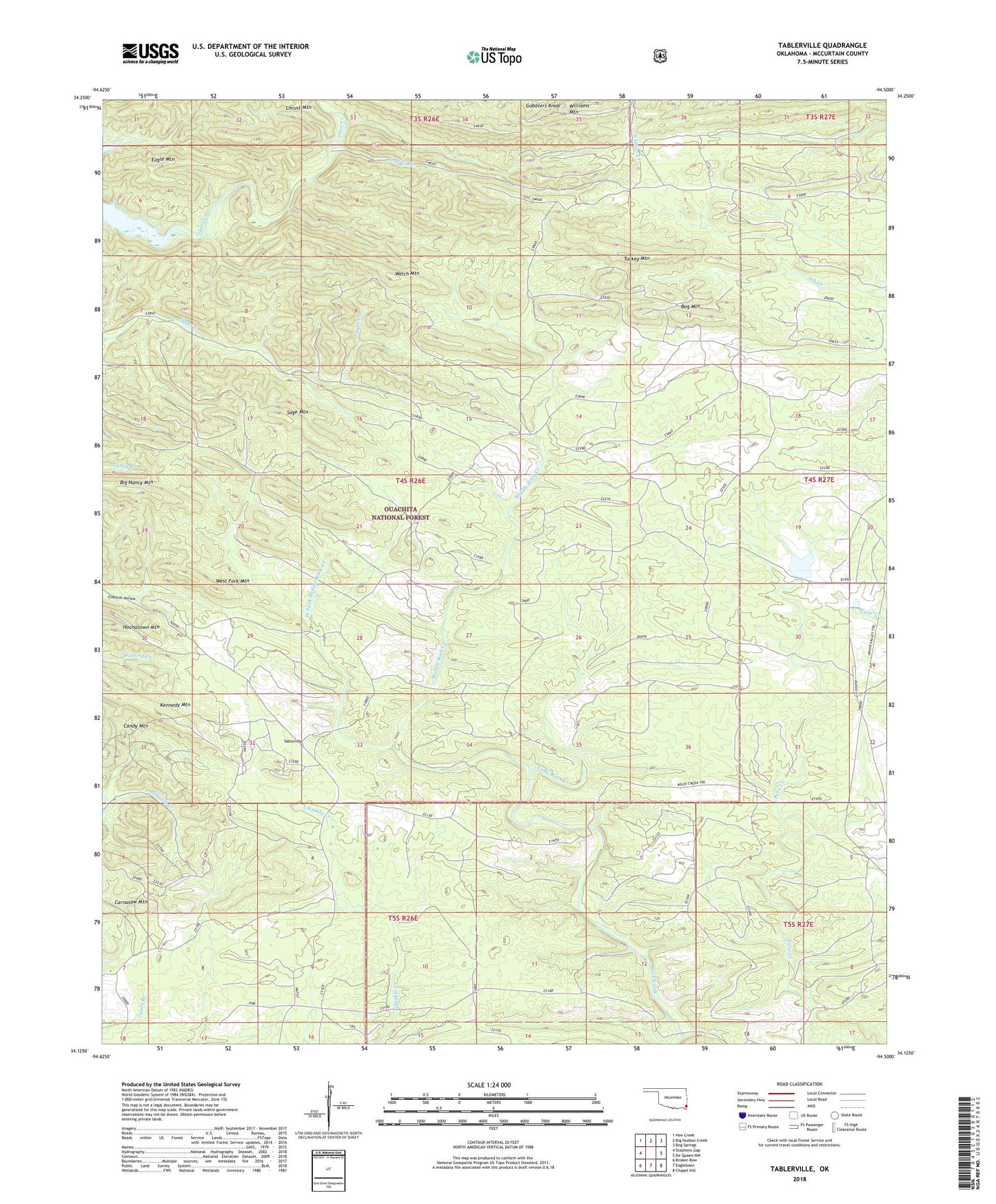
Tablerville Oklahoma US Topo Map
Couldn't load pickup availability
Also explore the Tablerville Forest Service Topo of this same quad for updated USFS data
2022 topographic map quadrangle Tablerville in the state of Oklahoma. Scale: 1:24000. Based on the newly updated USGS 7.5' US Topo map series, this map is in the following counties: McCurtain. The map contains contour data, water features, and other items you are used to seeing on USGS maps, but also has updated roads and other features. This is the next generation of topographic maps. Printed on high-quality waterproof paper with UV fade-resistant inks.
Quads adjacent to this one:
West: Stephens Gap
Northwest: Hee Creek
North: Big Hudson Creek
Northeast: Bog Springs
East: De Queen NW
Southeast: Chapel Hill
South: Eagletown
Southwest: Broken Bow
This map covers the same area as the classic USGS quad with code o34094b5.
Contains the following named places: Big Nancy Mountain, Bog Mountain, Eagle Mountain, East Otter Creek, Gobblers Knob, Henderson Lake, Henderson Lake Dam, Hochatown Mountain, Kennedy Mountain, Little Rock Creek, Locust Mountain, Luksuklo Creek, Middle Rock Creek, Sage Mountain, Tablerville, Turkey Mountain, Welch Mountain, West Fork Middle Rock Creek, West Fork Mountain, Williams Mountain