MyTopo
De Queen NW Arkansas US Topo Map
Couldn't load pickup availability
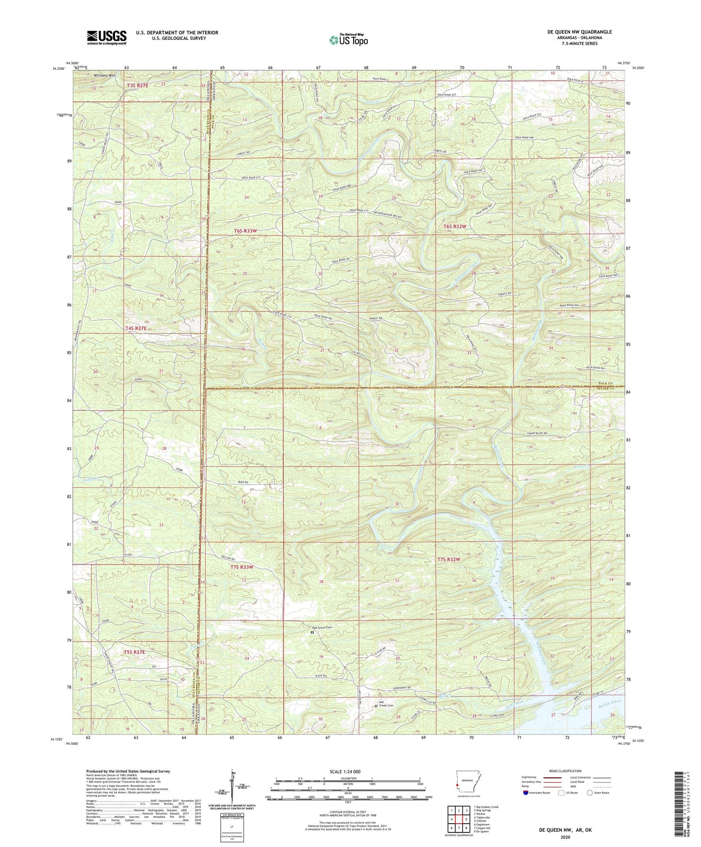
2024 topographic map quadrangle De Queen NW in the states of Arkansas, Oklahoma. Scale: 1:24000. Based on the newly updated USGS 7.5' US Topo map series, this map is in the following counties: Sevier, Polk, McCurtain. The map contains contour data, water features, and other items you are used to seeing on USGS maps, but also has updated roads and other features. This is the next generation of topographic maps. Printed on high-quality waterproof paper with UV fade-resistant inks.
Quads adjacent to this one:
West: Tablerville
Northwest: Big Hudson Creek
North: Bog Springs
Northeast: Wickes
East: Gillham
Southeast: De Queen
South: Chapel Hill
Southwest: Eagletown
Contains the following named places: Ash Creek, Blanchard, Cross Creek, Independence School, Midway Church, Mill Creek, Mill Creek Cemetery, Mill Creek School, Oak Grove Cemetery, Price Creek, Redding School, Robinson Creek, Shady Grove School, Township of Mill Creek