MyTopo
Elmer Oklahoma US Topo Map
Couldn't load pickup availability
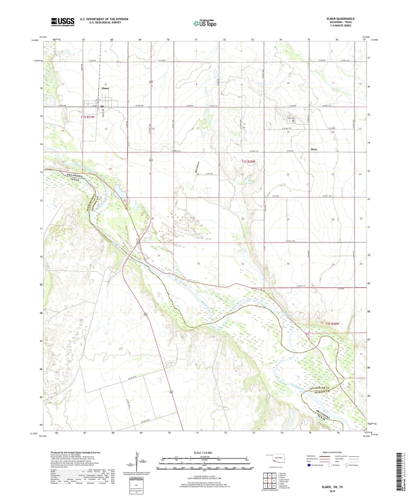
2019 topographic map quadrangle Elmer in the state of Oklahoma. Scale: 1:24000. Based on the newly updated USGS 7.5' US Topo map series, this map is in the following counties: Jackson, Wilbarger. The map contains contour data, water features, and other items you are used to seeing on USGS maps, but also has updated roads and other features. This is the next generation of topographic maps. Printed on high-quality waterproof paper with UV fade-resistant inks.
Quads adjacent to this one:
West: Ayers Island
Northwest: Olustee
North: Altus SE
Northeast: Tipton
East: White Lake
Southeast: Frederick SW
South: Northside
Southwest: Odell
Contains the following named places: Elmer, Elmer Post Office, Elmer Rural Volunteer Fire Department, Hess, Hess Cemetery, Red Hollow, Salt Fork Red River, Southside School, Town of Elmer, Township of Elmer, ZIP Code: 73539