MyTopo
Altus SE Oklahoma US Topo Map
Couldn't load pickup availability
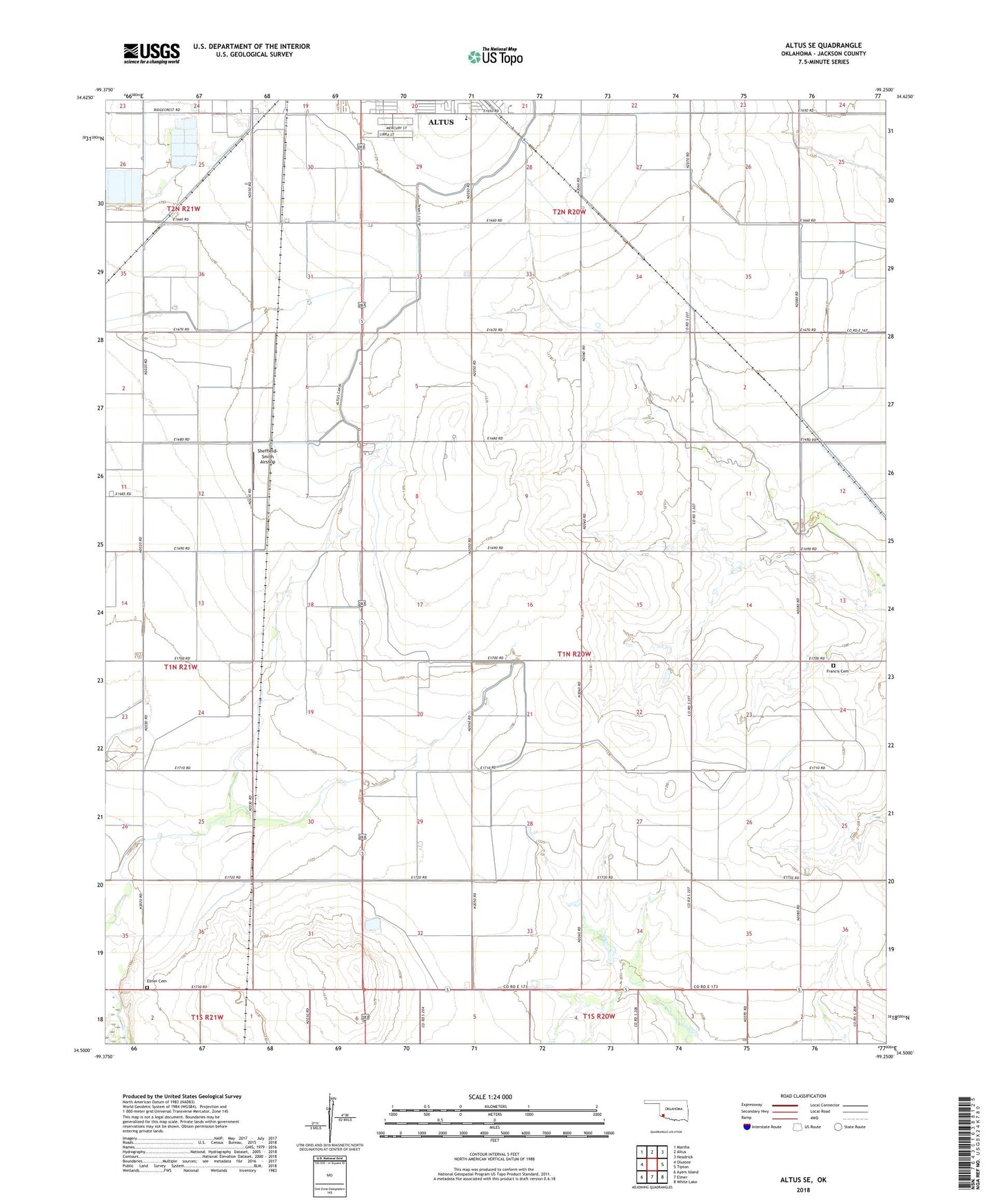
2022 topographic map quadrangle Altus SE in the state of Oklahoma. Scale: 1:24000. Based on the newly updated USGS 7.5' US Topo map series, this map is in the following counties: Jackson. The map contains contour data, water features, and other items you are used to seeing on USGS maps, but also has updated roads and other features. This is the next generation of topographic maps. Printed on high-quality waterproof paper with UV fade-resistant inks.
Quads adjacent to this one:
West: Olustee
Northwest: Martha
North: Altus
Northeast: Headrick
East: Tipton
Southeast: White Lake
South: Elmer
Southwest: Ayers Island
This map covers the same area as the classic USGS quad with code o34099e3.
Contains the following named places: Altus Junior High School, Altus South Division, Church of Christ Ridgecrest Road, Elmer Cemetery, Francis Cemetery, Sheffield-Smith Airstrip, Township of Baucum