MyTopo
Olustee Oklahoma US Topo Map
Couldn't load pickup availability
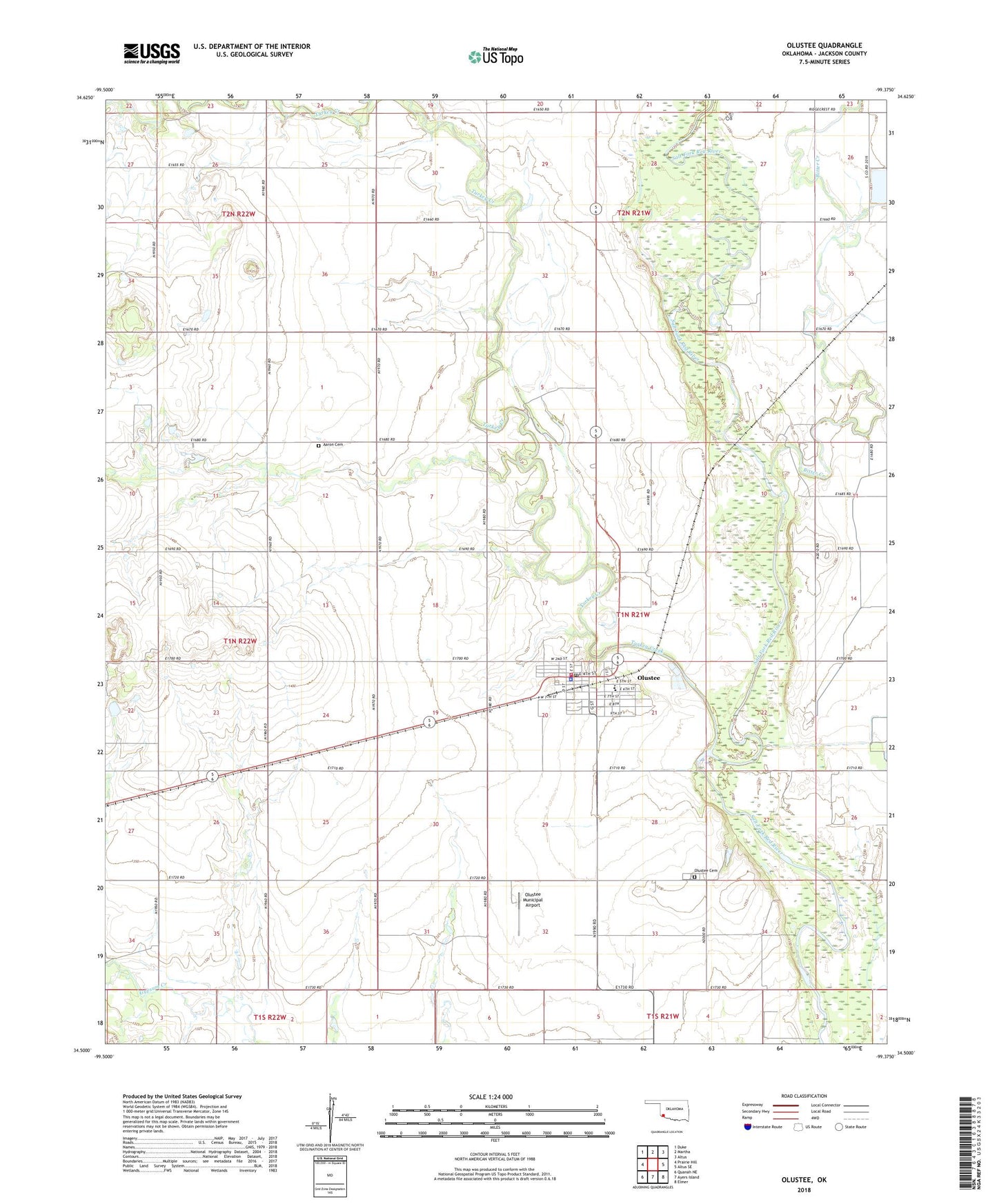
2022 topographic map quadrangle Olustee in the state of Oklahoma. Scale: 1:24000. Based on the newly updated USGS 7.5' US Topo map series, this map is in the following counties: Jackson. The map contains contour data, water features, and other items you are used to seeing on USGS maps, but also has updated roads and other features. This is the next generation of topographic maps. Printed on high-quality waterproof paper with UV fade-resistant inks.
Quads adjacent to this one:
West: Prairie Hill
Northwest: Duke
North: Martha
Northeast: Altus
East: Altus SE
Southeast: Elmer
South: Ayers Island
Southwest: Quanah NE
This map covers the same area as the classic USGS quad with code o34099e4.
Contains the following named places: Aaron Cemetery, Bitter Creek, Jackson County, Olustee, Olustee - Eldorado Elementary School, Olustee - Eldorado High School, Olustee Cemetery, Olustee Municipal Airport, Olustee Police Department, Olustee Post Office, Olustee Volunteer Fire Department, Town of Olustee, Township of Olustee, Turkey Creek, ZIP Code: 73560