MyTopo
Fort Cobb Oklahoma US Topo Map
Couldn't load pickup availability
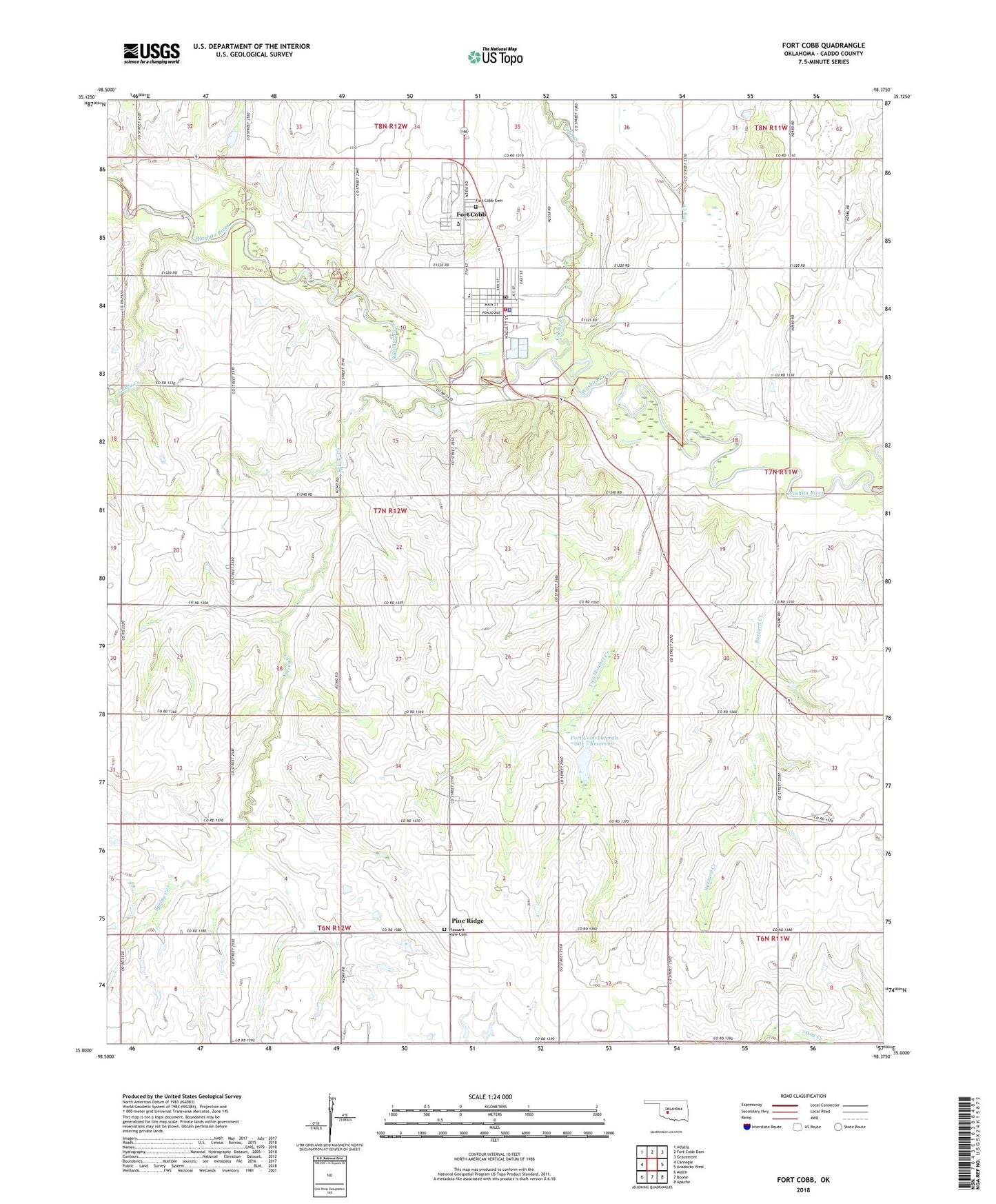
2022 topographic map quadrangle Fort Cobb in the state of Oklahoma. Scale: 1:24000. Based on the newly updated USGS 7.5' US Topo map series, this map is in the following counties: Caddo. The map contains contour data, water features, and other items you are used to seeing on USGS maps, but also has updated roads and other features. This is the next generation of topographic maps. Printed on high-quality waterproof paper with UV fade-resistant inks.
Quads adjacent to this one:
West: Carnegie
Northwest: Alfalfa
North: Fort Cobb Dam
Northeast: Gracemont
East: Anadarko West
Southeast: Apache
South: Boone
Southwest: Alden
This map covers the same area as the classic USGS quad with code o35098a4.
Contains the following named places: Apache Church, Behel Assembly of God Church, Buzzard Creek, Caddo Church, Caddo Kiowa Technology Center, Cobb Creek, Cowden Laterals Site 14 Dam, Cowden Laterals Site 14 Reservoir, Dry Creek, First Baptist Church, Fort Cobb, Fort Cobb - Broxton Elementary School, Fort Cobb - Broxton High School, Fort Cobb - Broxton Middle School, Fort Cobb Cemetery, Fort Cobb Division, Fort Cobb Fire Department, Fort Cobb Laterals Site 7 Dam, Fort Cobb Laterals Site 7 Reservoir, Fort Cobb Police Department, Fort Cobb Post Office, Gokey Creek, Macedonia Church, Pine Ridge, Pleasant View Cemetery, Spring Creek, Town of Fort Cobb, Township of Fort Cobb, Two Hatchet Creek, ZIP Code: 73038