MyTopo
Fox NE Oklahoma US Topo Map
Couldn't load pickup availability
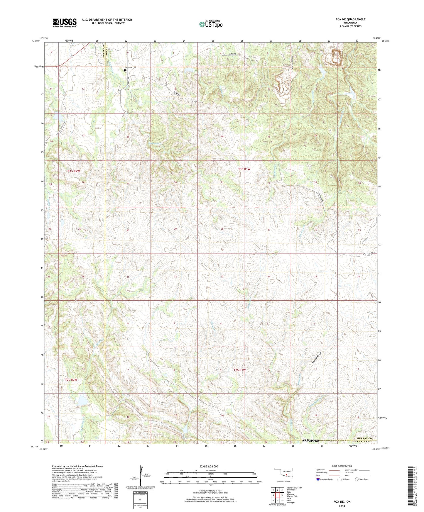
2022 topographic map quadrangle Fox NE in the state of Oklahoma. Scale: 1:24000. Based on the newly updated USGS 7.5' US Topo map series, this map is in the following counties: Murray, Carter. The map contains contour data, water features, and other items you are used to seeing on USGS maps, but also has updated roads and other features. This is the next generation of topographic maps. Printed on high-quality waterproof paper with UV fade-resistant inks.
Quads adjacent to this one:
West: Tatums
Northwest: Elmore City South
North: Hennepin
Northeast: Joy
East: Turner Falls
Southeast: Springer
South: Milo
Southwest: Fox
This map covers the same area as the classic USGS quad with code o34097d3.
Contains the following named places: Banks Humble Lake Number 1, Banks Humble Lake Number 1 Dam, Caddo Creek Site 7 Dam, Caddo Creek Site 7 Reservoir, Chickasaw Oklahoma Tribal Statistical Area, Hennepin Cemetery, Thomas Creek, Thomas Hollow, Wildhorse Creek Site 125 Dam, Wildhorse Creek Site 125 Reservoir, Wildhorse Creek Site 4 Dam, Wildhorse Creek Site 4 Reservoir, Wildhorse Creek Site 5 Dam, Wildhorse Creek Site 5 Reservoir, Wildhorse Creek Site 7 Dam, Wildhorse Creek Site 7 Reservoir, Wildhorse Creek Site 79 Dam, Wildhorse Creek Site 79 Reservoir, Wildhorse Creek Site 9 Dam, Wildhorse Creek Site 9 Reservoir, Zelder Humble Lake Number 2, Zelder Humble Lake Number 2 Dam, ZIP Code: 73444