MyTopo
Franklin Oklahoma US Topo Map
Couldn't load pickup availability
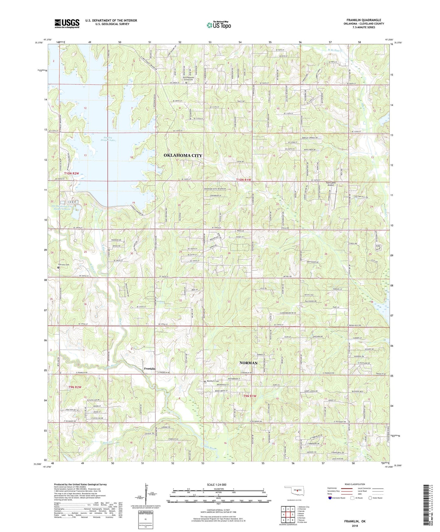
2022 topographic map quadrangle Franklin in the state of Oklahoma. Scale: 1:24000. Based on the newly updated USGS 7.5' US Topo map series, this map is in the following counties: Cleveland. The map contains contour data, water features, and other items you are used to seeing on USGS maps, but also has updated roads and other features. This is the next generation of topographic maps. Printed on high-quality waterproof paper with UV fade-resistant inks.
Quads adjacent to this one:
West: Moore
Northwest: Midwest City
North: Choctaw
Northeast: Harrah
East: Stella
Southeast: Little Axe
South: Denver
Southwest: Norman
This map covers the same area as the classic USGS quad with code o35097c3.
Contains the following named places: Blackburn Cemetery, Blackburn School, East Elm Creek, Elm Creek, Fairview Cemetery, Ford-Pleasant Grove Cemetery, Franklin, Franklin Baptist Church, Franklin United Methodist Church, Friendship Pentecostal Church, Gods Ministry Church, Grace Place Baptist Church, Hilltop Baptist Church, KGOU-FM (Norman), Lake Stanley Draper, Lakeview Elementary School, Liberty School, Little River Wildlife Managment Area, Meeks Chapel, Pleasant Hill Freewill Baptist Church, Robin Hill Elementary School, Robinson School, Rock Creek, Schwartz Elementary School, Stanley Draper Dam, Stanley Draper Lake, SW Oklahoma City Sludge Lagoon, SW Oklahoma City Sludge Lagoon Dam, Township of Case, Twin Lakes Airport, Union Grove Church, West Branch Hog Creek, West Elm Creek, ZIP Code: 73165