MyTopo
Stella Oklahoma US Topo Map
Couldn't load pickup availability
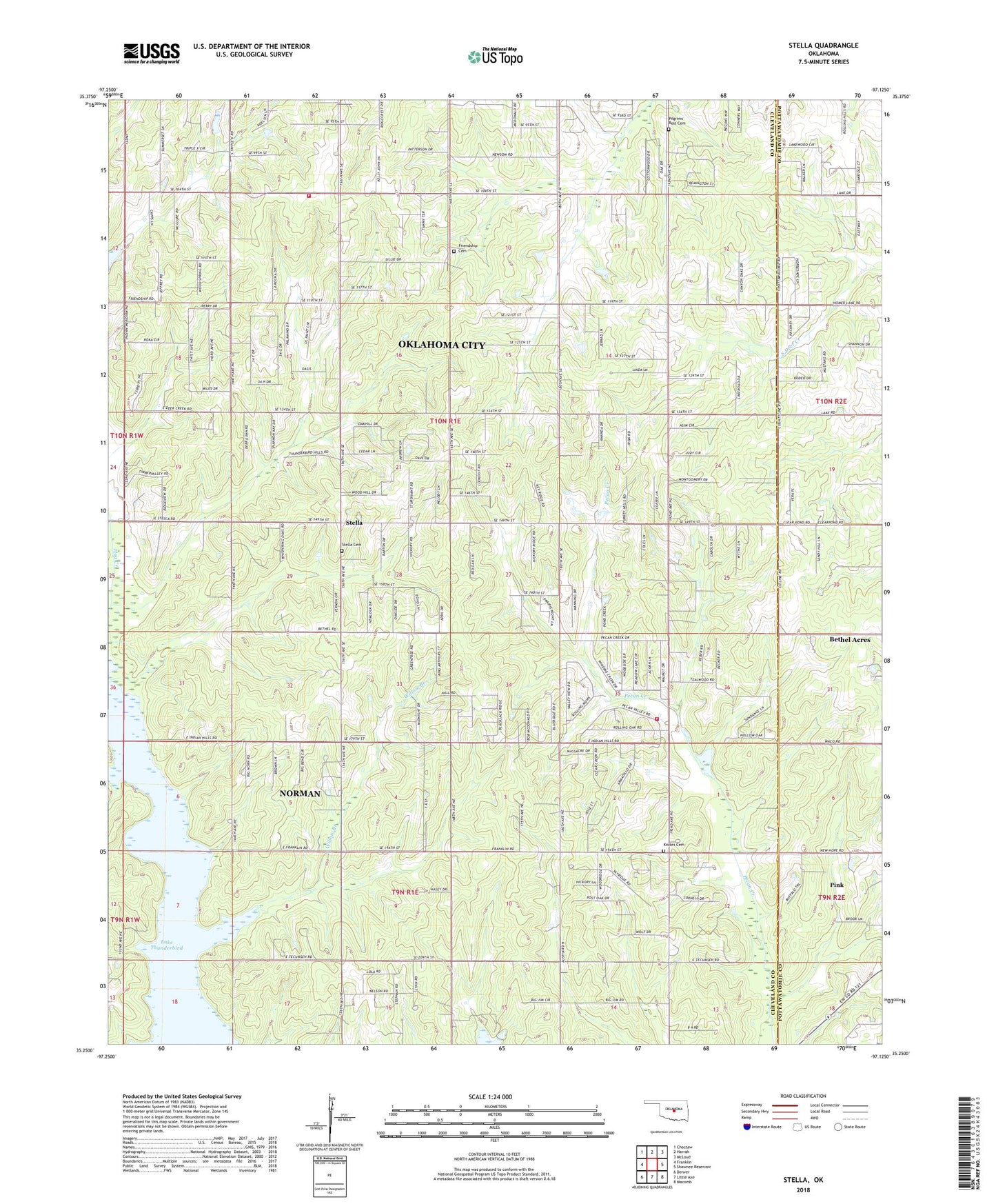
2022 topographic map quadrangle Stella in the state of Oklahoma. Scale: 1:24000. Based on the newly updated USGS 7.5' US Topo map series, this map is in the following counties: Cleveland, Pottawatomie. The map contains contour data, water features, and other items you are used to seeing on USGS maps, but also has updated roads and other features. This is the next generation of topographic maps. Printed on high-quality waterproof paper with UV fade-resistant inks.
Quads adjacent to this one:
West: Franklin
Northwest: Choctaw
North: Harrah
Northeast: McLoud
East: Shawnee Reservoir
Southeast: Macomb
South: Little Axe
Southwest: Denver
This map covers the same area as the classic USGS quad with code o35097c2.
Contains the following named places: Friendly Church, Friendship Cemetery, Knoles Cemetery, Little Axe Baptist Church, Little Axe Independent School District, Little Axe Volunteer Fire Department, Oklahoma City Fire Department Station 36, Oknoname 103005 Dam, Oknoname 103005 Reservoir, Pilgrim Rest Church, Pilgrims Rest Cemetery, Stella, Stella Cemetery, Township of Stell, Upper Black Bear Creek Site 10 Dam, Upper Black Bear Creek Site 10 Reservoir, Willow Branch, ZIP Code: 74857