MyTopo
Denver Oklahoma US Topo Map
Couldn't load pickup availability
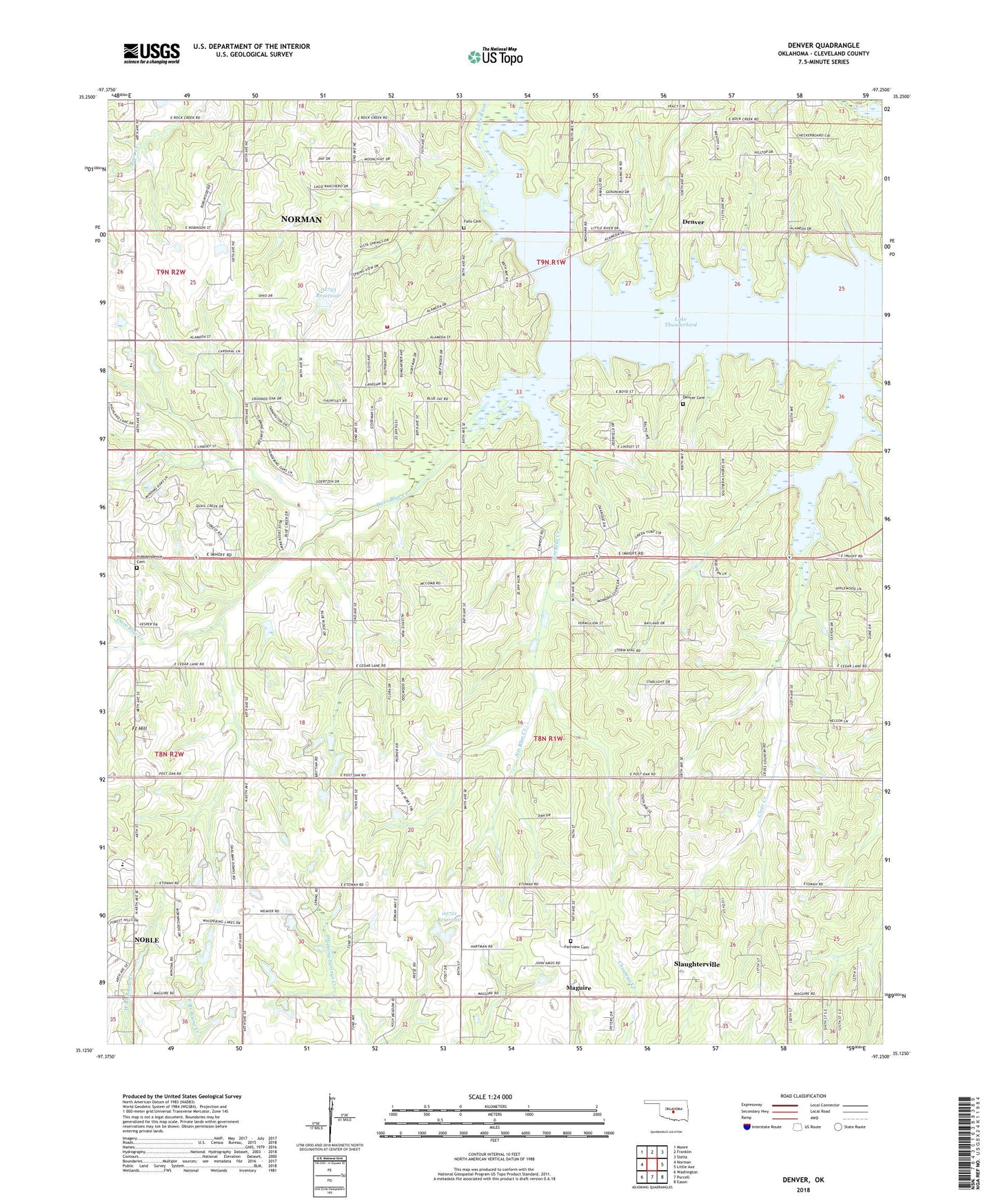
2022 topographic map quadrangle Denver in the state of Oklahoma. Scale: 1:24000. Based on the newly updated USGS 7.5' US Topo map series, this map is in the following counties: Cleveland. The map contains contour data, water features, and other items you are used to seeing on USGS maps, but also has updated roads and other features. This is the next generation of topographic maps. Printed on high-quality waterproof paper with UV fade-resistant inks.
Quads adjacent to this one:
West: Norman
Northwest: Moore
North: Franklin
Northeast: Stella
East: Little Axe
Southeast: Eason
South: Purcell
Southwest: Washington
This map covers the same area as the classic USGS quad with code o35097b3.
Contains the following named places: Adair School, All Welcome Victory Church, City of Noble, City of Norman, Clear Creek, Cleveland County, Dave Blue Creek, Denver, Denver Cemetery, Enterprise Baptist Church, Fairview Cemetery, Faith Baptist Church, Falls Cemetery, Falls School, Fort Hill, Independence Cemetery, Jim Blue Creek, Liberty Church, Maguire, Noble High School, Norman Fire Department Station 6, Oknoname 02721 Dam, Oknoname 02721 Reservoir, Oknoname 02722 Dam, Oknoname 02723 Dam, Oknoname 02723 Reservoir, Pata Skyhaven Airport, Township of Noble, Washington Elementary School, ZIP Codes: 73026, 73068