MyTopo
Gowen Oklahoma US Topo Map
Couldn't load pickup availability
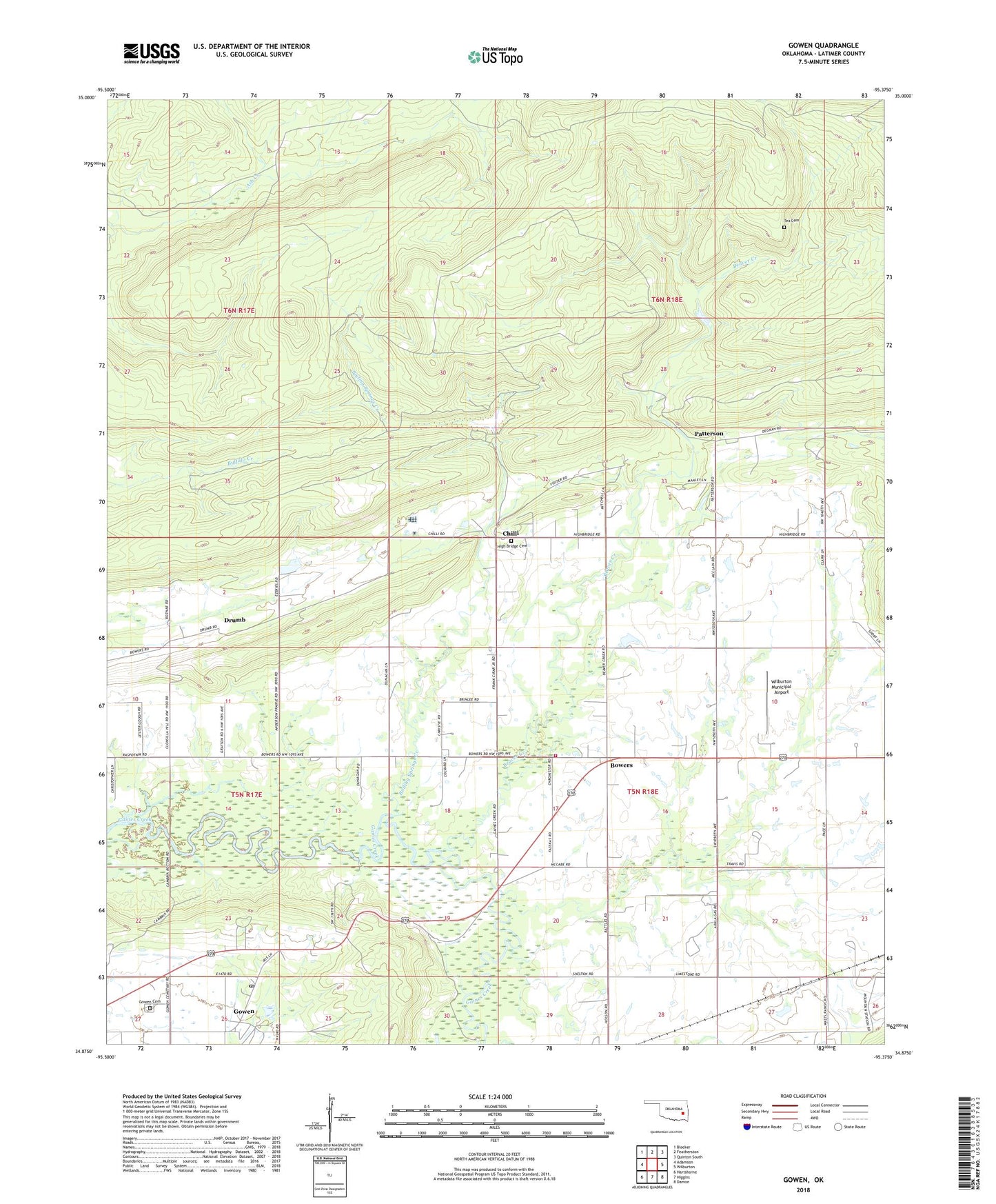
2018 topographic map quadrangle Gowen in the state of Oklahoma. Scale: 1:24000. Based on the newly updated USGS 7.5' US Topo map series, this map is in the following counties: Latimer. The map contains contour data, water features, and other items you are used to seeing on USGS maps, but also has updated roads and other features. This is the next generation of topographic maps. Printed on high-quality waterproof paper with UV fade-resistant inks.
Quads adjacent to this one:
West: Adamson
Northwest: Blocker
North: Featherston
Northeast: Quinton South
East: Wilburton
Southeast: Damon
South: Higgins
Southwest: Hartshorne
Contains the following named places: Beaver Creek, Boiling Springs Creek, Boiling Springs Site 1 Dam, Boiling Springs Site 1 Reservoir, Bowers, Bowers Church, Chilli, Drumb, Gowen, Gowen Cemetery, Gowen Census Designated Place, Gowen Post Office, High Bridge Cemetery, Patterson, Tea Cemetery, Township of Gowen, West End Volunteer Fire Department, Wilburton Division, Wilburton Municipal Airport