MyTopo
Hugo Dam Oklahoma US Topo Map
Couldn't load pickup availability
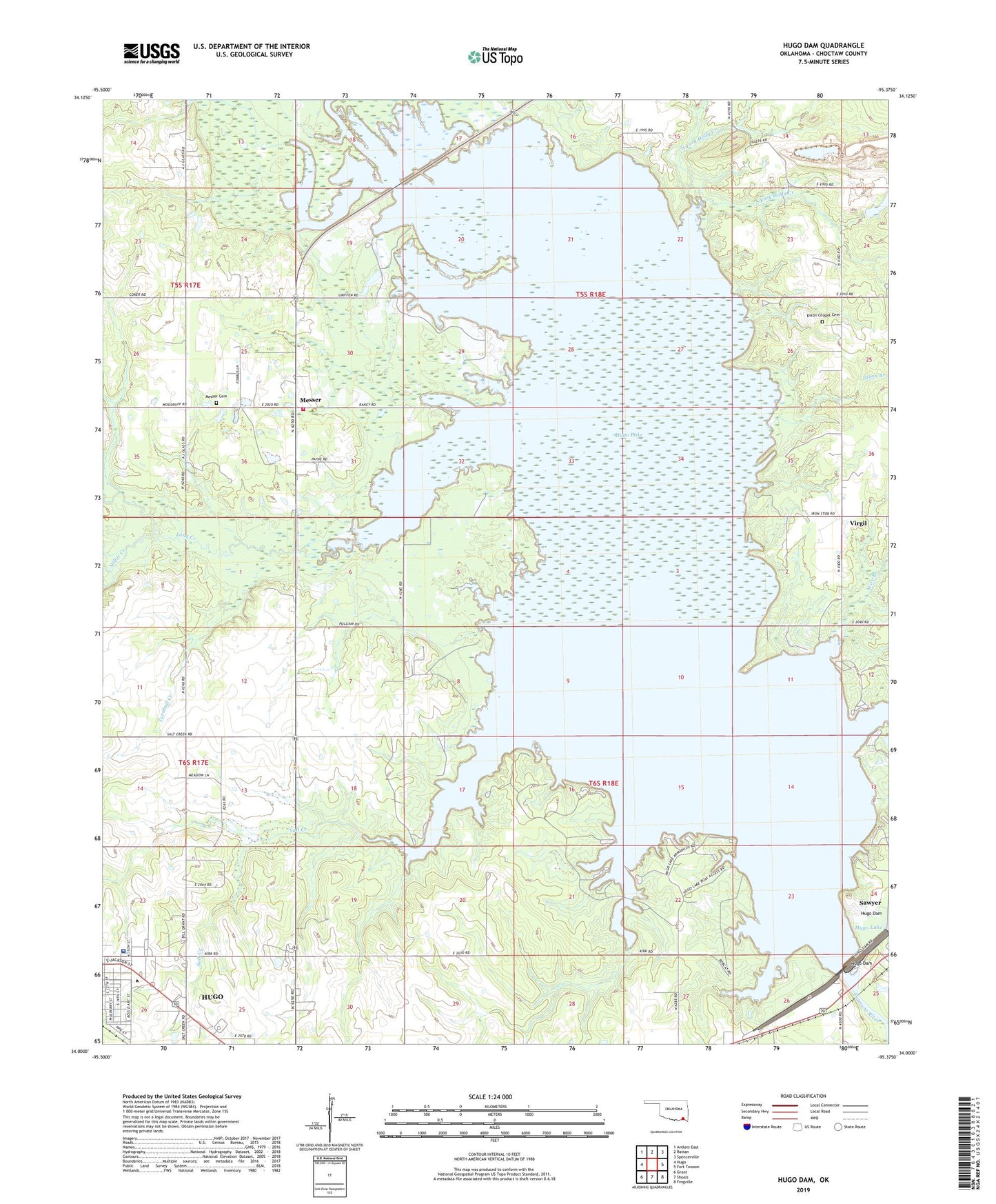
2022 topographic map quadrangle Hugo Dam in the state of Oklahoma. Scale: 1:24000. Based on the newly updated USGS 7.5' US Topo map series, this map is in the following counties: Choctaw. The map contains contour data, water features, and other items you are used to seeing on USGS maps, but also has updated roads and other features. This is the next generation of topographic maps. Printed on high-quality waterproof paper with UV fade-resistant inks.
Quads adjacent to this one:
West: Hugo
Northwest: Antlers East
North: Rattan
Northeast: Spencerville
East: Fort Towson
Southeast: Frogville
South: Shoals
Southwest: Grant
This map covers the same area as the classic USGS quad with code o34095a4.
Contains the following named places: Cedar Creek, Choctaw Memorial Hospital, Choctaw Shopping Center, Dixon Branch, Dixon Chapel Cemetery, Holly Creek, Hugo Dam, Hugo Lake, Jackson Plaza, Kiamichi Technology Center - Hugo Campus, KIHN-AM (Hugo), Lane Frost Health and Rehabilitation Center, Long Creek, Messer, Messer Cemetery, Messer Fire Department, Miller Creek, North Fork Holly Creek, Salt Creek, South Fork Holly Creek, South Lake, Town of Sawyer, Township of Ratliffe, Trinity Church, Turnbull Creek, Virgil, Wire Branch, ZIP Code: 74743