MyTopo
Hardy Oklahoma US Topo Map
Couldn't load pickup availability
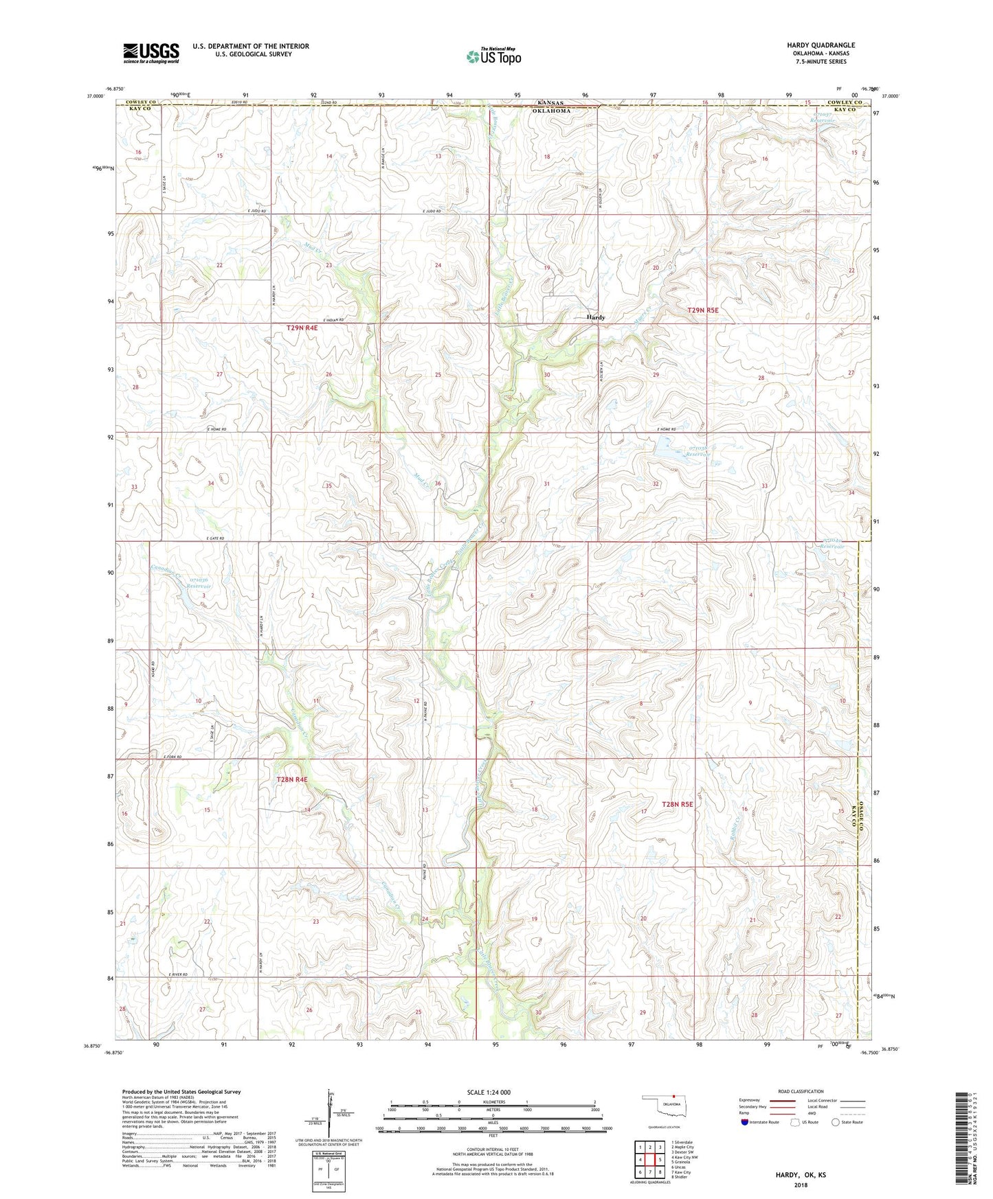
2018 topographic map quadrangle Hardy in the state of Oklahoma. Scale: 1:24000. Based on the newly updated USGS 7.5' US Topo map series, this map is in the following counties: Kay, Osage, Cowley. The map contains contour data, water features, and other items you are used to seeing on USGS maps, but also has updated roads and other features. This is the next generation of topographic maps. Printed on high-quality waterproof paper with UV fade-resistant inks.
Quads adjacent to this one:
West: Kaw City NW
Northwest: Silverdale
North: Maple City
Northeast: Dexter SW
East: Grainola
Southeast: Shidler
South: Kaw City
Southwest: Uncas
Contains the following named places: Canadian Creek, Hardy, Mud Creek, Myers Creek, Oknoname 071036 Dam, Oknoname 071036 Reservoir, Oknoname 071037 Dam, Oknoname 071037 Reservoir, Oknoname 071038 Dam, Oknoname 071038 Reservoir, Oknoname 071039 Dam, Oknoname 071039 Reservoir, Oknoname 071040 Dam, Oknoname 071040 Reservoir, Township of Brewer