MyTopo
Kaw City Oklahoma US Topo Map
Couldn't load pickup availability
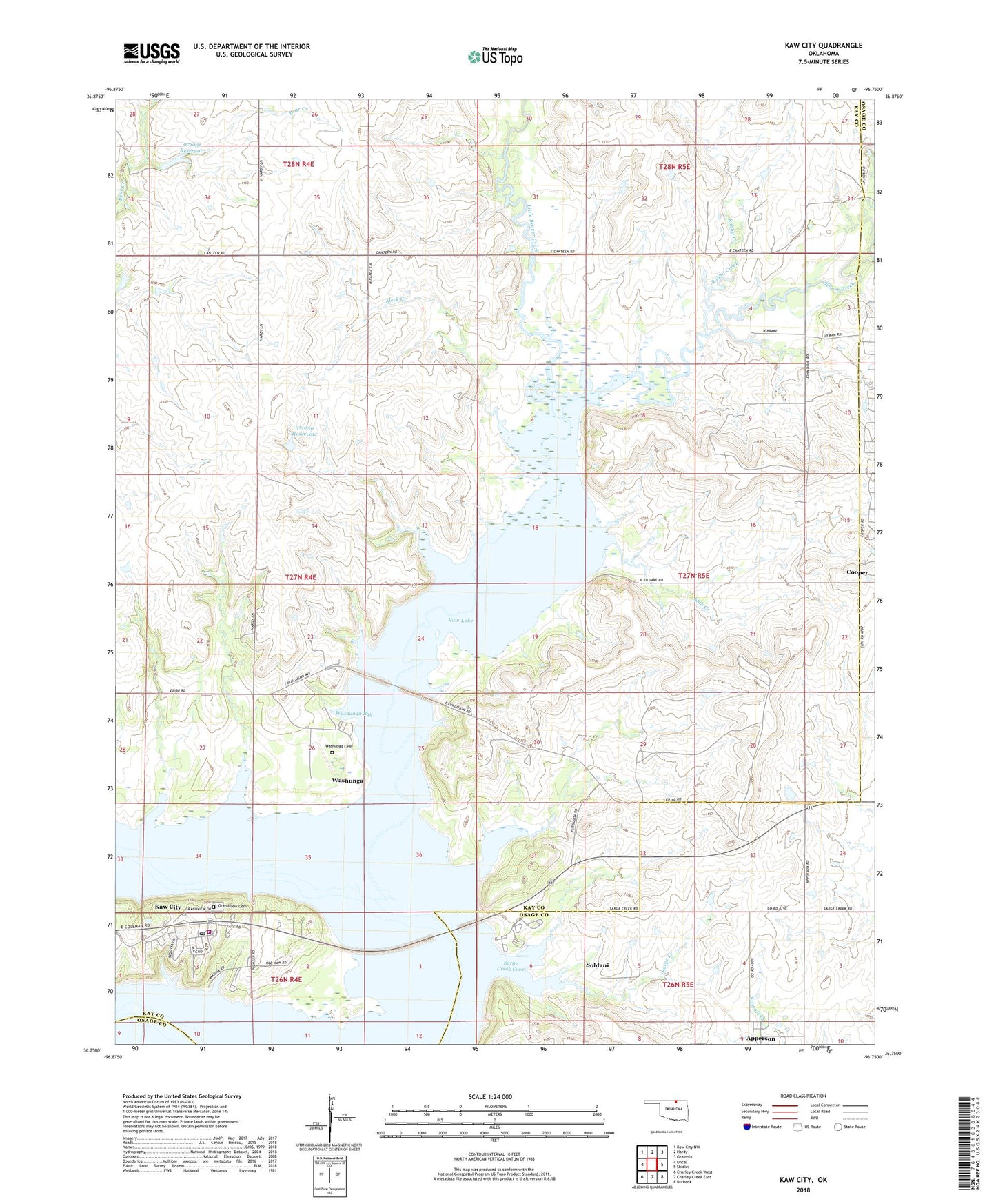
2022 topographic map quadrangle Kaw City in the state of Oklahoma. Scale: 1:24000. Based on the newly updated USGS 7.5' US Topo map series, this map is in the following counties: Kay, Osage. The map contains contour data, water features, and other items you are used to seeing on USGS maps, but also has updated roads and other features. This is the next generation of topographic maps. Printed on high-quality waterproof paper with UV fade-resistant inks.
Quads adjacent to this one:
West: Uncas
Northwest: Kaw City NW
North: Hardy
Northeast: Grainola
East: Shidler
Southeast: Burbank
South: Charley Creek East
Southwest: Charley Creek West
This map covers the same area as the classic USGS quad with code o36096g7.
Contains the following named places: Aleck Creek, Apperson, Beaver Creek, City of Kaw City, Cooper, Grandview Cemetery, Haines Creek, Kaw Agency, Kaw City, Kaw City Division, Kaw City Elementary School, Kaw City Fire Department, Kaw City Police Department, Kaw City Post Office, Kaw Oil Field, Kaw Wildlife Management Area, Little Beaver Creek, Oknoname 071030 Dam, Oknoname 071030 Reservoir, Oknoname 071031 Dam, Oknoname 071031 Reservoir, Pioneer Park, Rabbit Creek, Sarge Creek, Sarge Creek Cove, Sarge Creek Rural Fire Company, Soldani, Stub Creek, Township of Kaw, Washunga, Washunga Bay, Washunga Cemetery