MyTopo
Shidler Oklahoma US Topo Map
Couldn't load pickup availability
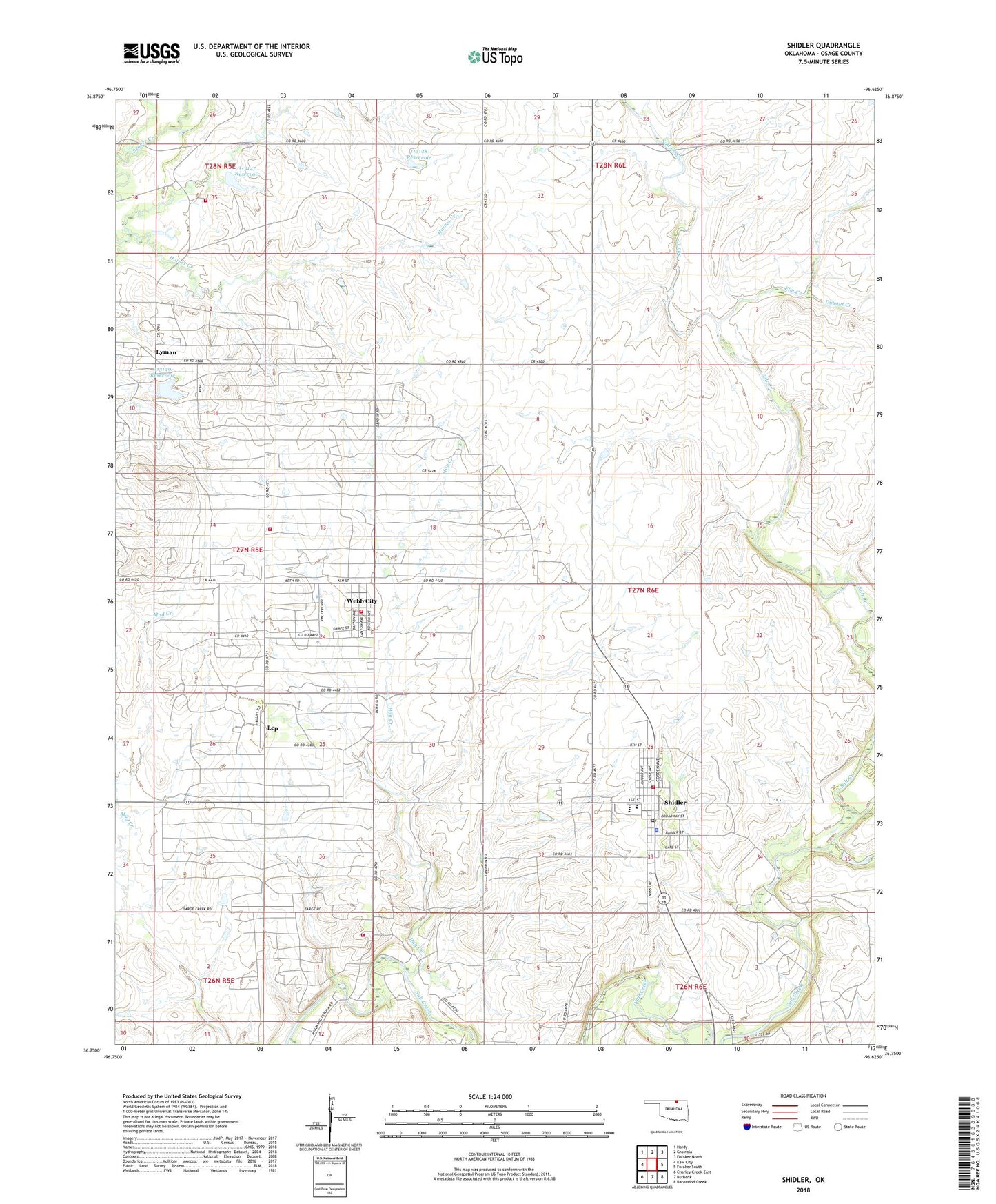
2022 topographic map quadrangle Shidler in the state of Oklahoma. Scale: 1:24000. Based on the newly updated USGS 7.5' US Topo map series, this map is in the following counties: Osage. The map contains contour data, water features, and other items you are used to seeing on USGS maps, but also has updated roads and other features. This is the next generation of topographic maps. Printed on high-quality waterproof paper with UV fade-resistant inks.
Quads adjacent to this one:
West: Kaw City
Northwest: Hardy
North: Grainola
Northeast: Foraker North
East: Foraker South
Southeast: Baconrind Creek
South: Burbank
Southwest: Charley Creek East
This map covers the same area as the classic USGS quad with code o36096g6.
Contains the following named places: Bar - C Volunteer Fire Department, Burbank Oil Field, City of Shidler, Cooper Ranch Airport, Denoya Rural Fire Department, Dugout Creek, Elm Creek, Hay Creek, Lep, Lyman, Lyman Rural Fire Company, Oknoname 113147 Dam, Oknoname 113147 Reservoir, Oknoname 113148 Dam, Oknoname 113148 Reservoir, Oknoname 113149 Dam, Oknoname 113149 Reservoir, Potato Creek, Shidler, Shidler High School, Shidler Police Department, Shidler Post Office, Shidler Volunteer Fire Department, Shidler Volunteer Fire Department and Ambulance, Town of Webb City, Van Camp Airport, Wamsley Creek, Ward Elementary School, Webb City, Webb City Volunteer Fire Department, ZIP Code: 74652