MyTopo
Hart Oklahoma US Topo Map
Couldn't load pickup availability
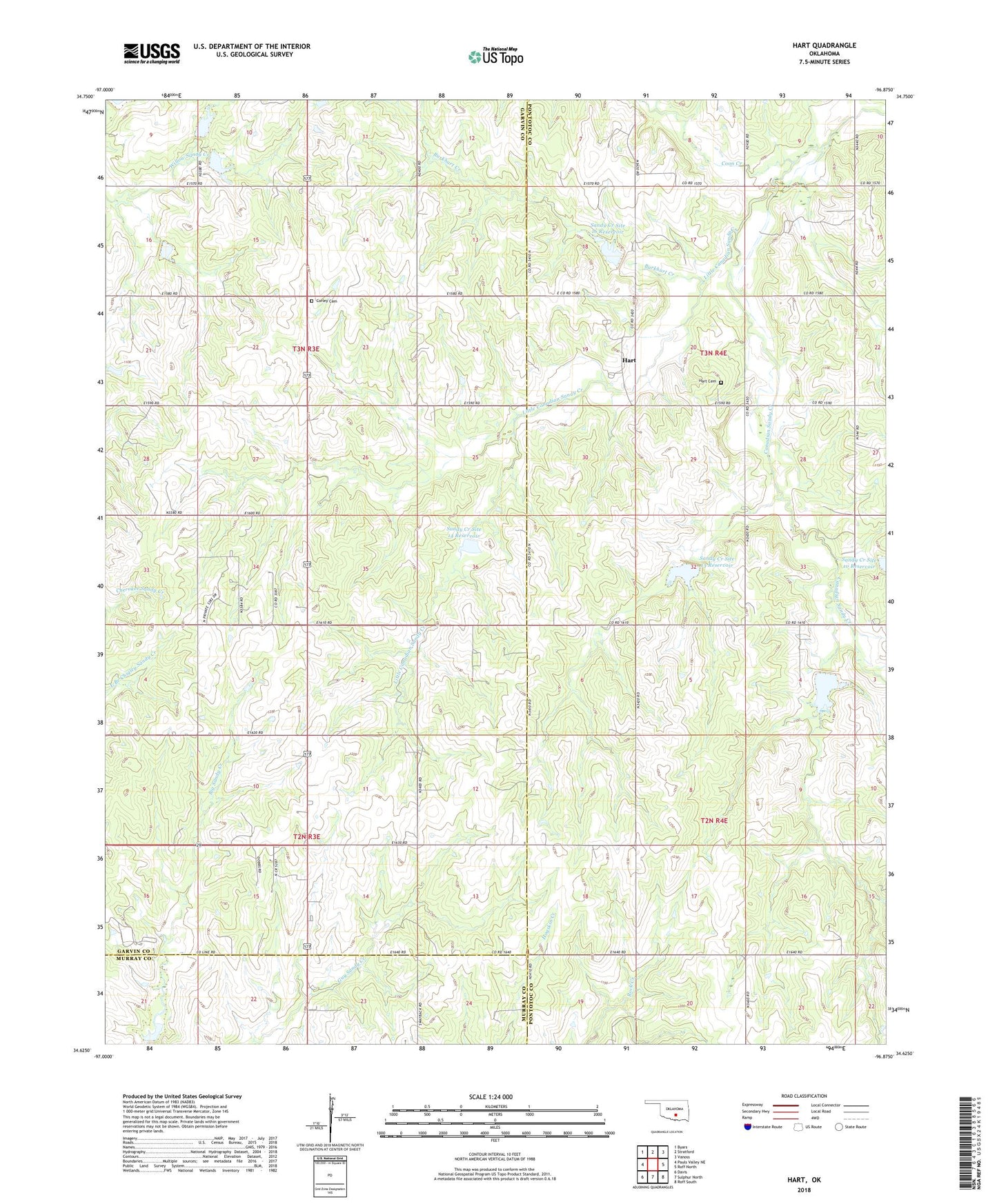
2018 topographic map quadrangle Hart in the state of Oklahoma. Scale: 1:24000. Based on the newly updated USGS 7.5' US Topo map series, this map is in the following counties: Garvin, Pontotoc, Murray. The map contains contour data, water features, and other items you are used to seeing on USGS maps, but also has updated roads and other features. This is the next generation of topographic maps. Printed on high-quality waterproof paper with UV fade-resistant inks.
Quads adjacent to this one:
West: Pauls Valley NE
Northwest: Byars
North: Stratford
Northeast: Vanoss
East: Roff North
Southeast: Roff South
South: Sulphur North
Southwest: Davis
Contains the following named places: Burkhart Creek, Cherokee Sandy Site 8b Dam, Cherokee Sandy Site 8b Reservoir, Cherokee Sandy Site 8c Dam, Cherokee Sandy Site 8c Reservoir, Cherokee Sandy Site 8d Dam, Cherokee Sandy Site 8d Reservoir, Coon Creek, Corley Cemetery, Dolberg, Dolberg Oil Field, Hart, Hart Cemetery, Little Canadian Sandy Creek, Prairie View Mission, Rock Creek Site 3 Dam, Rock Creek Site 3 Reservoir, Rock Creek Site 4a Dam, Sandy Creek 9 Dam, Sandy Creek 9 Reservoir, Sandy Creek Site 10 Dam, Sandy Creek Site 10 Reservoir, Sandy Creek Site 12 Dam, Sandy Creek Site 12 Reservoir, Sandy Creek Site 13 Dam, Sandy Creek Site 13 Reservoir, Sandy Creek Site 14 Dam, Sandy Creek Site 14 Reservoir, Sandy Creek Site 15 Dam, Sandy Creek Site 15 Reservoir, Sandy Creek Site 16 Dam, Sandy Creek Site 16 Reservoir