MyTopo
Roff North Oklahoma US Topo Map
Couldn't load pickup availability
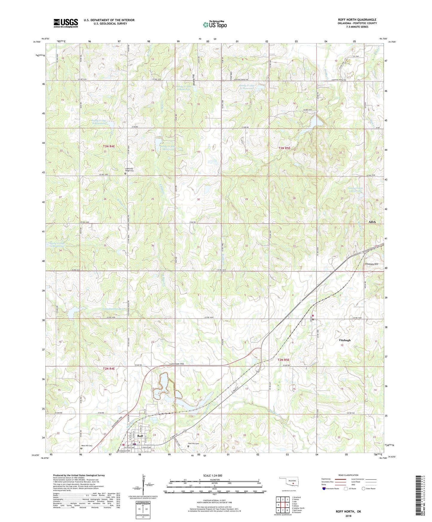
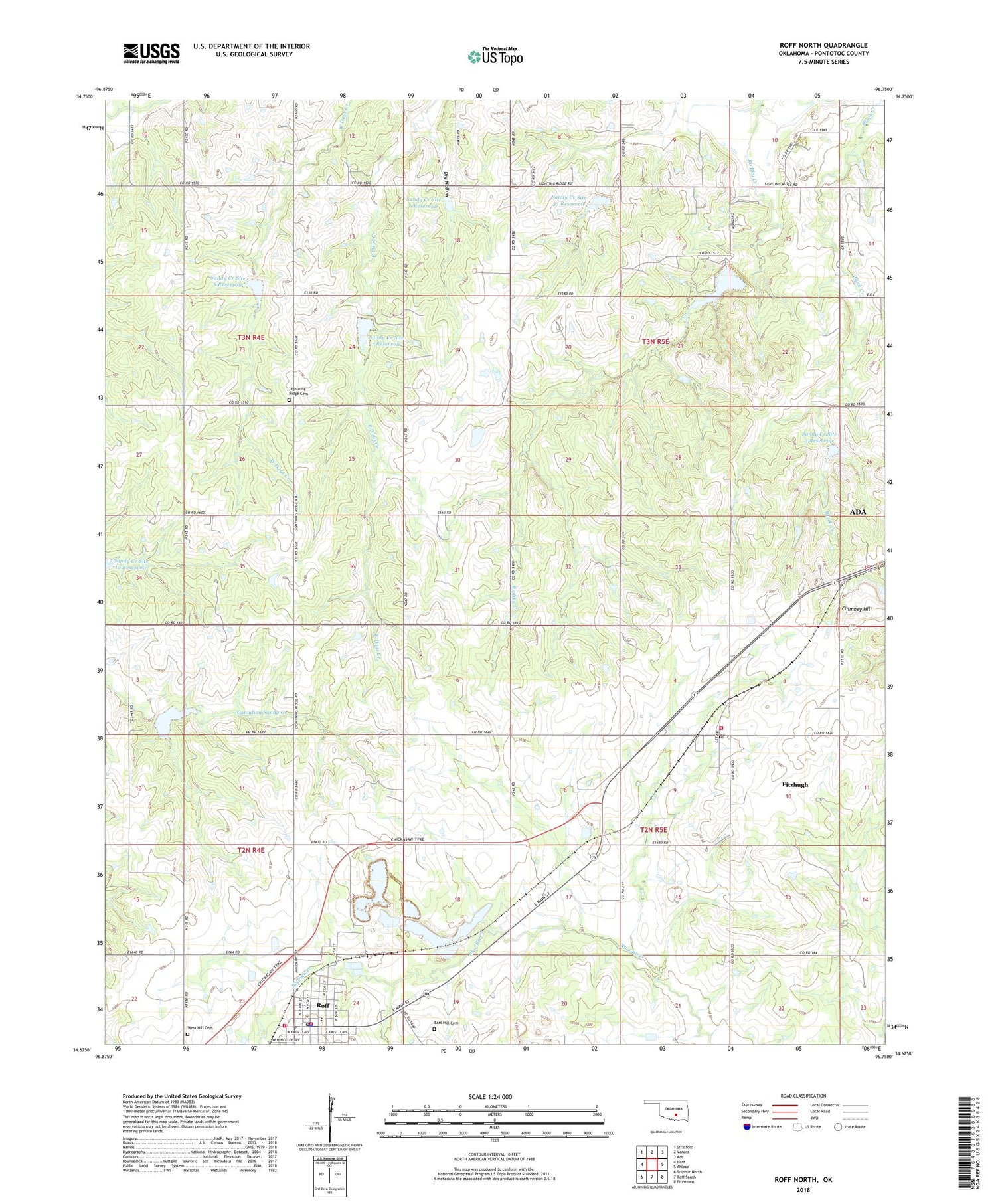
2022 topographic map quadrangle Roff North in the state of Oklahoma. Scale: 1:24000. Based on the newly updated USGS 7.5' US Topo map series, this map is in the following counties: Pontotoc. The map contains contour data, water features, and other items you are used to seeing on USGS maps, but also has updated roads and other features. This is the next generation of topographic maps. Printed on high-quality waterproof paper with UV fade-resistant inks.
Quads adjacent to this one:
West: Hart
Northwest: Stratford
North: Vanoss
Northeast: Ada
East: Ahloso
Southeast: Fittstown
South: Roff South
Southwest: Sulphur North
This map covers the same area as the classic USGS quad with code o34096f7.
Contains the following named places: Chimney Hill, Dry Hollow, East Hill Cemetery, Fitzhugh, Fitzhugh Post Office, Fitzhugh Volunteer Fire Department, Lightning Ridge Cemetery, Lightning Ridge Church, Oknoname 11904 Dam, Oknoname 11904 Reservoir, Rodtky Creek, Roff, Roff Elementary School, Roff Fire Department Station 1, Roff Fire Department Station 2, Roff High School, Roff Police Department, Roff Post Office, Sandy Creek Site 11 Dam, Sandy Creek Site 11 Reservoir, Sandy Creek Site 3 Dam, Sandy Creek Site 3 Reservoir, Sandy Creek Site 33 Dam, Sandy Creek Site 33 Reservoir, Sandy Creek Site 4 Dam, Sandy Creek Site 4 Reservoir, Sandy Creek Site 6 Dam, Sandy Creek Site 6 Reservoir, Sandy Creek Site 7 Dam, Sandy Creek Site 7 Reservoir, Sandy Creek Site 8 Dam, Sandy Creek Site 8 Reservoir, Town of Fitzhugh, Town of Roff, West Hill Cemetery, Wilson Church