MyTopo
Vanoss Oklahoma US Topo Map
Couldn't load pickup availability
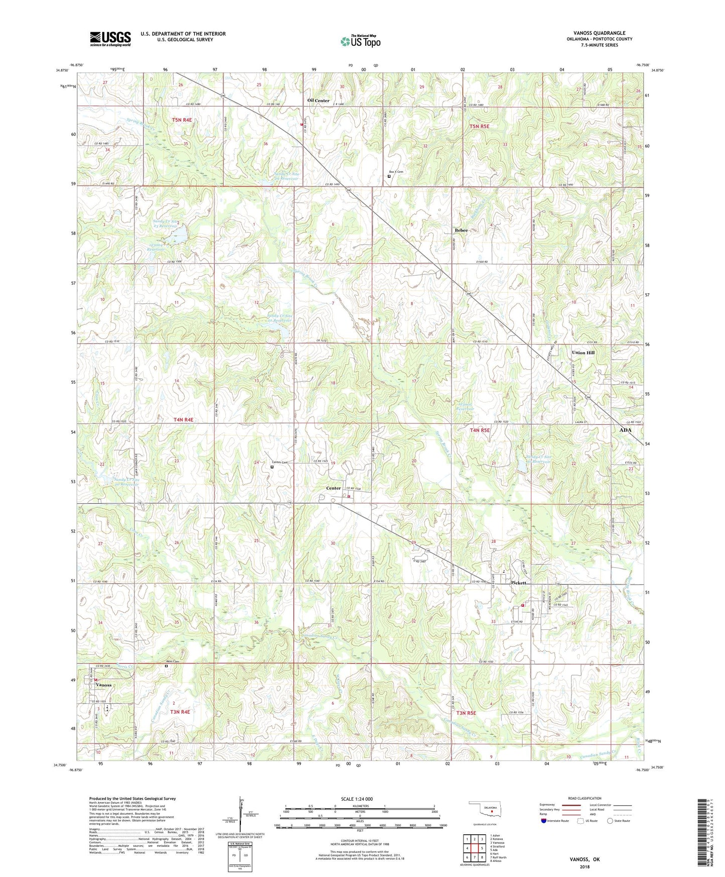
2022 topographic map quadrangle Vanoss in the state of Oklahoma. Scale: 1:24000. Based on the newly updated USGS 7.5' US Topo map series, this map is in the following counties: Pontotoc. The map contains contour data, water features, and other items you are used to seeing on USGS maps, but also has updated roads and other features. This is the next generation of topographic maps. Printed on high-quality waterproof paper with UV fade-resistant inks.
Quads adjacent to this one:
West: Stratford
Northwest: Asher
North: Konawa
Northeast: Vamoosa
East: Ada
Southeast: Ahloso
South: Roff North
Southwest: Hart
This map covers the same area as the classic USGS quad with code o34096g7.
Contains the following named places: Bebee, Bebee-Southwest Konawa Oil and Gas Field, Black Creek, Box X Cemetery, Burris Creek, Center, Center Cemetery, Center Volunteer Fire Department, Coon Creek, East Days Creek, Freewill Baptist Church, Gaar Corner, Moss Cemetery, Northeast Bebee Oil and Gas Field, Northwest Pontotoc Division, Oil Center, Oil Center Fire Department, Oknoname 123004 Dam, Oknoname 123004 Reservoir, Oknoname 123005 Dam, Oknoname 123005 Reservoir, Pickett, Pickett - Center Elementary School, Pickett Census Designated Place, Pickett Volunteer Fire Department, Sandy Creek Site 20 Dam, Sandy Creek Site 20 Reservoir, Sandy Creek Site 21 Dam, Sandy Creek Site 21 Reservoir, Sandy Creek Site 22 Dam, Sandy Creek Site 22 Reservoir, Sandy Creek Site 23 Dam, Sandy Creek Site 23 Reservoir, Sandy Creek Site 29 Dam, Sandy Creek Site 29 Reservoir, Sandy Creek Site 30 Dam, Sandy Creek Site 30 Reservoir, Sandy Creek Site 31 Dam, Southeast Oil and Gas Field, Township of Midland, Union Hill, Vanoss, Vanoss Census Designated Place, Vanoss Elementary School, Vanoss Fire Department, Vanoss High School, West Days Creek