MyTopo
Roff South Oklahoma US Topo Map
Couldn't load pickup availability
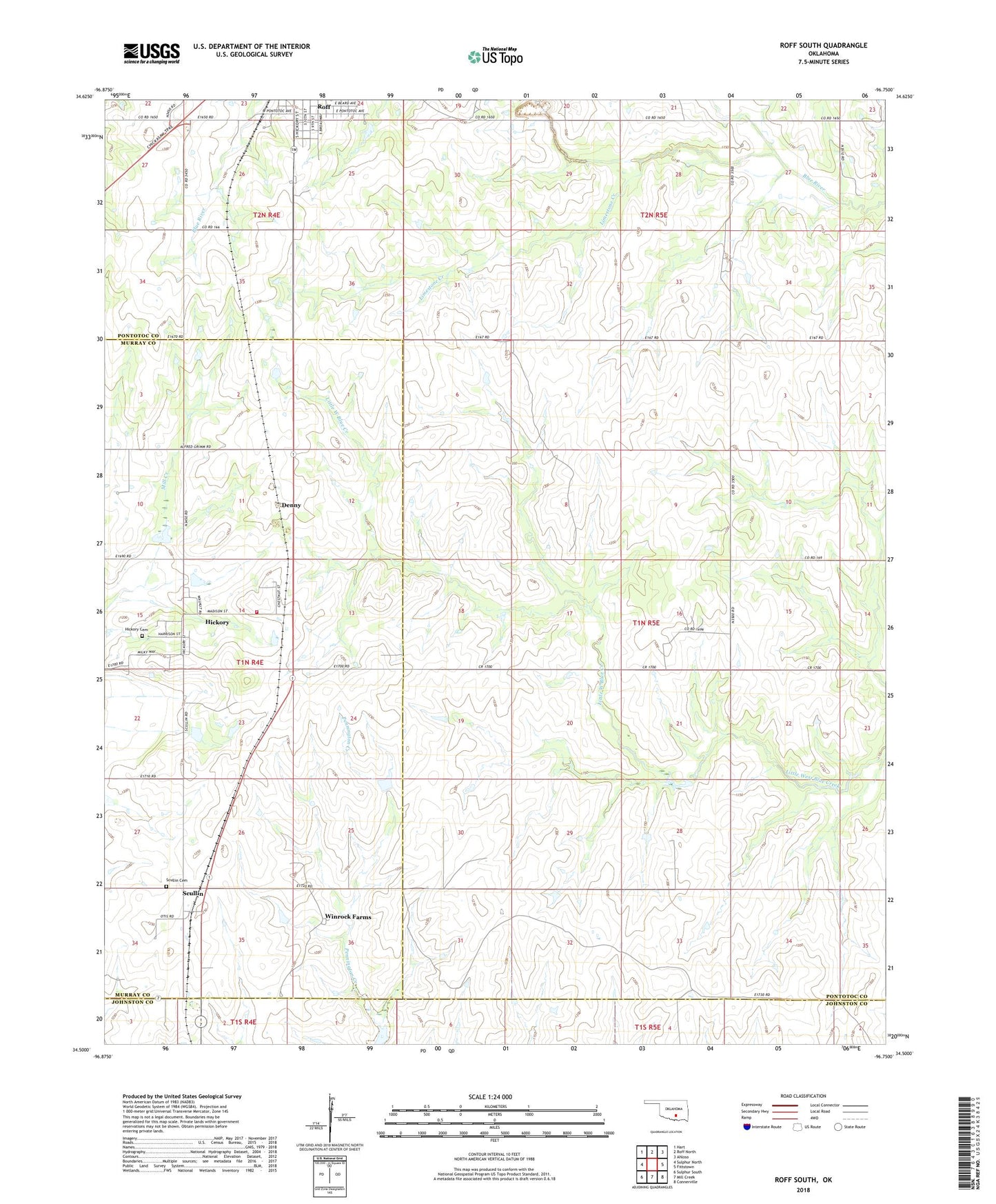
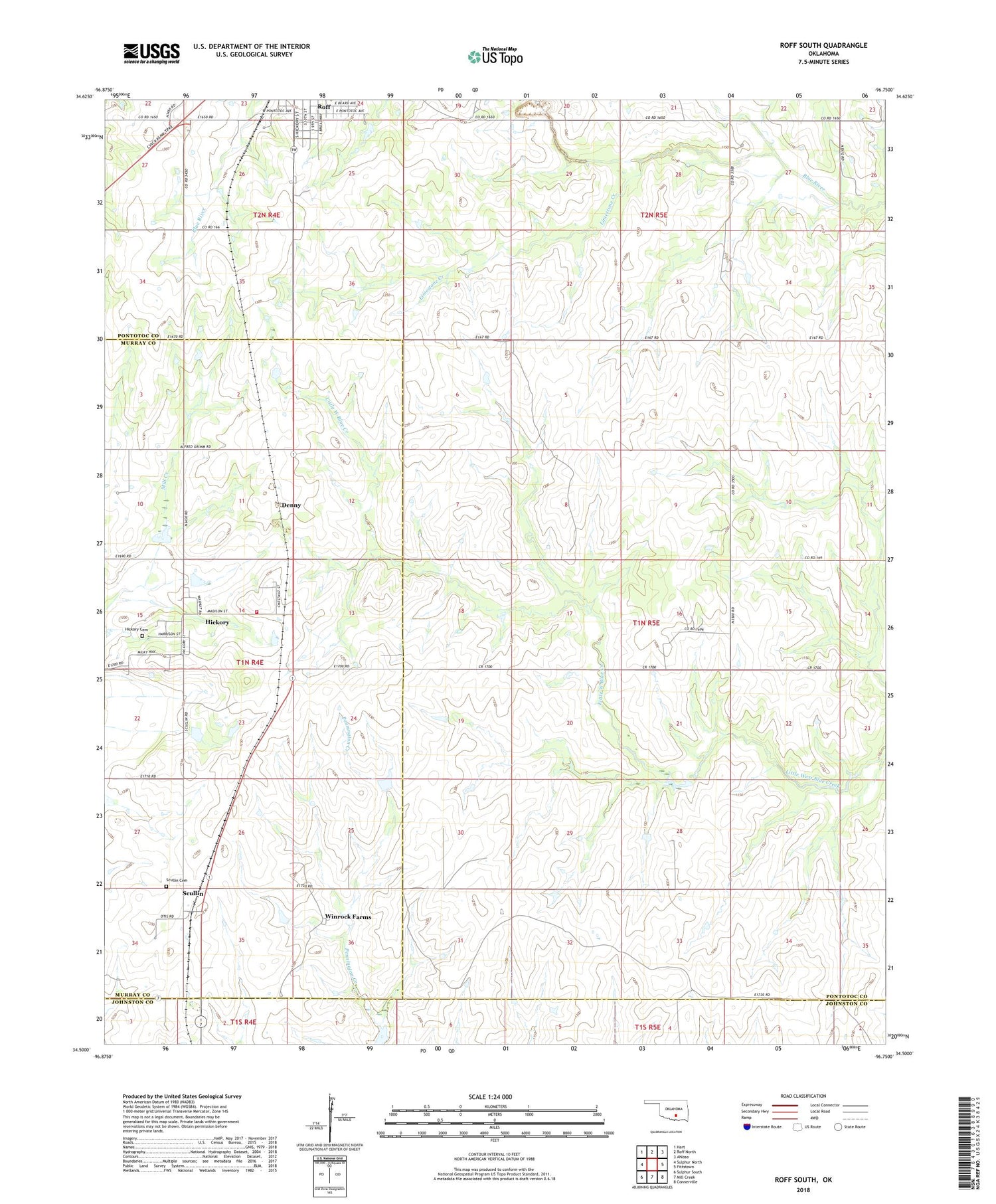
2022 topographic map quadrangle Roff South in the state of Oklahoma. Scale: 1:24000. Based on the newly updated USGS 7.5' US Topo map series, this map is in the following counties: Pontotoc, Murray, Johnston. The map contains contour data, water features, and other items you are used to seeing on USGS maps, but also has updated roads and other features. This is the next generation of topographic maps. Printed on high-quality waterproof paper with UV fade-resistant inks.
Quads adjacent to this one:
West: Sulphur North
Northwest: Hart
North: Roff North
Northeast: Ahloso
East: Fittstown
Southeast: Connerville
South: Mill Creek
Southwest: Sulphur South
This map covers the same area as the classic USGS quad with code o34096e7.
Contains the following named places: Denny, Hickory, Hickory Cemetery, Hickory Volunteer Fire Department, Horseshoe Ranch, Limestone Creek, Mill Creek Watershed 1 Dam, Mill Creek Watershed 1 Reservoir, Mill Creek Watershed 3 Dam, Mill Creek Watershed 3 Reservoir, Mill Creek Watershed 4 Dam, Mill Creek Watershed 4 Reservoir, Roos Landing Strip, Scullin, Scullin Cemetery, Southwest Pontotoc Division, Town of Hickory, Township of Fitzhugh, Winrock Farms, ZIP Code: 74865