
MyTopo
Hominy Oklahoma US Topo Map
Couldn't load pickup availability
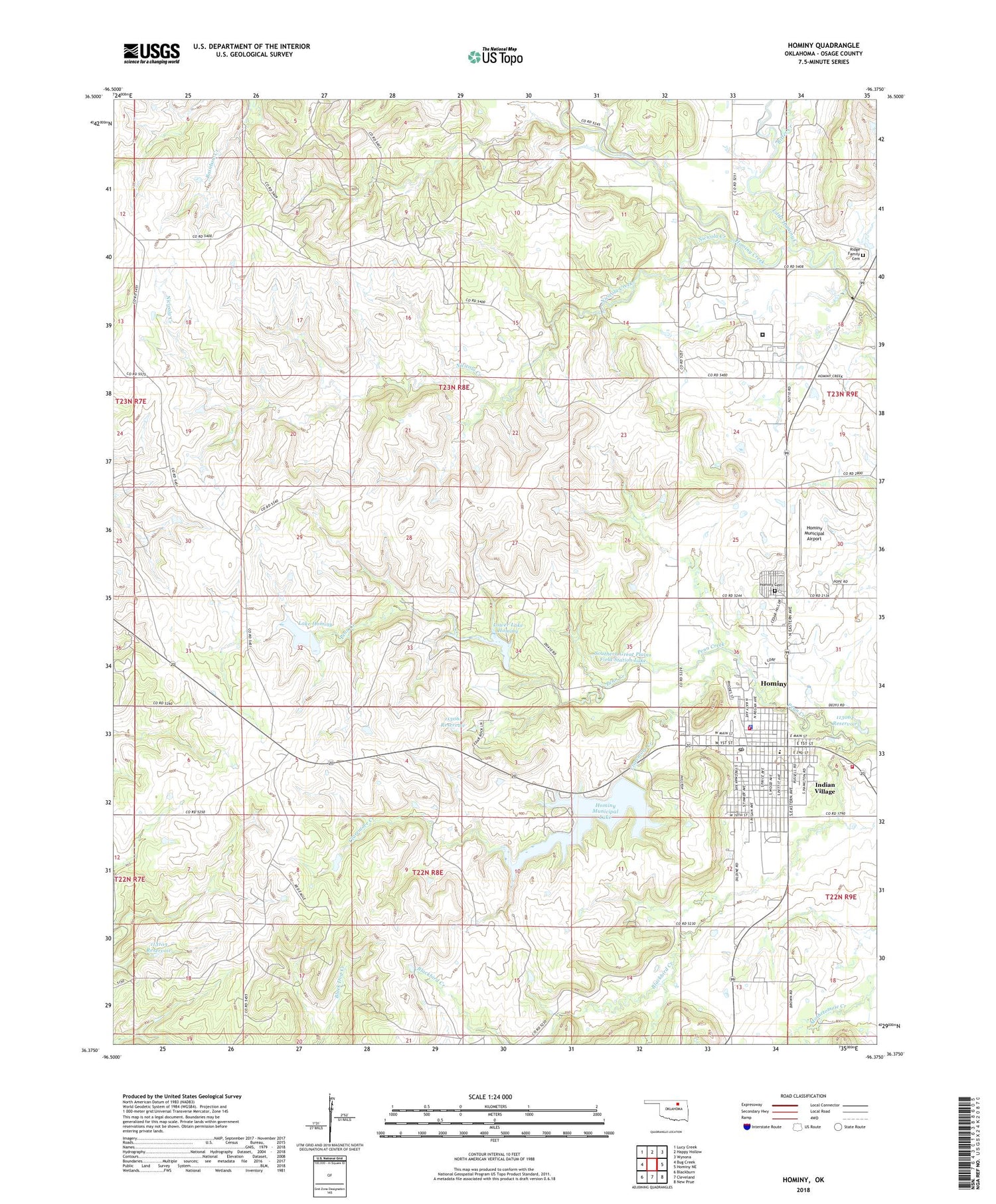
2018 topographic map quadrangle Hominy in the state of Oklahoma. Scale: 1:24000. Based on the newly updated USGS 7.5' US Topo map series, this map is in the following counties: Osage. The map contains contour data, water features, and other items you are used to seeing on USGS maps, but also has updated roads and other features. This is the next generation of topographic maps. Printed on high-quality waterproof paper with UV fade-resistant inks.
Quads adjacent to this one:
West: Bug Creek
Northwest: Lucy Creek
North: Happy Hollow
Northeast: Wynona
East: Hominy NE
Southeast: New Prue
South: Cleveland
Southwest: Blackburn
Contains the following named places: Bitter Creek, Blackbird Creek, Church of Nazarene, City of Hominy, Claremore Creek, Dick Conner Correctional Center, Faith Christian Fellowship Church, First Baptist Church, First Presbyterian Church, First United Methodist Church, Gilliland Oil Field, Hominy, Hominy Cemetery, Hominy Community Medical Trust Authority, Hominy Dam, Hominy Division, Hominy Fire Department, Hominy High School, Hominy Indian Village Cemetery, Hominy Middle School, Hominy Municipal Airport, Hominy Municipal Lake, Hominy Oil Field, Hominy Police Department, Hominy Post Office, Hominy Ranchers Rural Fire Department, Horace Mann Elementary School, Indian Village, Lake Hominy, Lake Hominy Dam, Little Hominy Creek, Lower Lake Hominy, Lower Lake Hominy Dam, Manion Oil Field, Mound Valley School, Mullins School, Municipal Lake, New Life Church, Nicicola Creek, Oknoname 113061 Dam, Oknoname 113061 Reservoir, Oknoname 113062 Dam, Oknoname 113062 Reservoir, Oknoname 113103 Dam, Oknoname 113103 Reservoir, Osage Hominy Oil Field, Penn Creek Oil Field, Ridge Family Cemetery, Saint Josephs Catholic Church, Southern Great Plains Field Station Lake, Township of Hominy, ZIP Code: 74035


