MyTopo
Hugo Oklahoma US Topo Map
Couldn't load pickup availability
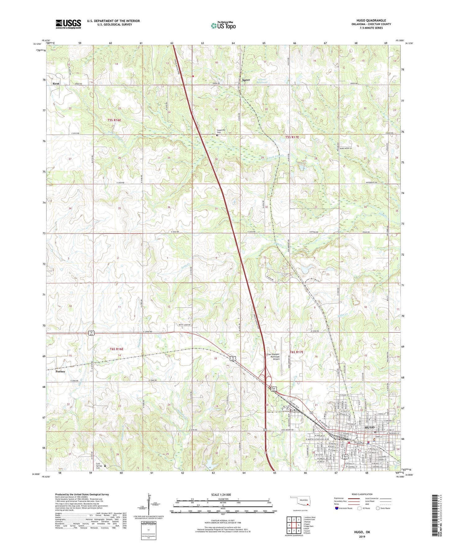
2019 topographic map quadrangle Hugo in the state of Oklahoma. Scale: 1:24000. Based on the newly updated USGS 7.5' US Topo map series, this map is in the following counties: Choctaw. The map contains contour data, water features, and other items you are used to seeing on USGS maps, but also has updated roads and other features. This is the next generation of topographic maps. Printed on high-quality waterproof paper with UV fade-resistant inks.
Quads adjacent to this one:
West: Soper
Northwest: Antlers West
North: Antlers East
Northeast: Rattan
East: Hugo Dam
Southeast: Shoals
South: Grant
Southwest: Bluff
Contains the following named places: Ansley Park, Ballard Aviation of Hugo, Choctaw County, Choctaw County Jail, Choctaw County Sheriff's Office, Choctaw Nation Law Enforcement, City of Hugo, Cold Springs Cemetery, Cooksville Cemetery, County District 8, Eugene Field School, First Baptist Church, First Christian Church, First United Methodist Church, Forney, Hugo, Hugo Division, Hugo Fire Department Station 1 Headquarters, Hugo Fire Department Station 2, Hugo High School, Hugo Intermediate School, Hugo Middle School, Hugo Police Department, Hugo Post Office, Hugo Public Schools Administration, Kent, Kingdom Hall-Jehovahs Witness, Main Shopping Center, Mann School, Mount Calvary Baptist Church, North Fork Long Creek, Oak Grove Church, Oknoname 023007 Dam, Oknoname 023007 Reservoir, Saint Marks Episcopal Church, Speer, Speer Volunteer Fire Department, Stan Stamper Municipal Airport, Township of Jeter, Wesley United Methodist Church, West Kiamichi Church