MyTopo
Antlers West Oklahoma US Topo Map
Couldn't load pickup availability
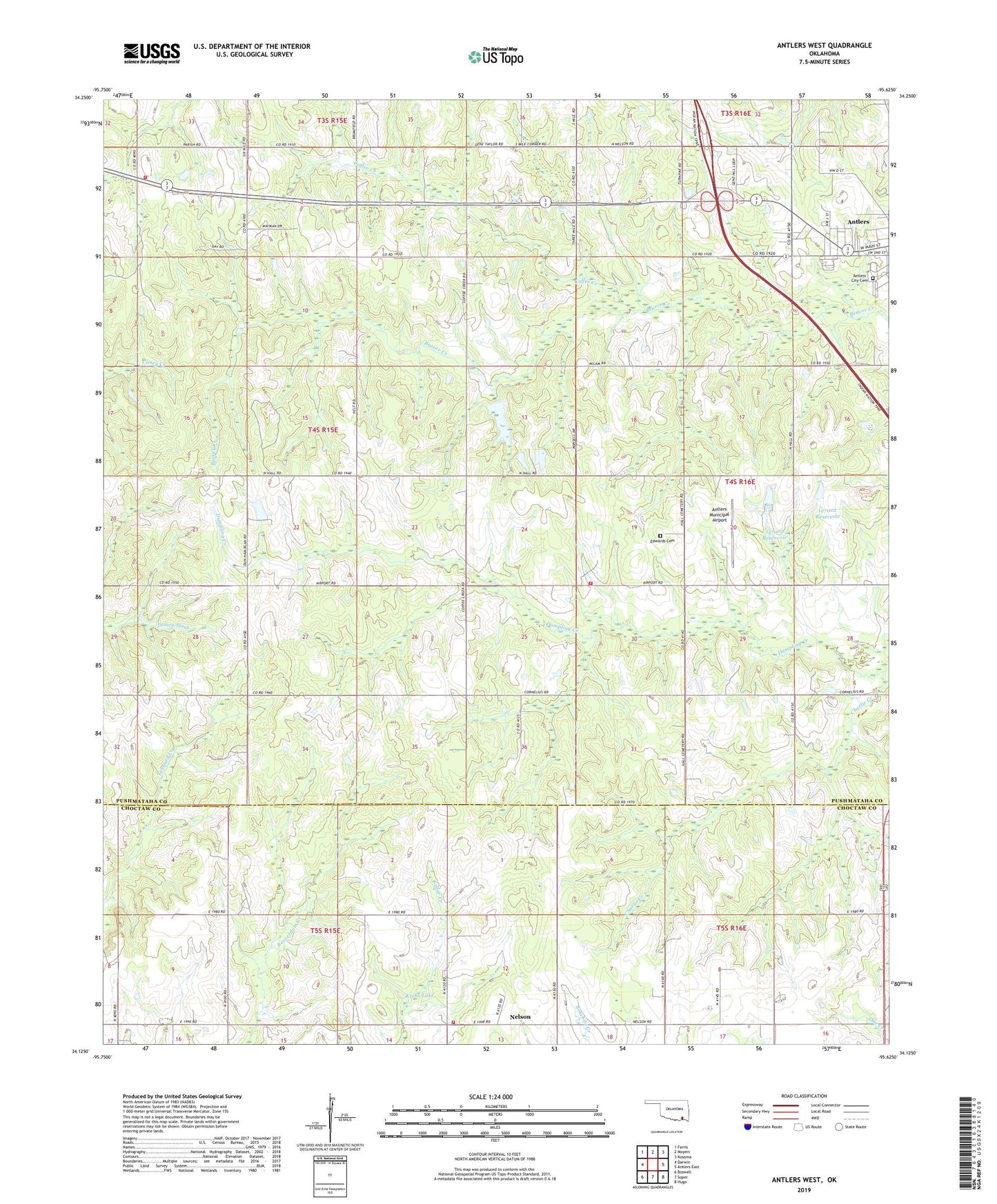
2022 topographic map quadrangle Antlers West in the state of Oklahoma. Scale: 1:24000. Based on the newly updated USGS 7.5' US Topo map series, this map is in the following counties: Pushmataha, Choctaw. The map contains contour data, water features, and other items you are used to seeing on USGS maps, but also has updated roads and other features. This is the next generation of topographic maps. Printed on high-quality waterproof paper with UV fade-resistant inks.
Quads adjacent to this one:
West: Darwin
Northwest: Farris
North: Moyers
Northeast: Kosoma
East: Antlers East
Southeast: Hugo
South: Soper
Southwest: Boswell
This map covers the same area as the classic USGS quad with code o34095b6.
Contains the following named places: Antlers City Cemetery, Antlers Fire Department Substation and Training Facility, Antlers Municipal Airport, Charlie Creek, Coffee Creek, Darwin Volunteer Fire Department, Hall Cemetery, Hall Volunteer Fire Department, Kellond Church, Krebs Lake, Krebs Lake Dam, Nelson, Nelson Volunteer Fire Department, Oknoname 127001 Dam, Oknoname 127001 Reservoir, Oknoname 127002 Dam, Oknoname 127002 Reservoir, Pierce Church, Sugarloaf Church, Township of Antlers