MyTopo
Rattan Oklahoma US Topo Map
Couldn't load pickup availability
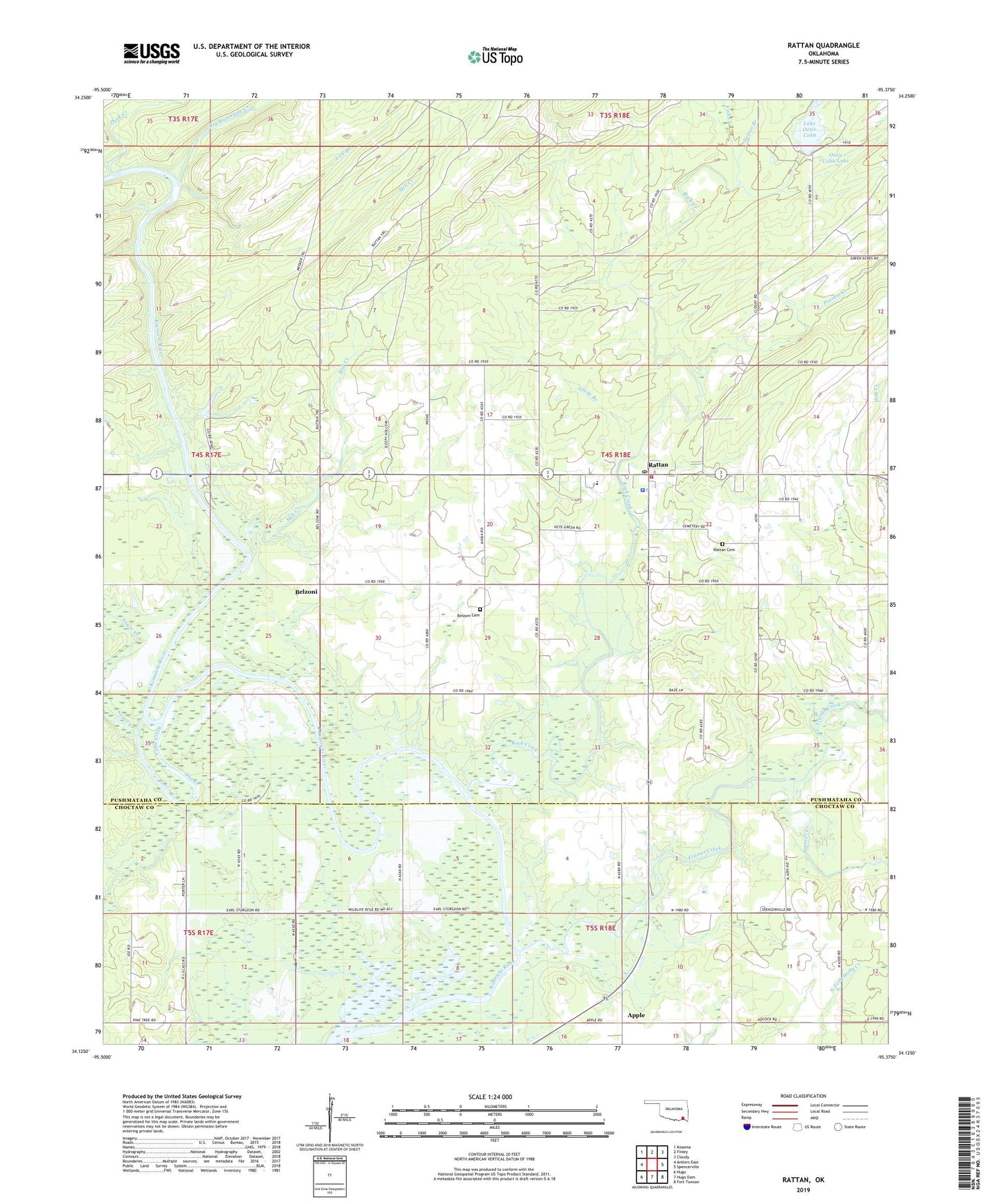
2022 topographic map quadrangle Rattan in the state of Oklahoma. Scale: 1:24000. Based on the newly updated USGS 7.5' US Topo map series, this map is in the following counties: Pushmataha, Choctaw. The map contains contour data, water features, and other items you are used to seeing on USGS maps, but also has updated roads and other features. This is the next generation of topographic maps. Printed on high-quality waterproof paper with UV fade-resistant inks.
Quads adjacent to this one:
West: Antlers East
Northwest: Kosoma
North: Finley
Northeast: Cloudy
East: Spencerville
Southeast: Fort Towson
South: Hugo Dam
Southwest: Hugo
This map covers the same area as the classic USGS quad with code o34095b4.
Contains the following named places: Apple, Belzoni, Belzoni Cemetery, Big Waterhole Creek, Duck Creek, Fish Creek, Frazier Creek, Glade Branch, Hog Creek, Hugo Wildlife Management Area, Lake Ozzie Cobb, Lick Branch, Mill Creek, Negro Creek, Nelson Branch, One Creek, Ozzie Cobb Lake Dam, Possum Creek, Rattan, Rattan Cemetery, Rattan Elementary School, Rattan Fire Department, Rattan High School, Rattan Junior High School, Rattan Police Department, Rattan Post Office, Rock Creek, Spencer Creek, Town of Rattan, Waterfowl Refuge