MyTopo
Odetta Oklahoma US Topo Map
Couldn't load pickup availability
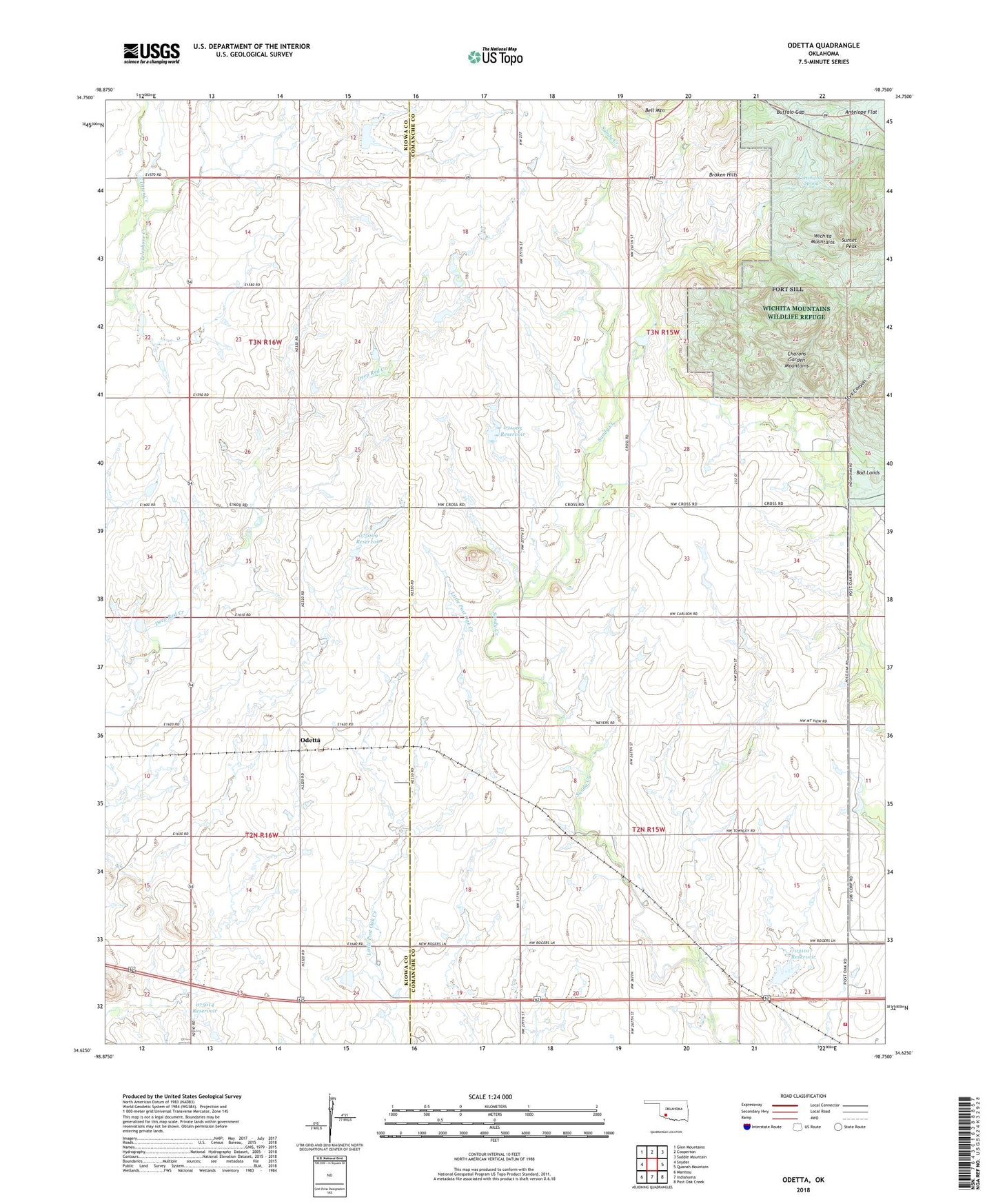
2022 topographic map quadrangle Odetta in the state of Oklahoma. Scale: 1:24000. Based on the newly updated USGS 7.5' US Topo map series, this map is in the following counties: Comanche, Kiowa. The map contains contour data, water features, and other items you are used to seeing on USGS maps, but also has updated roads and other features. This is the next generation of topographic maps. Printed on high-quality waterproof paper with UV fade-resistant inks.
Quads adjacent to this one:
West: Snyder
Northwest: Glen Mountains
North: Cooperton
Northeast: Saddle Mountain
East: Quanah Mountain
Southeast: Post Oak Creek
South: Indiahoma
Southwest: Manitou
This map covers the same area as the classic USGS quad with code o34098f7.
Contains the following named places: Bad Lands, Broken Hills, Buffalo Gap, Charons Garden Mountains, Cottonwood Spring, Indiahoma Volunteer Fire Department, Odetta, Oknoname 031017 Dam, Oknoname 031017 Reservoir, Oknoname 031065 Dam, Oknoname 031065 Reservoir, Oknoname 075009 Dam, Oknoname 075009 Reservoir, Oknoname 075010 Dam, Oknoname 075010 Reservoir, Oknoname 075014 Dam, Oknoname 075014 Reservoir, Otter Creek Site 5 Dam, Otter Creek Site 5 Reservoir, Otter Creek Site 6 Dam, Otter Creek Site 6 Reservoir, Styx Canyon, Sunset Peak, Telephone Creek, ZIP Code: 73552