MyTopo
Kellyville Oklahoma US Topo Map
Couldn't load pickup availability
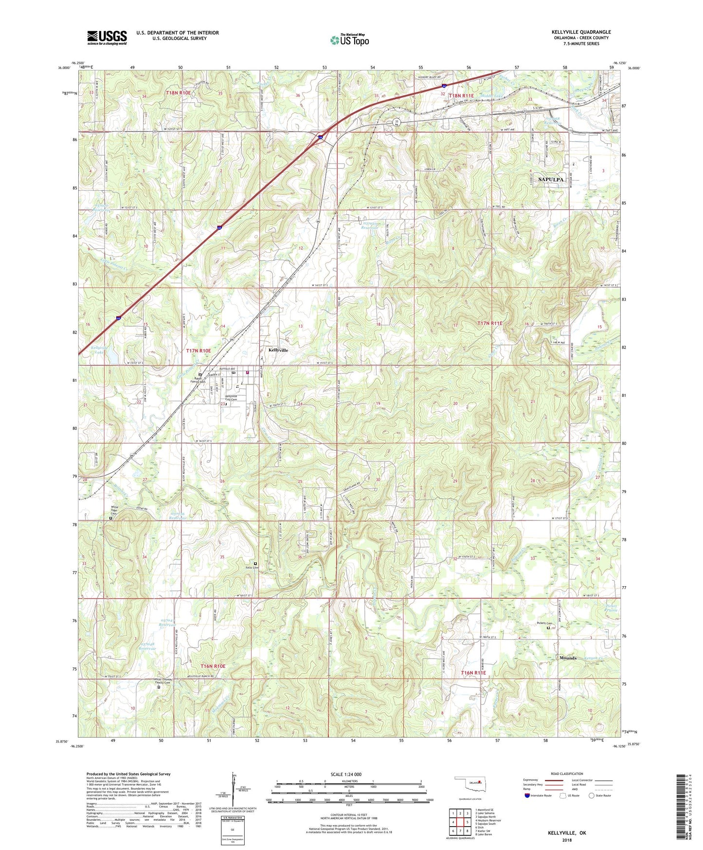
2022 topographic map quadrangle Kellyville in the state of Oklahoma. Scale: 1:24000. Based on the newly updated USGS 7.5' US Topo map series, this map is in the following counties: Creek. The map contains contour data, water features, and other items you are used to seeing on USGS maps, but also has updated roads and other features. This is the next generation of topographic maps. Printed on high-quality waterproof paper with UV fade-resistant inks.
Quads adjacent to this one:
West: Heyburn Reservoir
Northwest: Mannford SE
North: Lake Sahoma
Northeast: Sapulpa North
East: Sapulpa South
Southeast: Lake Boren
South: Kiefer SW
Southwest: Slick
This map covers the same area as the classic USGS quad with code o35096h2.
Contains the following named places: Baker Family Cemetery, Blue Bell Church, Clear Creek, Euchee Creek, Felix Cemetery, First Baptist Church, Jean, Jefferson Heights Elementary School, Kellyville, Kellyville City Cemetery, Kellyville Dam, Kellyville Elementary School, Kellyville High School, Kellyville Lake, Kellyville Middle School, Kellyville Police Department, Kellyville Post Office, Kellyville Upper Elementary School, Kellyville Volunteer Fire Department, Kenyon Creek, Lester Thomas Family Cemetery, Little Polecat Creek, Middle Lake, Mountain Creek, New Life Fellowship Church, Oknoname 037020 Dam, Oknoname 037020 Reservoir, Oknoname 037024 Dam, Oknoname 037024 Reservoir, Oknoname 037025 Dam, Oknoname 037025 Reservoir, Oknoname 037036 Dam, Oknoname 037036 Reservoir, Oknoname 037047 Dam, Oknoname 037047 Reservoir, Oknoname 037048 Dam, Oknoname 037048 Reservoir, Oknoname 037068 Dam, Oknoname 037068 Reservoir, Oknoname 063039 Dam, Oknoname 063039 Reservoir, Olintine Church, Picket Church, Picket Prairie, Pickett Cemetery, Skagway, Town of Kellyville, Township of Kellyville, Willie Tiger Cemetery, ZIP Codes: 74039, 74066