MyTopo
Heyburn Reservoir Oklahoma US Topo Map
Couldn't load pickup availability
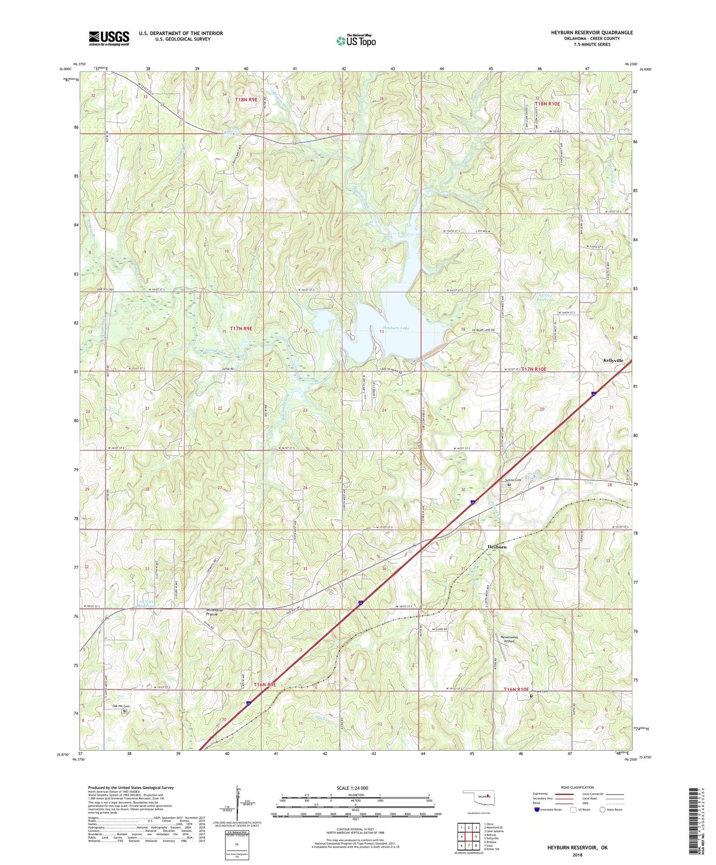
2022 topographic map quadrangle Heyburn Reservoir in the state of Oklahoma. Scale: 1:24000. Based on the newly updated USGS 7.5' US Topo map series, this map is in the following counties: Creek. The map contains contour data, water features, and other items you are used to seeing on USGS maps, but also has updated roads and other features. This is the next generation of topographic maps. Printed on high-quality waterproof paper with UV fade-resistant inks.
Quads adjacent to this one:
West: Bellvue
Northwest: Olive
North: Mannford SE
Northeast: Lake Sahoma
East: Kellyville
Southeast: Kiefer SW
South: Slick
Southwest: Bristow
This map covers the same area as the classic USGS quad with code o35096h3.
Contains the following named places: Browns Creek, Creek County, East Side Presbyterian Church, East Winkey Branch, Heyburn, Heyburn Dam, Heyburn Lake, Heyburn Reservoir, Heyburn Wildlife Management Area, Lake Heyburn State Park, Mosquito Creek, Neversweat Airport, Neversweat Creek, Oak Hill Cemetery, Oknoname 037016 Dam, Oknoname 037016 Reservoir, Oknoname 037021 Dam, Oknoname 037021 Reservoir, Oknoname 037022 Dam, Oknoname 037022 Reservoir, Oknoname 037035 Dam, Oknoname 037035 Reservoir, Oknoname 037044 Dam, Oknoname 037044 Reservoir, Oknoname 037078 Dam, Oknoname 037078 Reservoir, Provens Cemetery, Rowland Creek, Sunrise Cemetery, Tiger Creek, Township of Creek, Turkey Creek, Waterfowl Refuge, Wildhorse Prairie, Winkey Branch, Worman Junction