
MyTopo
Kenton Oklahoma US Topo Map
Couldn't load pickup availability
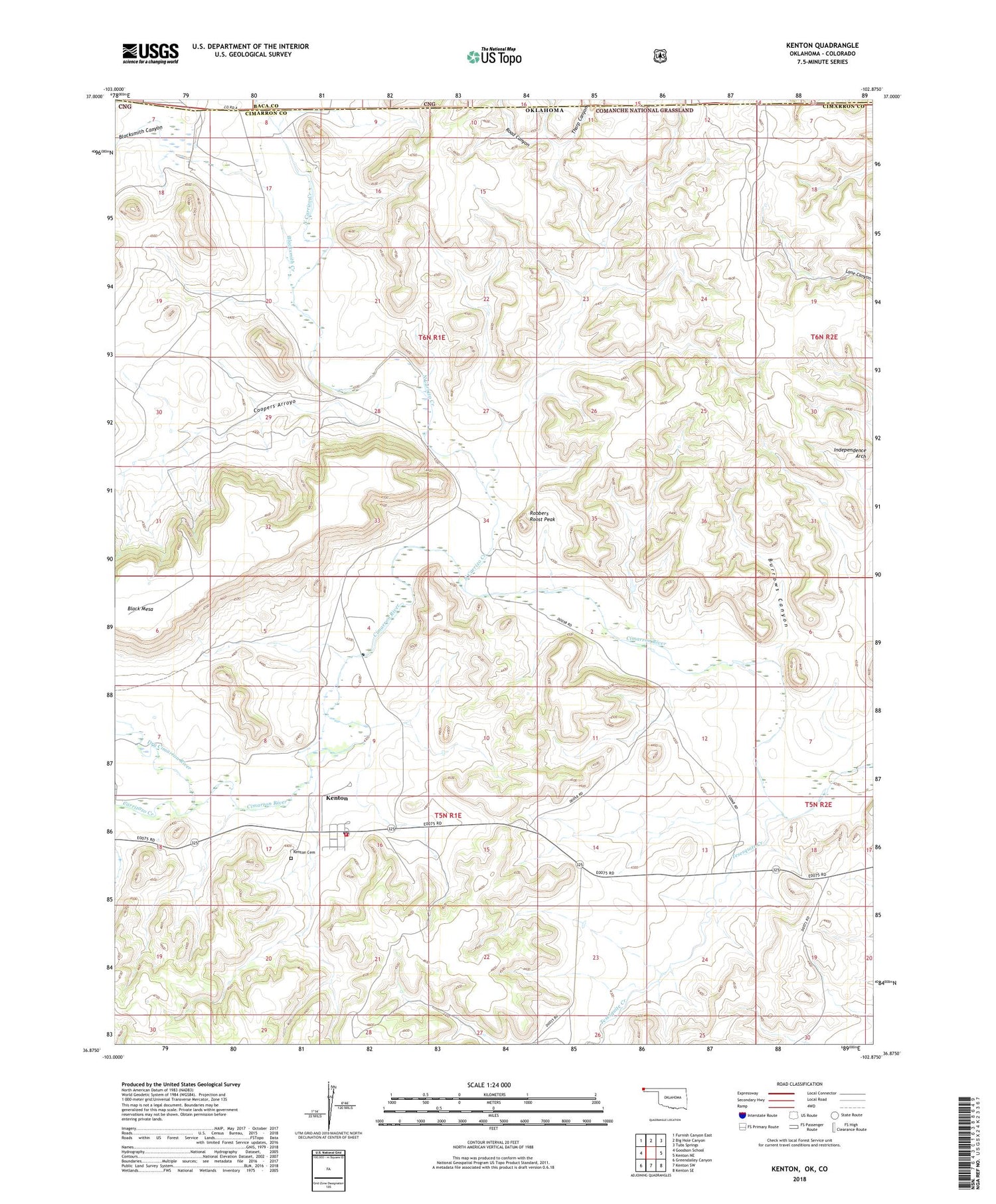
2018 topographic map quadrangle Kenton in the state of Oklahoma. Scale: 1:24000. Based on the newly updated USGS 7.5' US Topo map series, this map is in the following counties: Cimarron, Baca. The map contains contour data, water features, and other items you are used to seeing on USGS maps, but also has updated roads and other features. This is the next generation of topographic maps. Printed on high-quality waterproof paper with UV fade-resistant inks.
Quads adjacent to this one:
West: Goodson School
Northwest: Furnish Canyon East
North: Big Hole Canyon
Northeast: Tubs Springs
East: Kenton NE
Southeast: Kenton SE
South: Kenton SW
Southwest: Greendailey Canyon
Contains the following named places: Blacksmith Canyon, Blacksmith Creek, Burrows Canyon, Carrizozo Creek, Coopers Arroyo, Dry Cimarron River, Independence Arch, Kenton, Kenton Cemetery, Kenton Census Designated Place, Kenton Firefighters, Kenton Post Office, North Carrizo Creek, Road Canyon, Robbers Roost Peak, Tharp Canyon, Tucker Dam, Tucker Reservoir


