
MyTopo
Keota Oklahoma US Topo Map
Couldn't load pickup availability
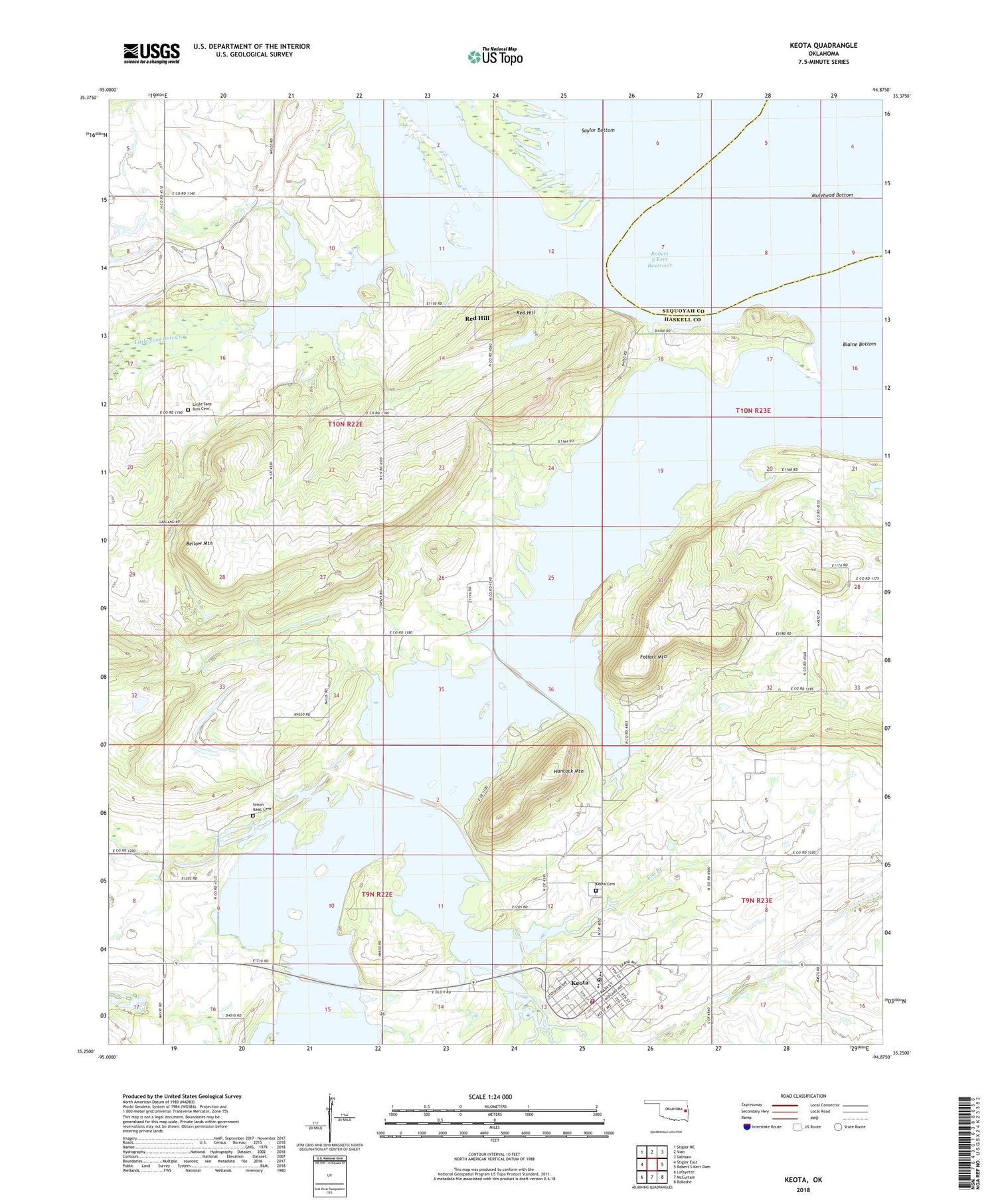
2018 topographic map quadrangle Keota in the state of Oklahoma. Scale: 1:24000. Based on the newly updated USGS 7.5' US Topo map series, this map is in the following counties: Haskell, Sequoyah. The map contains contour data, water features, and other items you are used to seeing on USGS maps, but also has updated roads and other features. This is the next generation of topographic maps. Printed on high-quality waterproof paper with UV fade-resistant inks.
Quads adjacent to this one:
West: Stigler East
Northwest: Stigler NE
North: Vian
Northeast: Sallisaw
East: Robert S Kerr Dam
Southeast: Bokoshe
South: McCurtain
Southwest: Lafayette
Contains the following named places: Bellow Mountain, Bellow Mountain Church, Elm Branch, Foliart Mountain, Hancock Mountain, Keota, Keota Cemetery, Keota Division, Keota Elementary School, Keota High School, Keota Police Department, Keota Post Office, Keota Volunteer Fire Department, Little Sans Bois Cemetery, Little Sans Bois Creek, Lone Elm Church, Mulehead Bottom, New Hope Church, Oknoname 061002 Reservoir, Oknoname 361002 Dam, Otter Creek, Red Hill, Robert S Kerr Reservoir, Rock Ford Church, Shoat Creek, Simon Isaac Cemetery, Town of Keota, Township of Sans Bois, ZIP Code: 74941


