MyTopo
Bokoshe Oklahoma US Topo Map
Couldn't load pickup availability
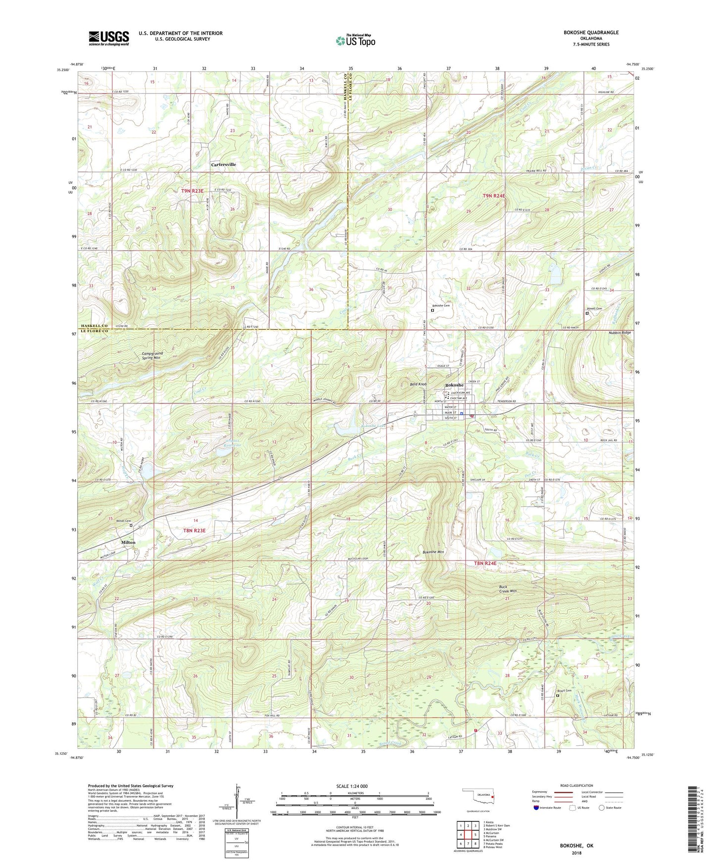
2022 topographic map quadrangle Bokoshe in the state of Oklahoma. Scale: 1:24000. Based on the newly updated USGS 7.5' US Topo map series, this map is in the following counties: Le Flore, Haskell. The map contains contour data, water features, and other items you are used to seeing on USGS maps, but also has updated roads and other features. This is the next generation of topographic maps. Printed on high-quality waterproof paper with UV fade-resistant inks.
Quads adjacent to this one:
West: McCurtain
Northwest: Keota
North: Robert S Kerr Dam
Northeast: Muldrow SW
East: Panama
Southeast: Poteau West
South: Potato Peaks
Southwest: McCurtain SW
This map covers the same area as the classic USGS quad with code o35094b7.
Contains the following named places: Bald Knob, Bokoshe, Bokoshe Cemetery, Bokoshe Church, Bokoshe Elementary School, Bokoshe Fire Department, Bokoshe High School, Bokoshe Junior High School, Bokoshe Lake, Bokoshe Lake Dam, Bokoshe Mountain, Bokoshe Police Department, Bokoshe Post Office, Brazil Cemetery, Buck Creek Mountain, Cartersville, Doe Creek, Latham Dog Creek Fire Department, Mack Watson Creek, Milton, Milton Cemetery, Nubbin Ridge, Oknoname 079001 Dam, Oknoname 079001 Reservoir, Panama-Bokoshe Division, Powell Cemetery, Reese Lake, Reese Lake Dam, Sienickie Lake, Sienickie Lake Dam, Town of Bokoshe, Township of Bokoshe, Township of Milton, ZIP Code: 74930