MyTopo
Lafayette Oklahoma US Topo Map
Couldn't load pickup availability
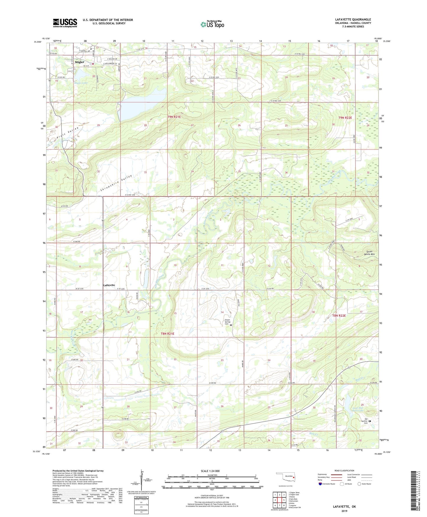
2022 topographic map quadrangle Lafayette in the state of Oklahoma. Scale: 1:24000. Based on the newly updated USGS 7.5' US Topo map series, this map is in the following counties: Haskell. The map contains contour data, water features, and other items you are used to seeing on USGS maps, but also has updated roads and other features. This is the next generation of topographic maps. Printed on high-quality waterproof paper with UV fade-resistant inks.
Quads adjacent to this one:
West: Sans Bois
Northwest: Stigler West
North: Stigler East
Northeast: Keota
East: McCurtain
Southeast: McCurtain SW
South: Lequire
Southwest: Kinta
This map covers the same area as the classic USGS quad with code o35095b1.
Contains the following named places: Choctaw Mine, County District 5, Haskell County, Haskell County Sheriff's Office, John Wells Park, Kiamichi Technology Center Stigler, Lafayette, Lafayette Church, Lake John Wells, Lake John Wells Dam, Lone Star Steel Lake, McCurtain Division, McCurtain Indian Reservation, Mule Creek, Old Panther Cemetery, Robert Mitchell Lake, Robert Mitchell Lake Dam, Rose Hill Church, Shropshire Valley, Siloam Spring Church, Siloam Springs Cemetery, Southside Volunteer Fire Department, Stigler Dam, Stigler Lake, Township of Center