MyTopo
McCurtain Oklahoma US Topo Map
Couldn't load pickup availability
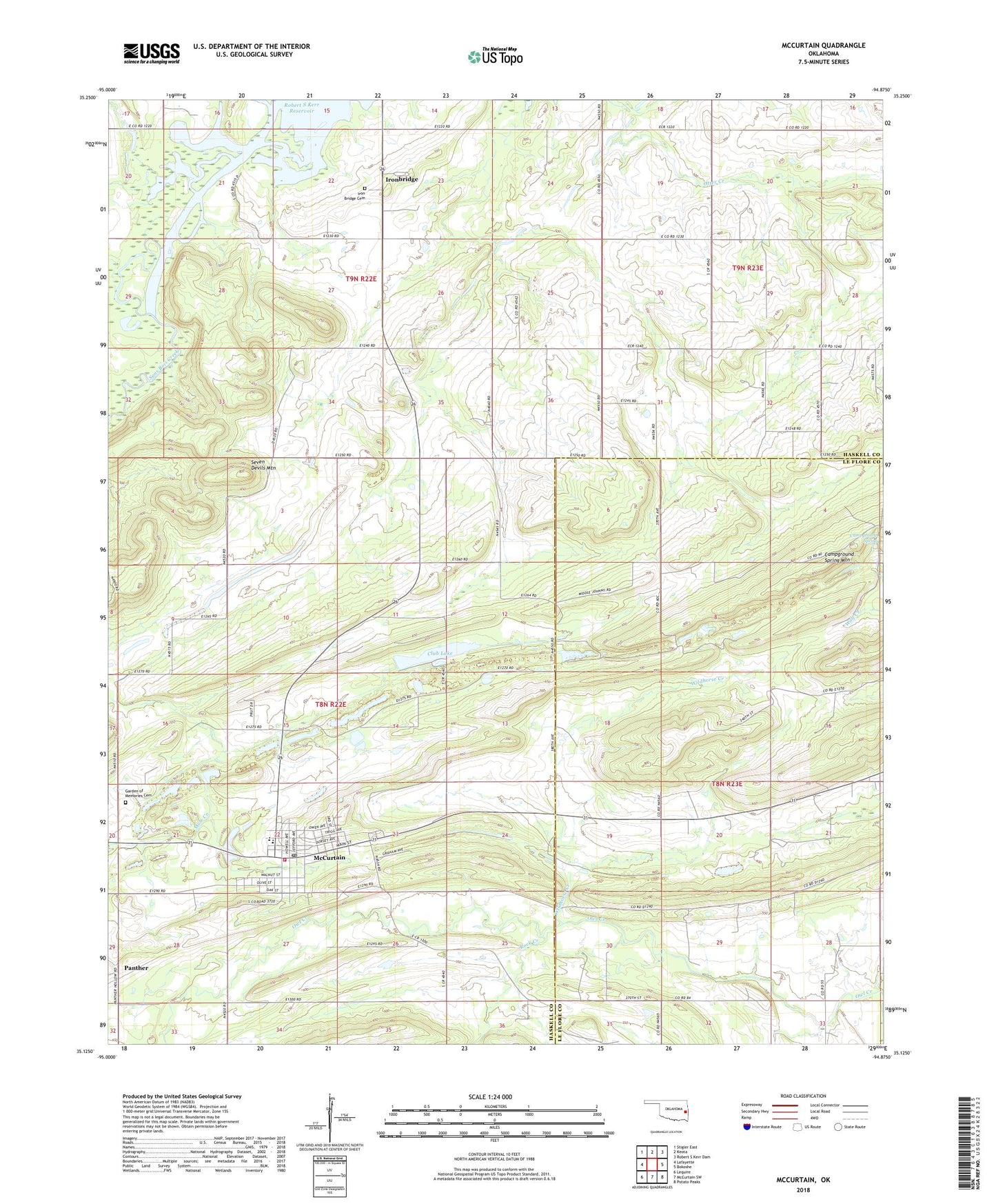
2022 topographic map quadrangle McCurtain in the state of Oklahoma. Scale: 1:24000. Based on the newly updated USGS 7.5' US Topo map series, this map is in the following counties: Haskell, Le Flore. The map contains contour data, water features, and other items you are used to seeing on USGS maps, but also has updated roads and other features. This is the next generation of topographic maps. Printed on high-quality waterproof paper with UV fade-resistant inks.
Quads adjacent to this one:
West: Lafayette
Northwest: Stigler East
North: Keota
Northeast: Robert S Kerr Dam
East: Bokoshe
Southeast: Potato Peaks
South: McCurtain SW
Southwest: Lequire
This map covers the same area as the classic USGS quad with code o35094b8.
Contains the following named places: Campground Spring, Campground Spring Mountain, Center Point Church, Club Lake, Iron Bridge Cemetery, Ironbridge, McCurtain, McCurtain Club Lake, McCurtain Club Lake Dam, Mccurtain Elementary School, McCurtain Fire Department, McCurtain High School, McCurtain Post Office, Miners Cemetery, Mount Olive Church, Panther, Rock Creek, Sans Bois Creek, Seven Devils Mountain, Town of McCurtain, Wildhorse Creek, ZIP Code: 74944