MyTopo
Ketchum Oklahoma US Topo Map
Couldn't load pickup availability
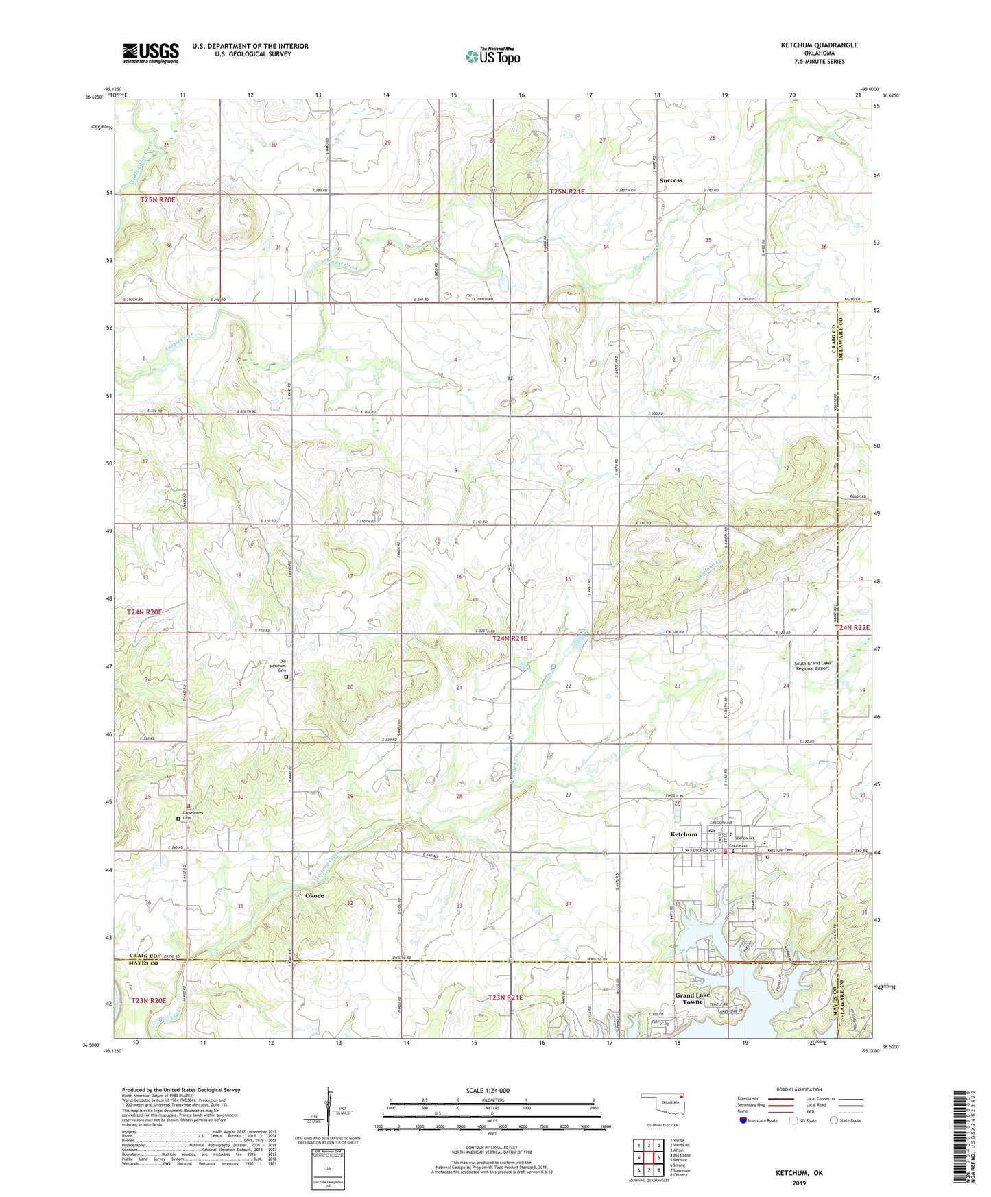
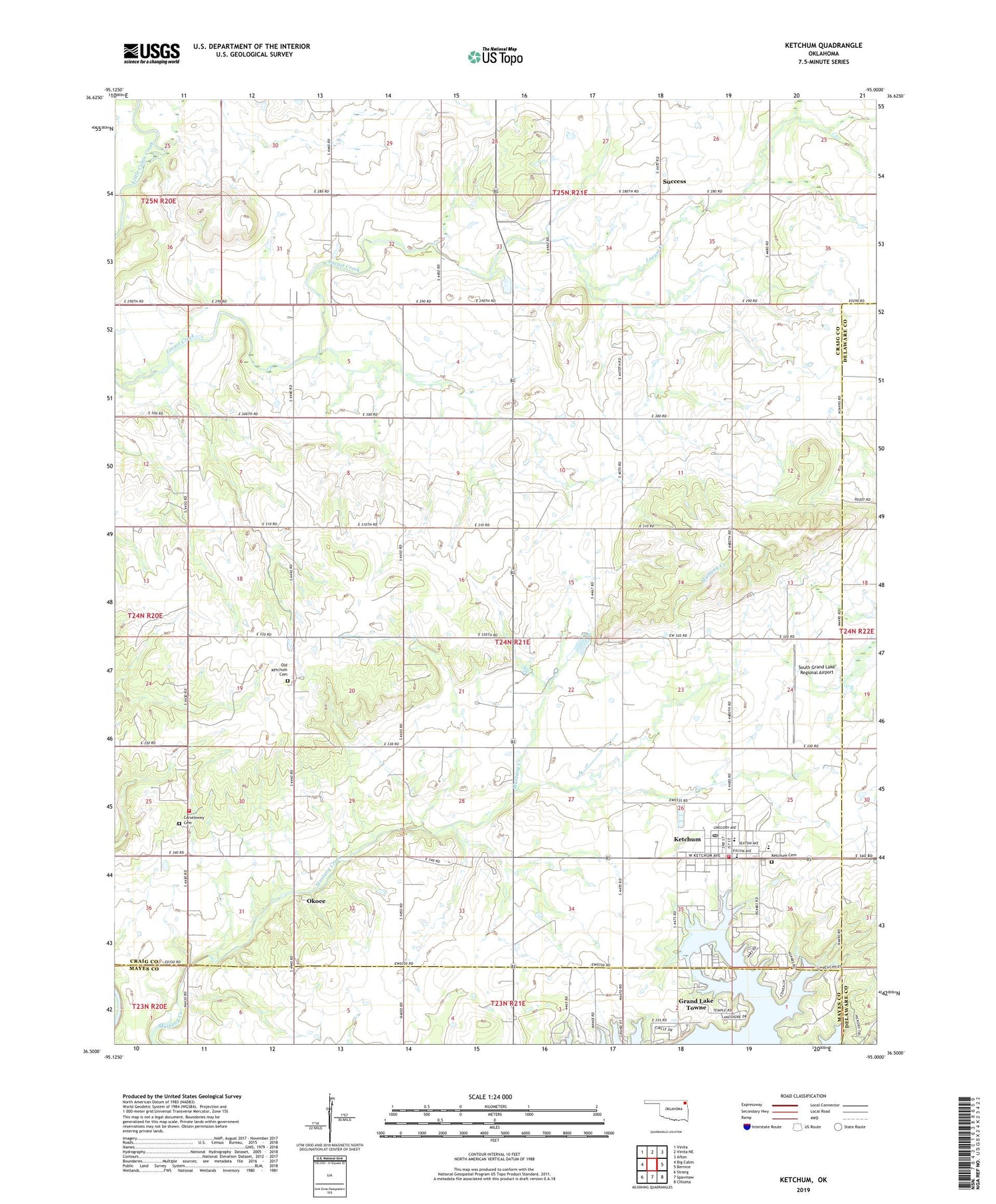
2019 topographic map quadrangle Ketchum in the state of Oklahoma. Scale: 1:24000. Based on the newly updated USGS 7.5' US Topo map series, this map is in the following counties: Craig, Mayes, Delaware. The map contains contour data, water features, and other items you are used to seeing on USGS maps, but also has updated roads and other features. This is the next generation of topographic maps. Printed on high-quality waterproof paper with UV fade-resistant inks.
Quads adjacent to this one:
West: Big Cabin
Northwest: Vinita
North: Vinita NE
Northeast: Afton
East: Bernice
Southeast: Chloeta
South: Spavinaw
Southwest: Strang
Contains the following named places: Carselowey Cemetery, Carselowey Community Fire Department, Foursquare Gospel Church, Grand Lake Towne, Ketchum, Ketchum Cemetery, Ketchum Community, Ketchum Elementary School, Ketchum Emergency Medical Services, Ketchum Family Cemetery, Ketchum Fire Department, Ketchum High School, Ketchum Middle School, Ketchum Post Office, KITO-FM (Vinita), Okoee, South Grand Lake Regional Airport, Success, Town of Grand Lake Towne, Town of Ketchum, Vinita Waterworks, ZIP Code: 74349