MyTopo
Chloeta Oklahoma US Topo Map
Couldn't load pickup availability
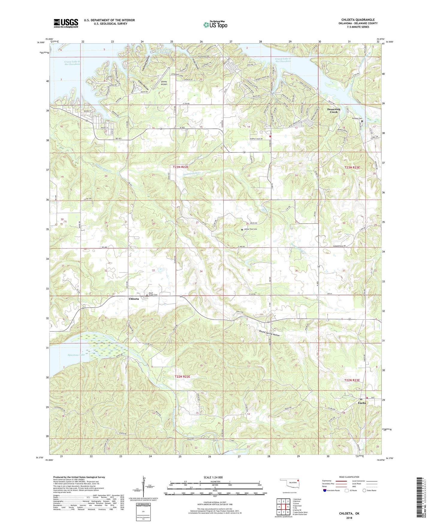
2022 topographic map quadrangle Chloeta in the state of Oklahoma. Scale: 1:24000. Based on the newly updated USGS 7.5' US Topo map series, this map is in the following counties: Delaware. The map contains contour data, water features, and other items you are used to seeing on USGS maps, but also has updated roads and other features. This is the next generation of topographic maps. Printed on high-quality waterproof paper with UV fade-resistant inks.
Quads adjacent to this one:
West: Spavinaw
Northwest: Ketchum
North: Bernice
Northeast: Grove
East: Jay
Southeast: Lake Eucha East
South: Lake Eucha West
Southwest: Salina SE
This map covers the same area as the classic USGS quad with code o36094d8.
Contains the following named places: Chloeta, Disney Airport, Drowning Creek, Drowning Creek Census Designated Place, Eucha, Eucha Dam, Eucha Post Office, Eucha Volunteer Fire Station, Free Holiness Church, Ghost Hollow, Grays Hollow, Hillside Cemetery, Hillside Church, Lakemont Shores Fire Protection District, Lakemont Shores Heliport, Lawhead Hollow, Mose Ridge Cemetery, New Eucha, Round Spring Hollow, Township 3, Woods Spring Branch, Yellow Tree Cemetery, ZIP Code: 74342