MyTopo
Bernice Oklahoma US Topo Map
Couldn't load pickup availability
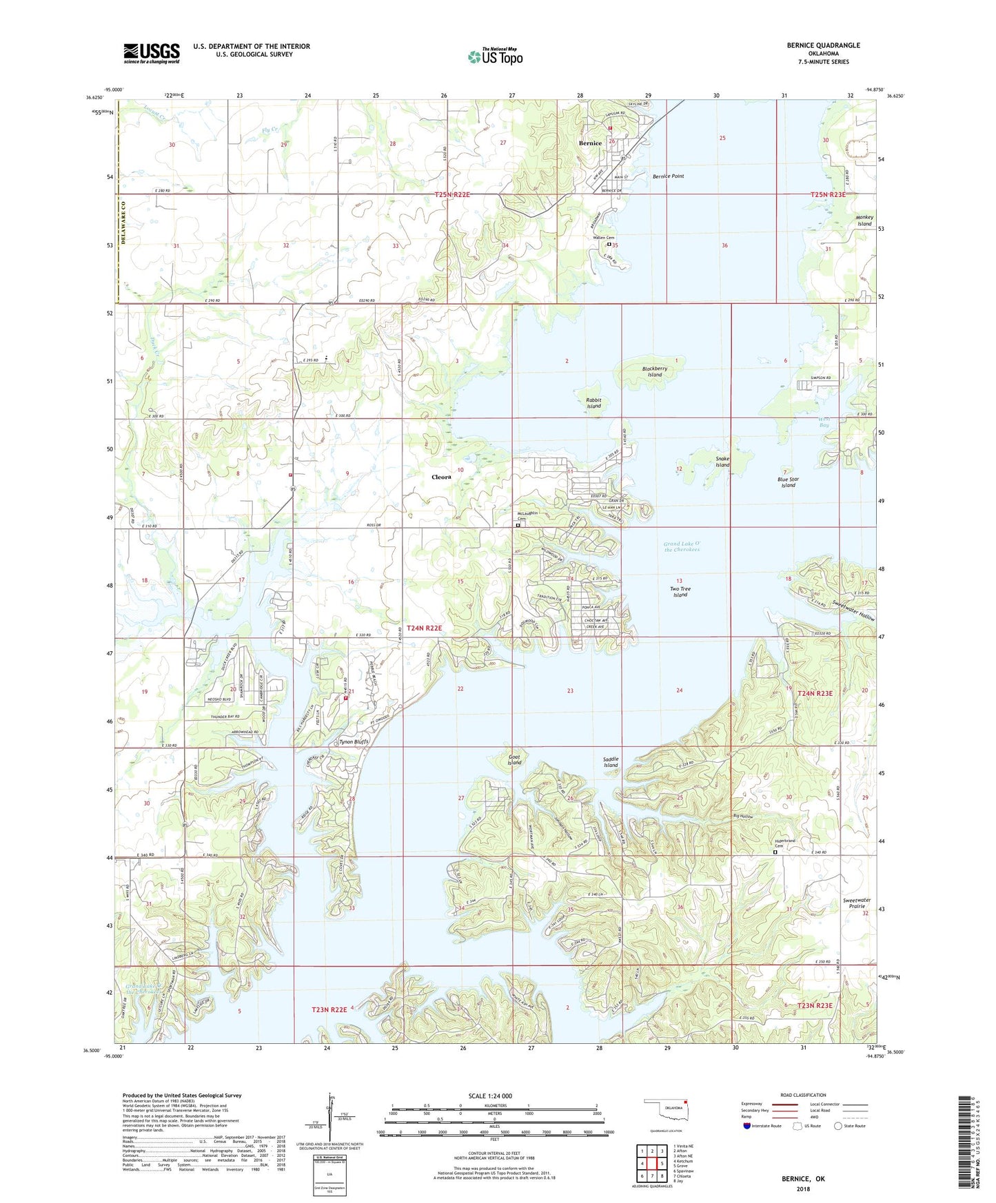
2022 topographic map quadrangle Bernice in the state of Oklahoma. Scale: 1:24000. Based on the newly updated USGS 7.5' US Topo map series, this map is in the following counties: Delaware, Craig. The map contains contour data, water features, and other items you are used to seeing on USGS maps, but also has updated roads and other features. This is the next generation of topographic maps. Printed on high-quality waterproof paper with UV fade-resistant inks.
Quads adjacent to this one:
West: Ketchum
Northwest: Vinita NE
North: Afton
Northeast: Afton NE
East: Grove
Southeast: Jay
South: Chloeta
Southwest: Spavinaw
This map covers the same area as the classic USGS quad with code o36094e8.
Contains the following named places: Bernice, Bernice Point, Big Hollow, Blackberry Island, Blue Star Island, Cherokee Seaplane Base, City of Bernice Volunteer Fire Department, Cleora, Cleora Census Designated Place, Cleora Community Fire Department, Cleora Emergency Medical Services, Cleora Fire Department Station 2, Cleora Public School, Dennis, Duck Creek, Goat Island, Harbors Inn Heliport, Hilderbrand Cemetery, Johnson Hollow, Lyon Airport, McLaughlin Cemetery, Monkey Island, Rabbit Island, Saddle Island, Snake Island, Sweetwater Hollow, Town of Bernice, Township 5, Two Tree Island, Tynon Bluffs, Wallen Cemetery, West Bay