MyTopo
Kingfisher NE Oklahoma US Topo Map
Couldn't load pickup availability
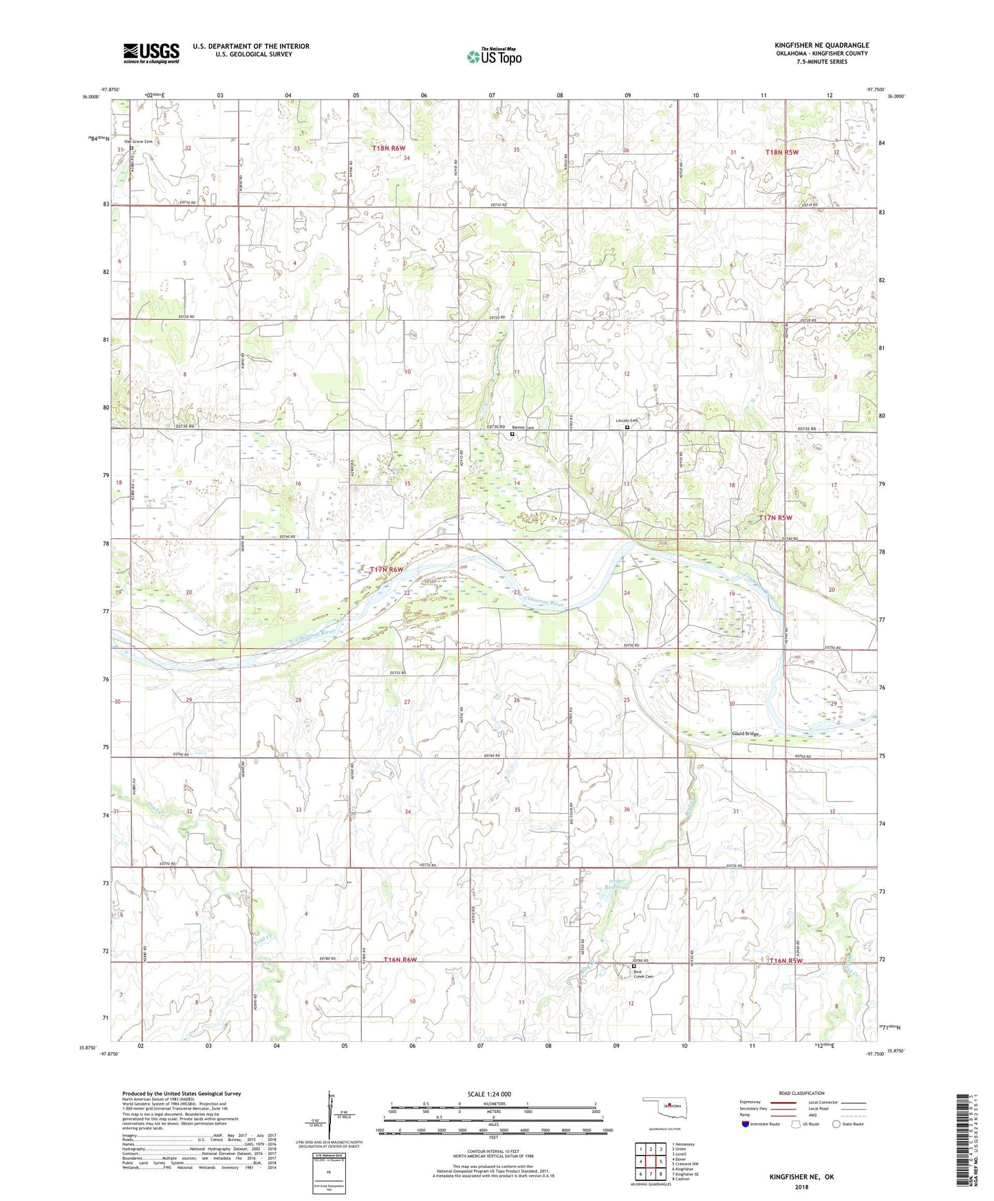
2018 topographic map quadrangle Kingfisher NE in the state of Oklahoma. Scale: 1:24000. Based on the newly updated USGS 7.5' US Topo map series, this map is in the following counties: Kingfisher. The map contains contour data, water features, and other items you are used to seeing on USGS maps, but also has updated roads and other features. This is the next generation of topographic maps. Printed on high-quality waterproof paper with UV fade-resistant inks.
Quads adjacent to this one:
West: Dover
Northwest: Hennessey
North: Union
Northeast: Lovell
East: Crescent NW
Southeast: Cashion
South: Kingfisher SE
Southwest: Kingfisher
Contains the following named places: Banner Cemetery, Banner Church, Big Four School, Bird Creek, Bird Creek Cemetery, Booker T Washington School, Gould Bridge, Lincoln Cemetery, Mount Olive Church, Oak Grove Cemetery, Oknoname 07307 Dam, Oknoname 07307 Reservoir, Township of Banner, Winter Creek Site 10 Dam, Winter Creek Site 10 Reservoir, ZIP Code: 73734