MyTopo
Kingfisher Oklahoma US Topo Map
Couldn't load pickup availability
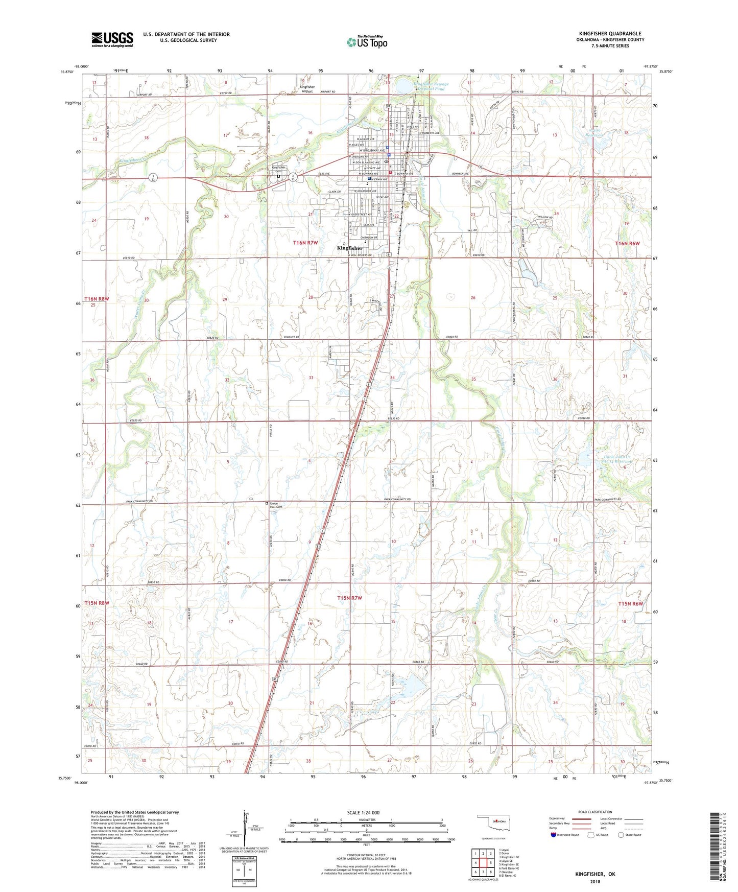
2022 topographic map quadrangle Kingfisher in the state of Oklahoma. Scale: 1:24000. Based on the newly updated USGS 7.5' US Topo map series, this map is in the following counties: Kingfisher. The map contains contour data, water features, and other items you are used to seeing on USGS maps, but also has updated roads and other features. This is the next generation of topographic maps. Printed on high-quality waterproof paper with UV fade-resistant inks.
Quads adjacent to this one:
West: Loyal SE
Northwest: Loyal
North: Dover
Northeast: Kingfisher NE
East: Kingfisher SE
Southeast: El Reno NE
South: Okarche
Southwest: Fort Reno NE
This map covers the same area as the classic USGS quad with code o35097g8.
Contains the following named places: Church of the Nazarene, City of Kingfisher, Clear Creek, Emmanuel Lutheran Church, First Baptist Church, First Christian Church, First United Methodist Church, Gilmour Elementary School, Kingfisher, Kingfisher Airport, Kingfisher Cemetery, Kingfisher County Jail, Kingfisher County Sheriff's Department, Kingfisher Fire Department and Emergency Medical Services, Kingfisher High School, Kingfisher Middle School, Kingfisher Police Dept, Kingfisher Post Office, Kingfisher Regional Hospital, Kingfisher Sewage Disposal Dam, Kingfisher Sewage Disposal Pond, Lighthouse Praise and Worship Church, Oak Street Baptist Church, Okarche-Cashion Division, Oknoname 07309 Dam, Oknoname 07309 Reservoir, Oknoname 07311 Dam, Pilgrim Rest Baptist Church, Reherman Airport, Saints Peter and Paul School, Shaw Park, Township of Harrison, Township of Kingfisher, Uncle John Creek Site 14 Dam, Uncle John Creek Site 14 Reservoir, Uncle John Creek Site 2 Dam, Uncle John Creek Site 2 Reservoir, Uncle Johns Creek, Union Hall Cemetery, Victory Baptist Church, Washington School, Winter Camp Creek, ZIP Code: 73750