MyTopo
Kinta Oklahoma US Topo Map
Couldn't load pickup availability
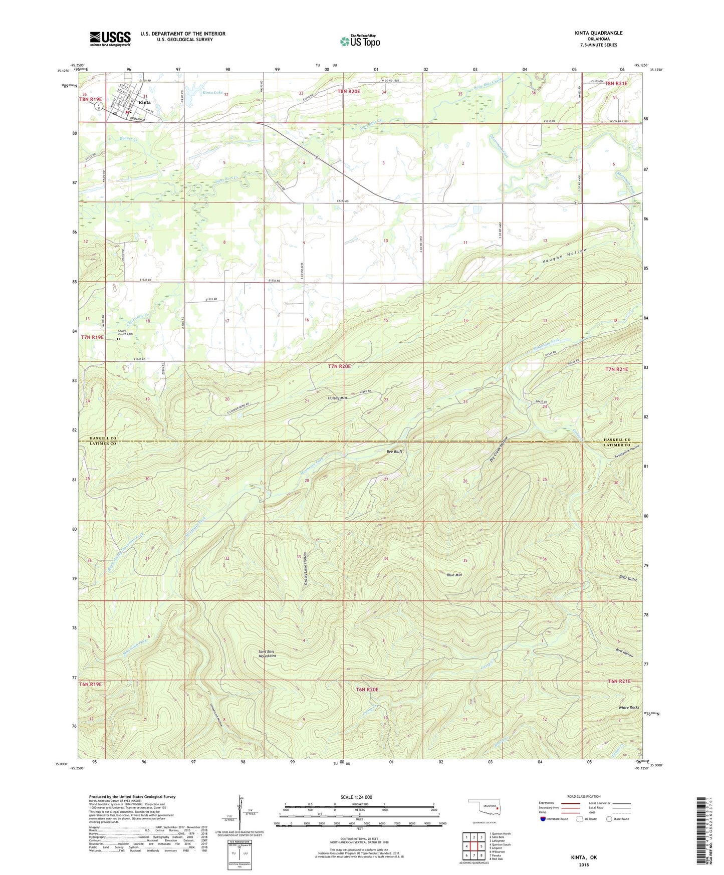
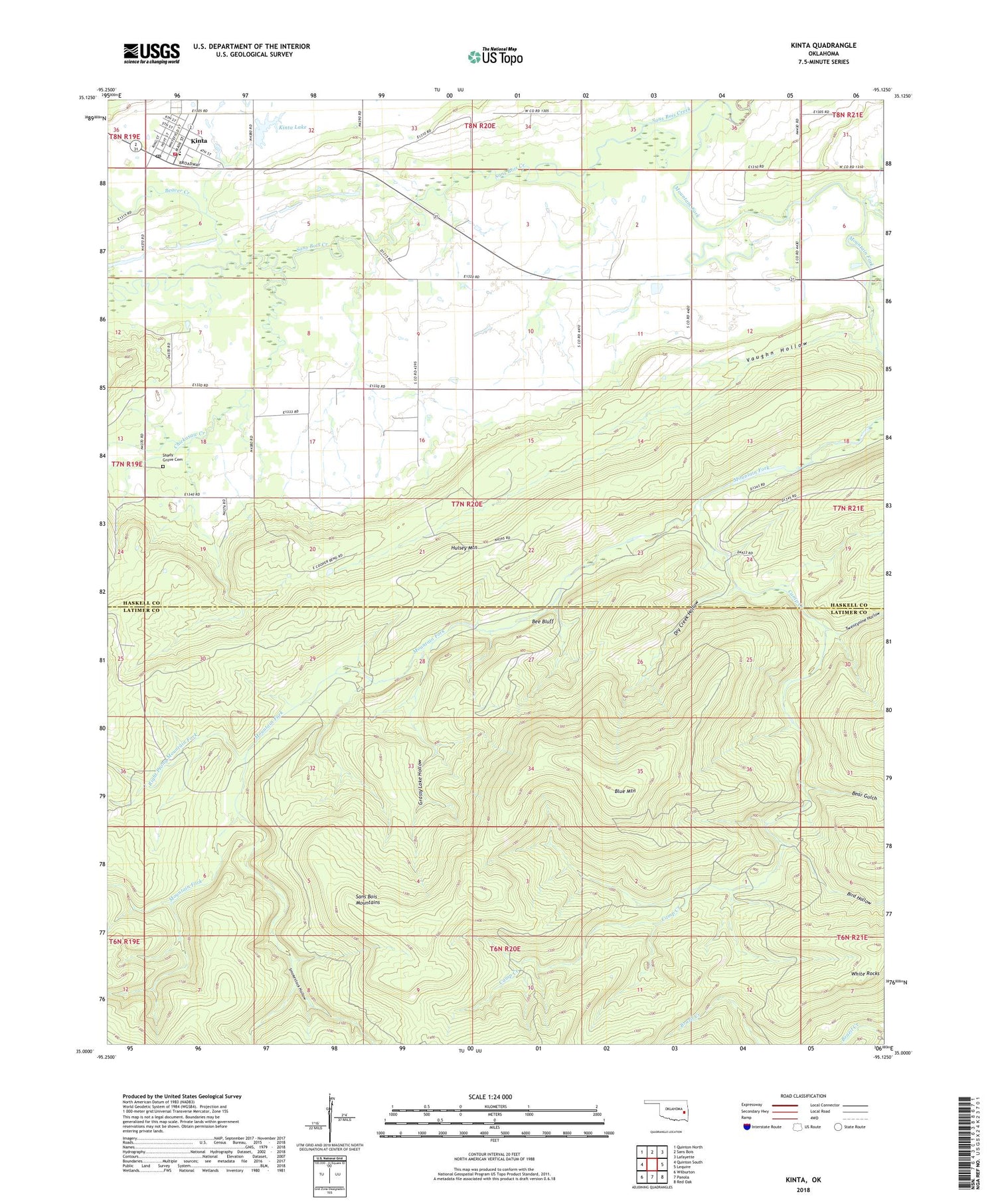
2018 topographic map quadrangle Kinta in the state of Oklahoma. Scale: 1:24000. Based on the newly updated USGS 7.5' US Topo map series, this map is in the following counties: Latimer, Haskell. The map contains contour data, water features, and other items you are used to seeing on USGS maps, but also has updated roads and other features. This is the next generation of topographic maps. Printed on high-quality waterproof paper with UV fade-resistant inks.
Quads adjacent to this one:
West: Quinton South
Northwest: Quinton North
North: Sans Bois
Northeast: Lafayette
East: Lequire
Southeast: Red Oak
South: Panola
Southwest: Wilburton
Contains the following named places: Andrew Creek, Bear Gulch, Beaver Creek, Bee Bluff, Bird Hollow, Blue Mountain, Camp Creek, Chickasaw Creek, Dry Creek Hollow, Grassy Lake Hollow, Hulsey Mountain, Kinta, Kinta Elementary School, Kinta Fire Department, Kinta High School, Kinta Lake, Kinta Lake Dam, Kinta Post Office, Mountain Fork, Right Prong Mountain Fork, Sans Bois Mountains, Shady Grove Cemetery, Smokestack Hollow, Town of Kinta, Township of Beaver, Turkey Creek, Twentynine Hollow, Vaughn Hollow, White Rocks, ZIP Code: 74552