MyTopo
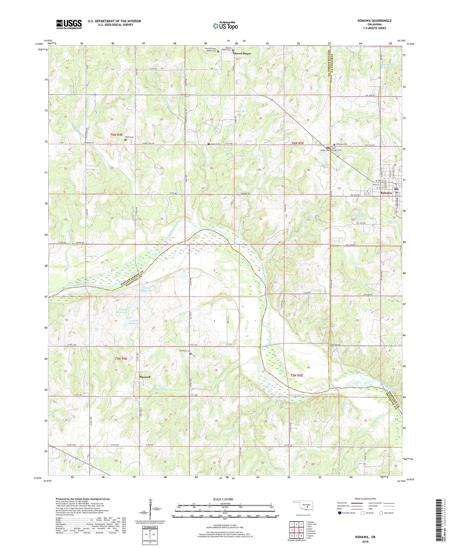
Konawa Oklahoma US Topo Map
Couldn't load pickup availability
2018 topographic map quadrangle Konawa in the state of Oklahoma. Scale: 1:24000. Based on the newly updated USGS 7.5' US Topo map series, this map is in the following counties: Pottawatomie, Pontotoc, Seminole. The map contains contour data, water features, and other items you are used to seeing on USGS maps, but also has updated roads and other features. This is the next generation of topographic maps. Printed on high-quality waterproof paper with UV fade-resistant inks.
Quads adjacent to this one:
West: Asher
Northwest: Pearson
North: Saint Louis
Northeast: Wolf
East: Vamoosa
Southeast: Ada
South: Vanoss
Southwest: Stratford
Contains the following named places: Antioch Church, Bates Cemetery, Bebee Oil Field, City of Konawa, Gray Oil Field, Grayson Church, Grayson Oil Field, Konawa, Konawa Elementary School, Konawa Emergency Medical Services, Konawa High School, Konawa Memorial Cemetery, Konawa Middle School, Konawa Police Department, Konawa Post Office, Konawa Volunteer Fire Department, Lyons Cemetery, Maxwell, Maxwell Cemetery, Maxwell Church, Maxwell Creek, Mud Flat Creek, Oknoname 123001 Dam, Oknoname 123001 Reservoir, Oknoname 123002 Dam, Oknoname 123002 Reservoir, Oknoname 123003 Dam, Oknoname 123003 Reservoir, Oknoname 133003 Dam, Oknoname 133003 Reservoir, Preacher Creek, Sacred Heart Cemetery, Sacred Heart Sisters Cemetery, Salt Creek Site 46 Dam, Salt Creek Site 46 Reservoir, Sledge Oil Field, Township of Avoca, Township of Maxwell, Violet Springs Cemetery, Vista Cemetery, Young Creek