MyTopo
Saint Louis Oklahoma US Topo Map
Couldn't load pickup availability
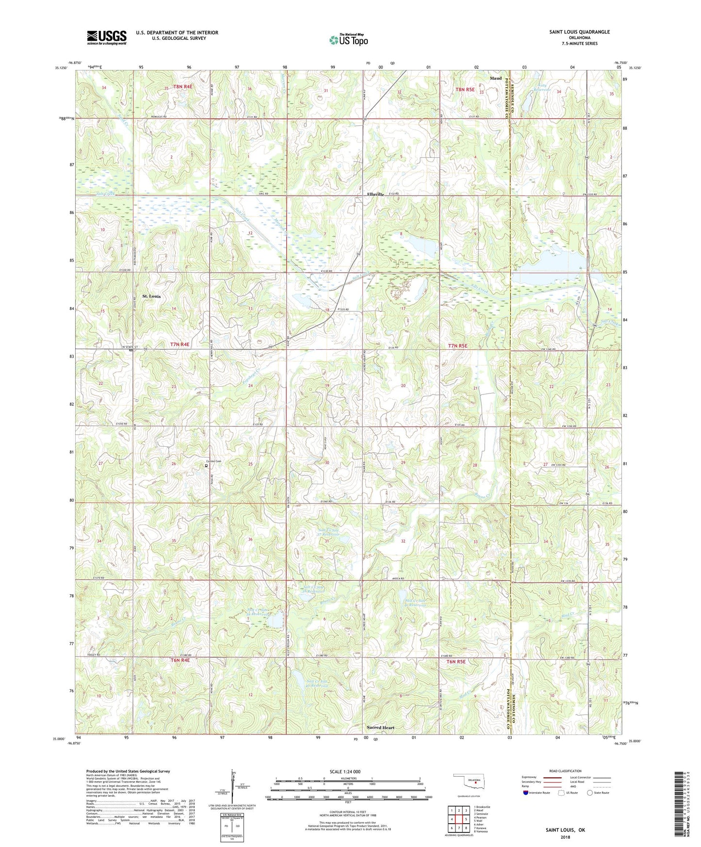
2022 topographic map quadrangle Saint Louis in the state of Oklahoma. Scale: 1:24000. Based on the newly updated USGS 7.5' US Topo map series, this map is in the following counties: Pottawatomie, Seminole. The map contains contour data, water features, and other items you are used to seeing on USGS maps, but also has updated roads and other features. This is the next generation of topographic maps. Printed on high-quality waterproof paper with UV fade-resistant inks.
Quads adjacent to this one:
West: Pearson
Northwest: Brooksville
North: Maud
Northeast: Seminole
East: Wolf
Southeast: Vamoosa
South: Konawa
Southwest: Asher
This map covers the same area as the classic USGS quad with code o35096a7.
Contains the following named places: Bruno Creek, Collins Cemetery, Ellaville, Katy Reservoir, Katy Reservoir Dam, Marcum Creek, Maud Division, Popshego Creek, Sacred Heart, Saint Louis, Saint Louis Post Office, Salt Creek Site 37 Dam, Salt Creek Site 37 Reservoir, Salt Creek Site 38 Dam, Salt Creek Site 38 Reservoir, Salt Creek Site 39 Dam, Salt Creek Site 39 Reservoir, Salt Creek Site 40 Dam, Salt Creek Site 40 Reservoir, Salt Creek Site 41 Dam, Salt Creek Site 41 Reservoir, Sand Creek, Town of Saint Louis, Township of Saint Louis