MyTopo
Lamar Oklahoma US Topo Map
Couldn't load pickup availability
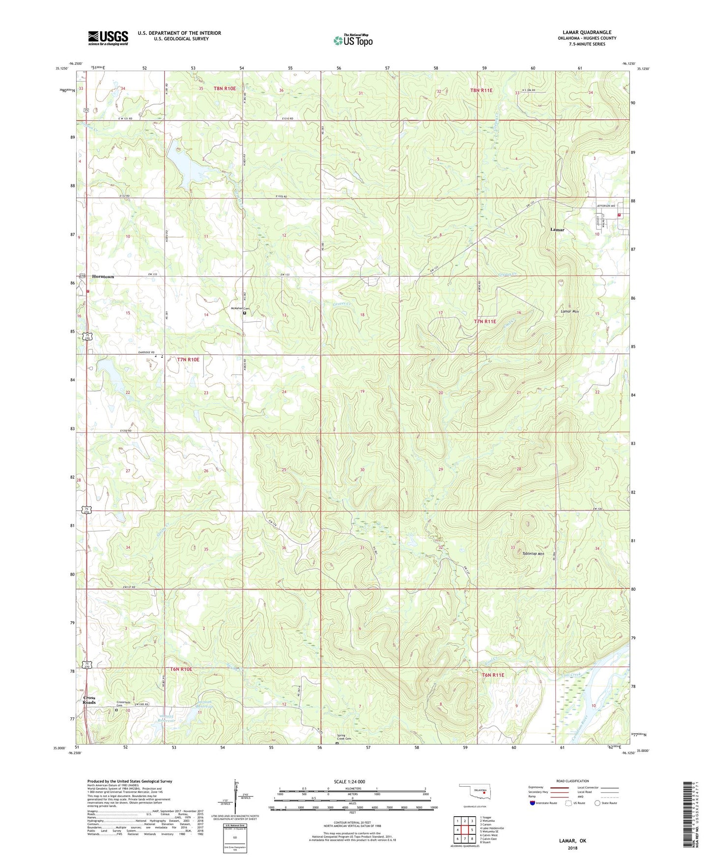
2018 topographic map quadrangle Lamar in the state of Oklahoma. Scale: 1:24000. Based on the newly updated USGS 7.5' US Topo map series, this map is in the following counties: Hughes. The map contains contour data, water features, and other items you are used to seeing on USGS maps, but also has updated roads and other features. This is the next generation of topographic maps. Printed on high-quality waterproof paper with UV fade-resistant inks.
Quads adjacent to this one:
West: Lake Holdenville
Northwest: Yeager
North: Wetumka
Northeast: Carson
East: Wetumka SE
Southeast: Stuart
South: Calvin East
Southwest: Calvin West
Contains the following named places: Coal Creek, Cross Roads, Crossroads Cemetery, Hack Black Junior Dam, Hack Black Junior Reservoir, Horntown, Horntown Fire Department, Hughes County Emergency Medical Services Station 2, Lamar, Lamar Mountain, Lamar Volunteer Fire Department, Little Wewoka Creek Site 13 Dam, Little Wewoka Creek Site 13 Reservoir, Little Wewoka Creek Site 14 Dam, Little Wewoka Creek Site 14 Reservoir, McMahan Cemetery, Moss Elementary School, Moss High School, Oknoname 063025 Dam, Oknoname 063025 Reservoir, Oknoname 063026 Dam, Oknoname 063026 Reservoir, Spring Creek Cemetery, Tabletop Mountain, Town of Horntown, Township of Barnard