MyTopo
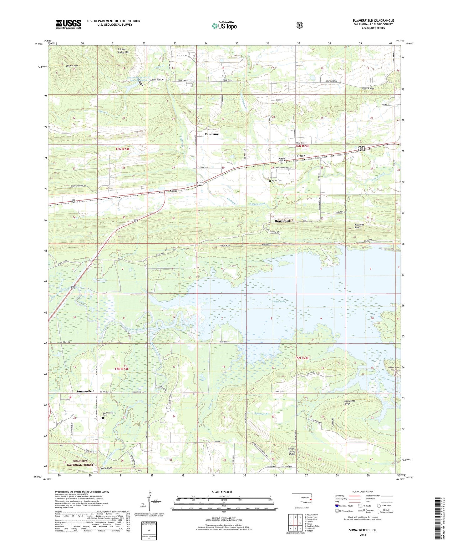
Summerfield Oklahoma US Topo Map
Couldn't load pickup availability
Also explore the Summerfield Forest Service Topo of this same quad for updated USFS data
2022 topographic map quadrangle Summerfield in the state of Oklahoma. Scale: 1:24000. Based on the newly updated USGS 7.5' US Topo map series, this map is in the following counties: Le Flore. The map contains contour data, water features, and other items you are used to seeing on USGS maps, but also has updated roads and other features. This is the next generation of topographic maps. Printed on high-quality waterproof paper with UV fade-resistant inks.
Quads adjacent to this one:
West: Leflore
Northwest: McCurtain SW
North: Potato Peaks
Northeast: Poteau West
East: Wister
Southeast: Hodgen
South: Leflore SE
Southwest: Blackjack Ridge
This map covers the same area as the classic USGS quad with code o34094h7.
Contains the following named places: Anderson Branch, Braidwood, Buzzards Roost, Caston, Caston Mountain Creek Site 1 Dam, Caston Mountain Creek Site 1 Reservoir, Caston Mountain Creek Site 3 Dam, Caston Mountain Creek Site 3 Reservoir, Cedar Creek, Coal Creek, Community Chapel, Fourche Maline, Goat Ridge, Goats Bluff, Heart o' the Hills Church, Holson Creek, Horseshoe Ridge, Lewis Creek, Little Caston Creek, Maxey Cemetery, Round Mountain, Summerfield, Summerfield Cemetery, Summerfield Fire Department, Township of Wister, Victor, Waterfowl Refuge, Wister Division, Wister Lake, Wister Lake State Park, Wister Public Hunting Area, Yellow Spring Ridge, ZIP Code: 74966