MyTopo
West Point Oklahoma US Topo Map
Couldn't load pickup availability
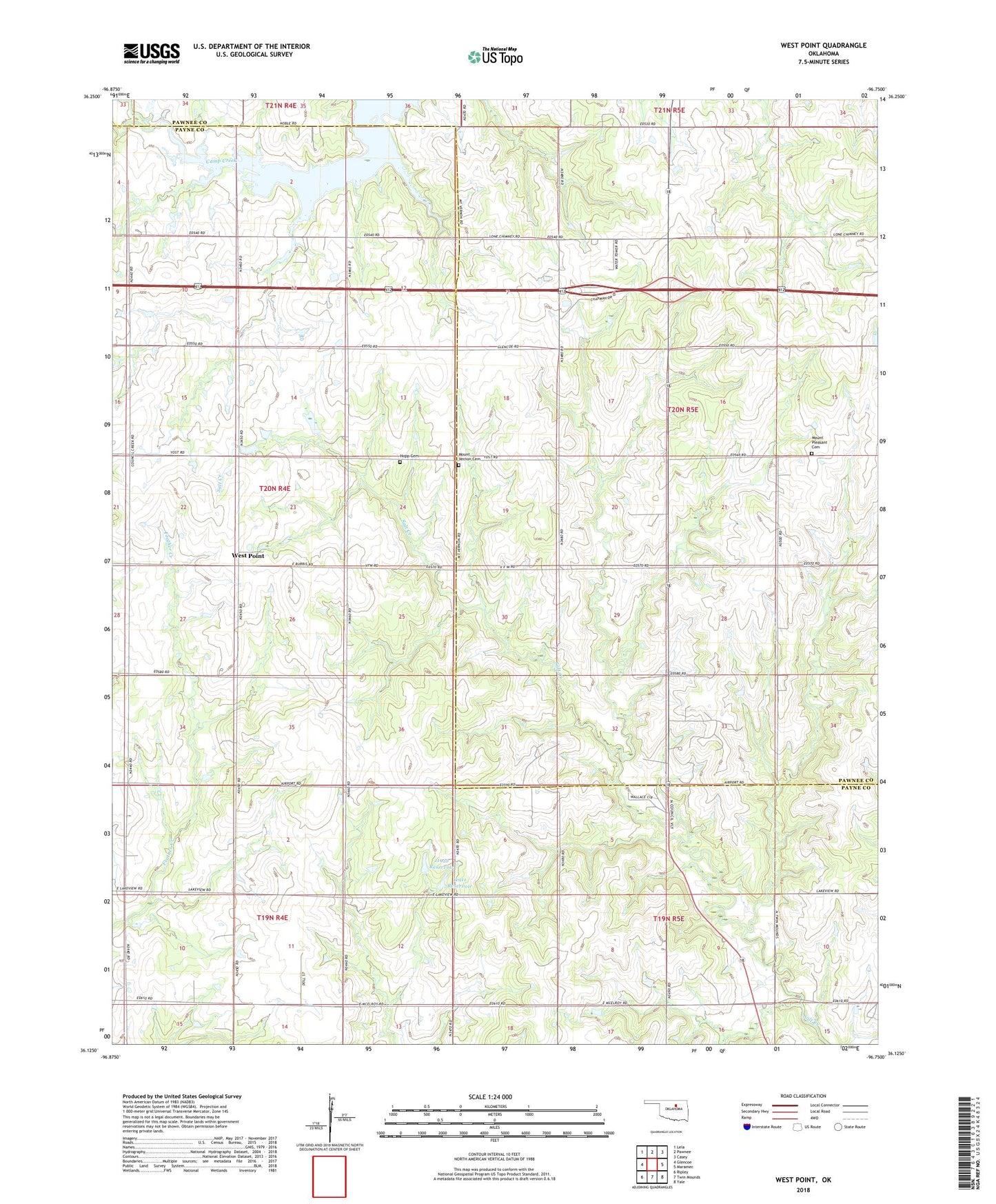
2022 topographic map quadrangle West Point in the state of Oklahoma. Scale: 1:24000. Based on the newly updated USGS 7.5' US Topo map series, this map is in the following counties: Payne, Pawnee. The map contains contour data, water features, and other items you are used to seeing on USGS maps, but also has updated roads and other features. This is the next generation of topographic maps. Printed on high-quality waterproof paper with UV fade-resistant inks.
Quads adjacent to this one:
West: Glencoe
Northwest: Lela
North: Pawnee
Northeast: Casey
East: Maramec
Southeast: Yale
South: Twin Mounds
Southwest: Ripley
This map covers the same area as the classic USGS quad with code o36096b7.
Contains the following named places: Camp Koinonia, Hopp Cemetery, Lone Chimney, Lone Chimney Church, Mount Pleasant Cemetery, Mount Vernon Cemetery, Oknoname 11910 Dam, Oknoname 11910 Reservoir, Oknoname 11911 Dam, Oknoname 11911 Reservoir, Township of Banner, Township of Rose, West Point