MyTopo
Empire City Oklahoma US Topo Map
Couldn't load pickup availability
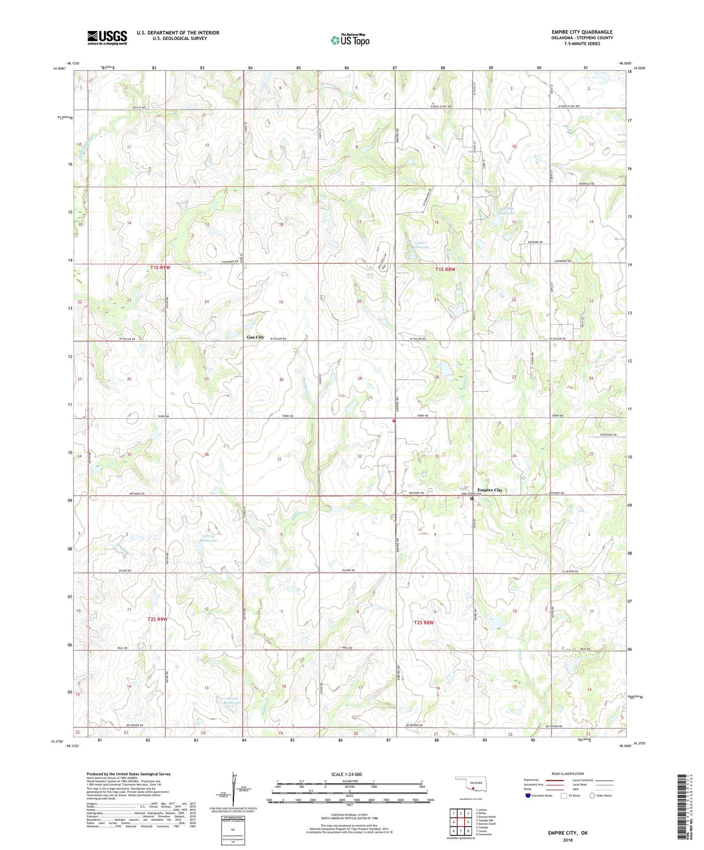
2022 topographic map quadrangle Empire City in the state of Oklahoma. Scale: 1:24000. Based on the newly updated USGS 7.5' US Topo map series, this map is in the following counties: Stephens. The map contains contour data, water features, and other items you are used to seeing on USGS maps, but also has updated roads and other features. This is the next generation of topographic maps. Printed on high-quality waterproof paper with UV fade-resistant inks.
Quads adjacent to this one:
West: Temple NW
Northwest: Letitia
North: Nellie
Northeast: Duncan North
East: Duncan South
Southeast: Comanche
South: Corum
Southwest: Temple
This map covers the same area as the classic USGS quad with code o34098d1.
Contains the following named places: Banner Church, Cow Creek Site 35 Dam, Cow Creek Site 35 Reservoir, Empire City, Empire Elementary School, Empire High School, Empire Oil Field, Empire Volunteer Fire Department, Fair Church, Gas City, Oak Grove Cemetery, Oknoname 137013 Dam, Oknoname 137013 Reservoir, Oknoname 137014 Dam, Oknoname 137014 Reservoir, Oknoname 137015 Dam, Oknoname 137015 Reservoir, Oknoname 137016 Dam, Oknoname 137016 Reservoir, Oknoname 137017 Dam, Oknoname 137017 Reservoir, Oknoname 137089 Dam, Oknoname 137089 Reservoir, Town of Empire City, Township of Rock Creek, West Duncan Oil and Gas Field