MyTopo
Walters NE Oklahoma US Topo Map
Couldn't load pickup availability
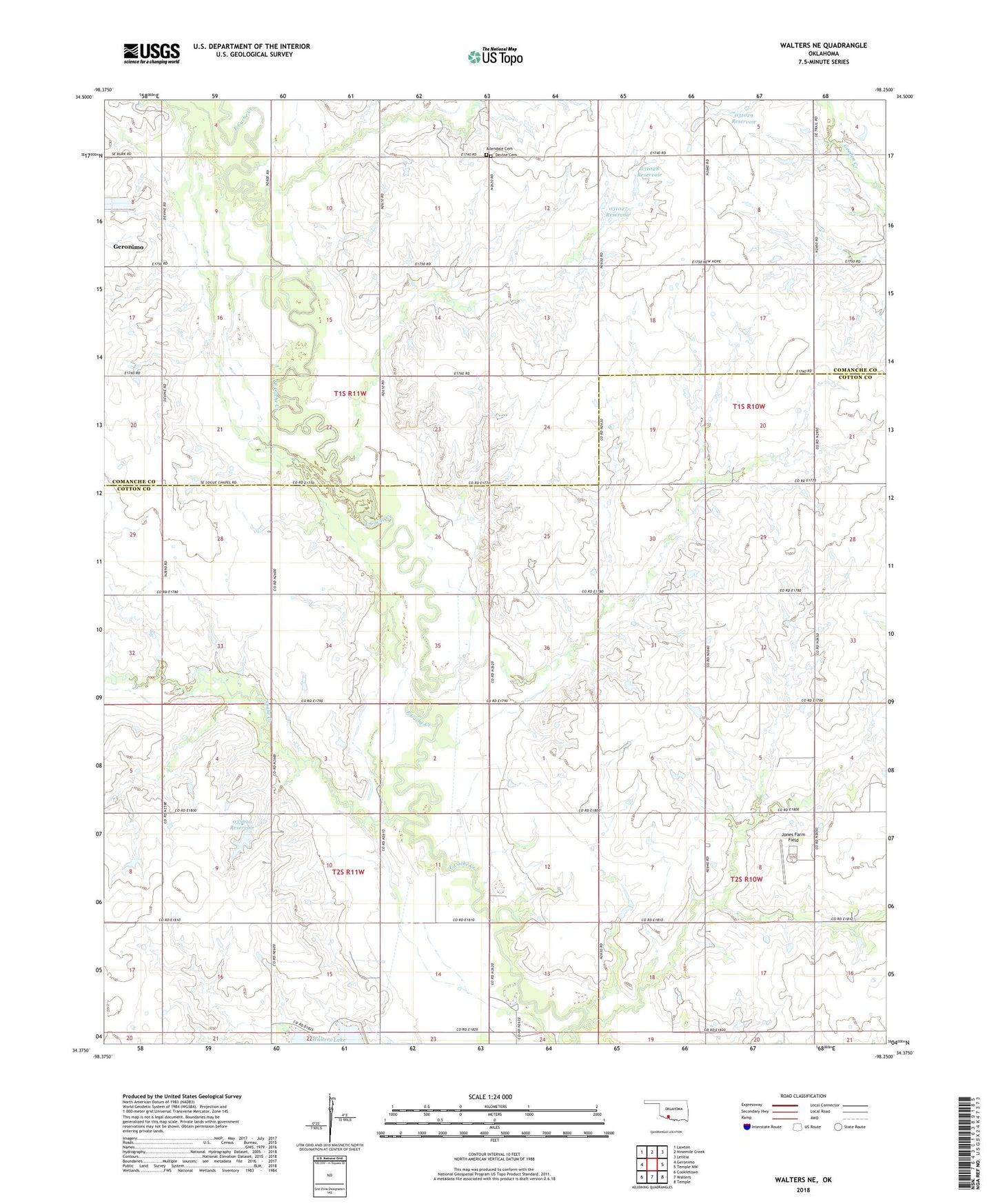
2022 topographic map quadrangle Walters NE in the state of Oklahoma. Scale: 1:24000. Based on the newly updated USGS 7.5' US Topo map series, this map is in the following counties: Cotton, Comanche. The map contains contour data, water features, and other items you are used to seeing on USGS maps, but also has updated roads and other features. This is the next generation of topographic maps. Printed on high-quality waterproof paper with UV fade-resistant inks.
Quads adjacent to this one:
West: Geronimo
Northwest: Lawton
North: Ninemile Creek
Northeast: Letitia
East: Temple NW
Southeast: Temple
South: Walters
Southwest: Cookietown
This map covers the same area as the classic USGS quad with code o34098d3.
Contains the following named places: Allendale Cemetery, Dave Boyer Lake, Devine Cemetery, Jones Farm Field, New Salem Church, Oknoname 031027 Dam, Oknoname 031027 Reservoir, Oknoname 031028 Dam, Oknoname 031028 Reservoir, Oknoname 031029 Dam, Oknoname 031029 Reservoir, Oknoname 033007 Dam, Oknoname 033007 Reservoir, Oknoname 033010 Dam, Oknoname 033010 Reservoir, Oknoname 141015 Dam, Oknoname 141015 Reservoir, Snake Creek, Sulton Park, Township of Strauss, Walters Dam, ZIP Code: 73543