MyTopo
Milo Oklahoma US Topo Map
Couldn't load pickup availability
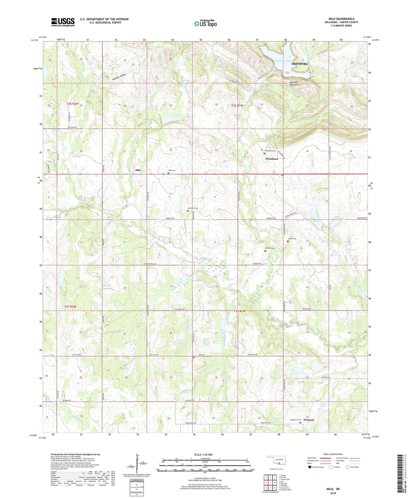
2018 topographic map quadrangle Milo in the state of Oklahoma. Scale: 1:24000. Based on the newly updated USGS 7.5' US Topo map series, this map is in the following counties: Carter. The map contains contour data, water features, and other items you are used to seeing on USGS maps, but also has updated roads and other features. This is the next generation of topographic maps. Printed on high-quality waterproof paper with UV fade-resistant inks.
Quads adjacent to this one:
West: Fox
Northwest: Tatums
North: Fox NE
Northeast: Turner Falls
East: Springer
Southeast: Ardmore West
South: Lone Grove
Southwest: Healdton
Contains the following named places: Caddo Creek Site 10 Dam, Caddo Creek Site 10 Reservoir, Caddo Creek Site 15 Dam, Caddo Creek Site 15 Reservoir, Caddo Creek Site 16 Dam, Caddo Creek Site 16 Reservoir, Caddo Creek Site 19 Dam, Caddo Creek Site 19 Reservoir, Caddo Creek Site 20 Dam, Caddo Creek Site 20 Reservoir, Caddo Creek Site 21 Dam, Caddo Creek Site 21 Reservoir, Caddo Creek Site 7a Dam, Caddo Creek Site 7a Reservoir, Caddo Creek Site 8 Dam, Caddo Creek Site 8 Reservoir, Caddo Creek Site 9 Dam, Caddo Creek Site 9 Reservoir, Carter County, Hickory Cemetery, Hickory Creek, Hickory Falls, Jehovah Cemetery, Jehovah Church, Little Hickory Creek, Milo, Milo Cemetery, Mount Olive Church, Mountain Dam, Mountain Lake, Newport, Newport Cemetery, Pruitt Cemetery, Red Branch, Redoak Hollow, Saint Paul Church, Sand Branch, Sneed Volunteer Fire Department, Spring Creek, Township of Akers, West Spring Creek, Woodford, Woodford Cemetery, Woodford Volunteer Fire Department, ZIP Code: 73458