MyTopo
Springer Oklahoma US Topo Map
Couldn't load pickup availability
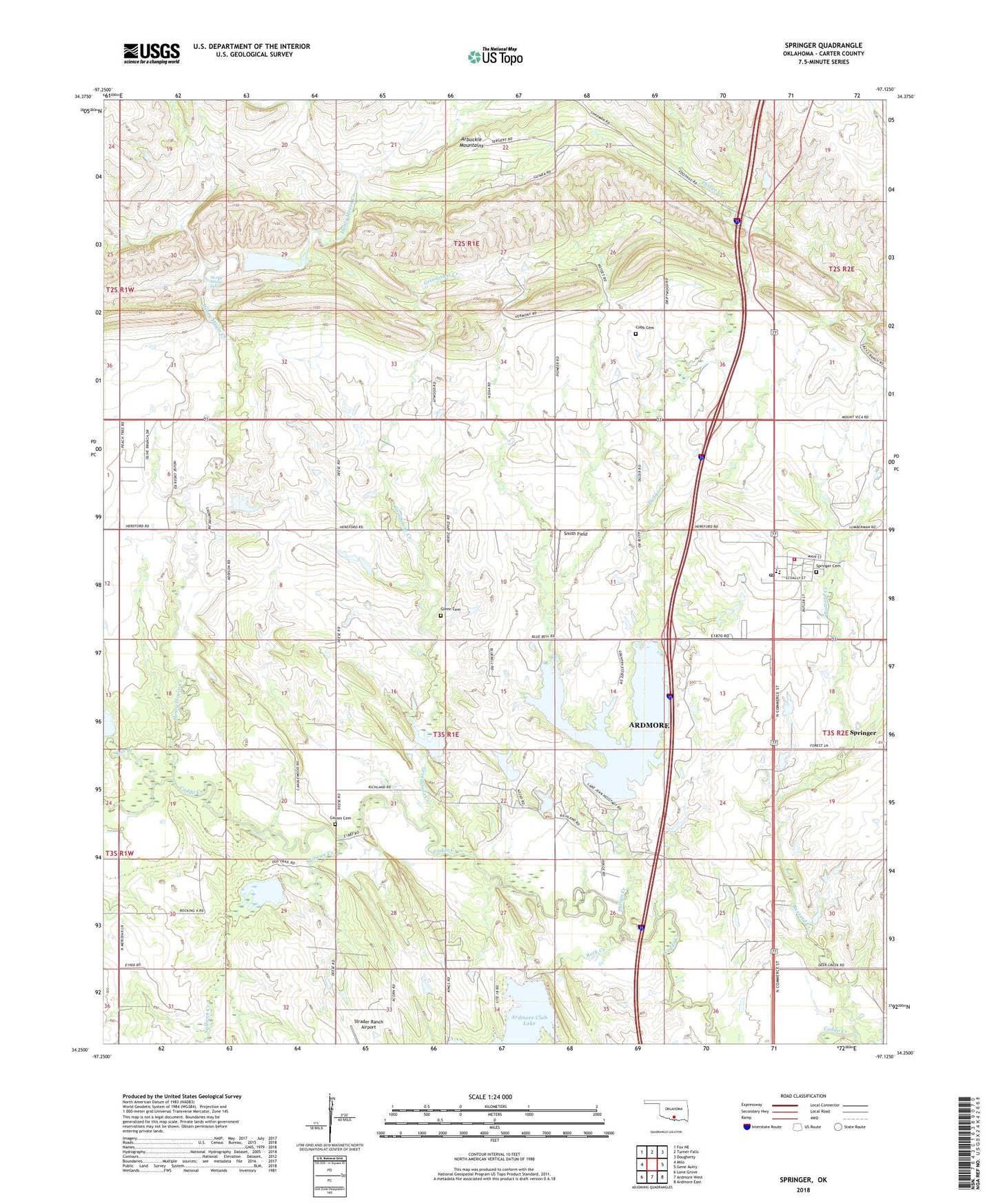
2022 topographic map quadrangle Springer in the state of Oklahoma. Scale: 1:24000. Based on the newly updated USGS 7.5' US Topo map series, this map is in the following counties: Carter. The map contains contour data, water features, and other items you are used to seeing on USGS maps, but also has updated roads and other features. This is the next generation of topographic maps. Printed on high-quality waterproof paper with UV fade-resistant inks.
Quads adjacent to this one:
West: Milo
Northwest: Fox NE
North: Turner Falls
Northeast: Dougherty
East: Gene Autry
Southeast: Ardmore East
South: Ardmore West
Southwest: Lone Grove
This map covers the same area as the classic USGS quad with code o34097c2.
Contains the following named places: Ardmore Club Lake, Ardmore North Division, Buzzard Creek, Caddo Creek Site 11 Dam, Caddo Creek Site 11 Reservoir, Caddo Creek Site 12 Dam, Caddo Creek Site 12 Reservoir, Caddo Creek Site 13 Dam, Caddo Creek Site 13 Reservoir, Caddo Creek Site 14 Dam, Caddo Creek Site 14 Reservoir, Caddo Creek Site 17 Dam, Caddo Creek Site 17 Reservoir, Caddo Creek Site 18 Dam, Caddo Creek Site 18 Reservoir, Caddo Creek Site 27 Dam, Caddo Creek Site 27 Reservoir, Caddo Pool Oil Field, Cobb Cemetery, D C Fitzgerald Dam, Fitzgerald Reservoir, Gaines Cemetery, Glenn, Glenn Cemetery, Grindstone Creek, Henry House Creek, Henry House Falls, Noble-Sea Cattle Company Dam, Noble-Sea Cattle Company Reservoir, Oknoname 01901 Dam, Oknoname 01901 Reservoir, Oknoname 01902 Dam, Oknoname 01902 Reservoir, Philips Creek, Rock Creek, Salt Branch, Smith Field, Springer, Springer Cemetery, Springer Elementary School, Springer Fire Department, Springer High School, Springer Post Office, Strader Ranch Airport, Sullivan Creek, Town of Springer