MyTopo
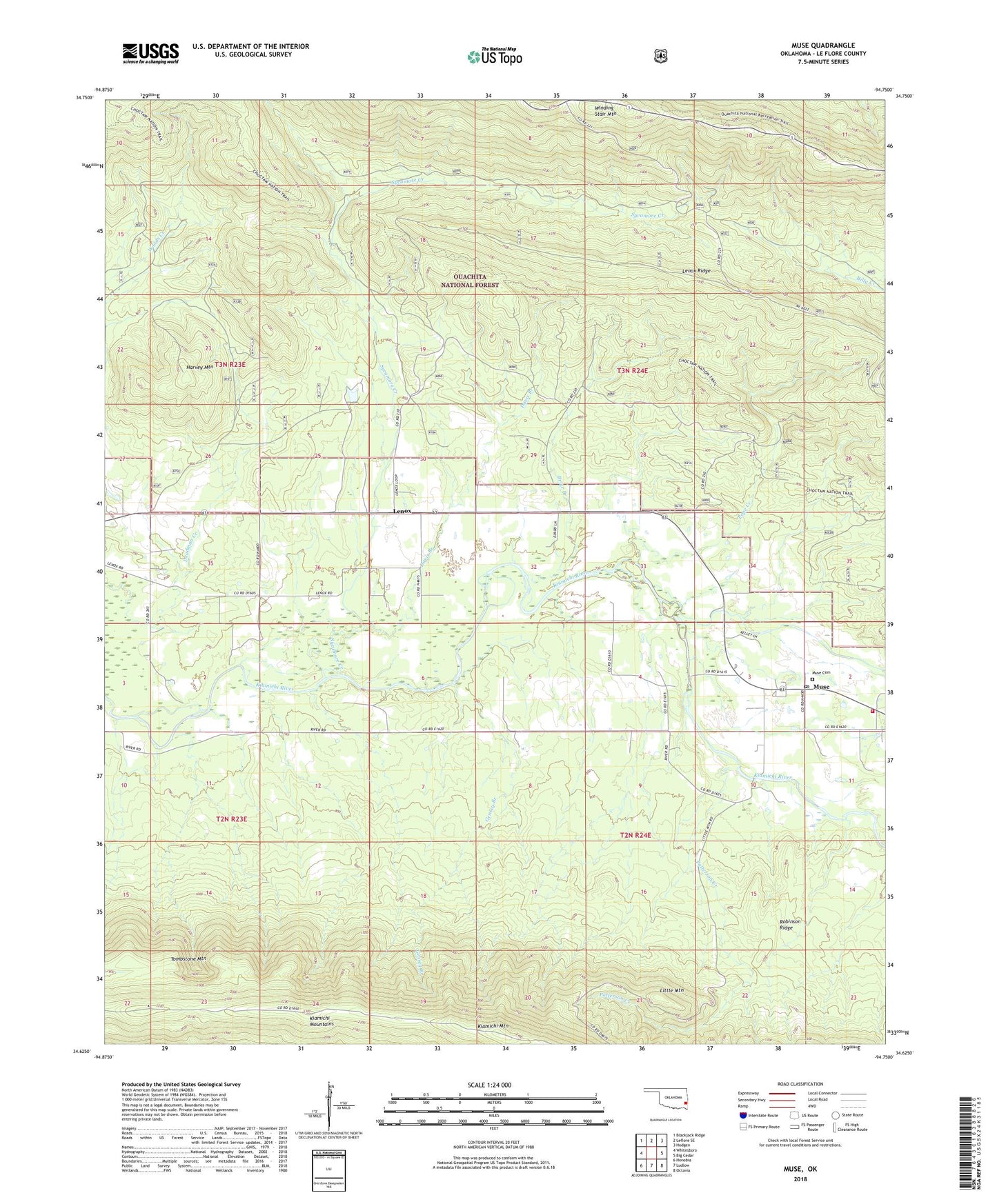
Muse Oklahoma US Topo Map
Couldn't load pickup availability
Also explore the Muse Forest Service Topo of this same quad for updated USFS data
2022 topographic map quadrangle Muse in the state of Oklahoma. Scale: 1:24000. Based on the newly updated USGS 7.5' US Topo map series, this map is in the following counties: Le Flore. The map contains contour data, water features, and other items you are used to seeing on USGS maps, but also has updated roads and other features. This is the next generation of topographic maps. Printed on high-quality waterproof paper with UV fade-resistant inks.
Quads adjacent to this one:
West: Whitesboro
Northwest: Blackjack Ridge
North: Leflore SE
Northeast: Hodgen
East: Big Cedar
Southeast: Octavia
South: Ludlow
Southwest: Honobia
This map covers the same area as the classic USGS quad with code o34094f7.
Contains the following named places: Big Cedar Volunteer Fire Department Station 2, Billy Creek, Briar Branch, Davis Branch, Gensey Branch, Good Spring Church, Harvey Mountain, James Chapel, Kiamichi Mountain, Lenox, Lenox Ridge, Little Mountain, Muse, Muse Cemetery, Muse Post Office, Patterson Creek, Pope Creek, Robinson Ridge, Sycamore Creek, Talihina Division, Winding Stair Mountain National Recreation Area, ZIP Codes: 74577, 74949